Places
26 places found.
Those places high-lighted have photos. All locations may have maps, books and memories.
- Cemmaes Road, Powys
- Six Road Ends, County Down
- Road Weedon, Northamptonshire
- Severn Road Bridge, Gloucestershire
- Roade, Northamptonshire
- Berkeley Road, Gloucestershire
- Harling Road, Norfolk
- Road Green, Devon
- Builth Road, Powys
- Cross Roads, Yorkshire
- Steele Road, Borders
- Cross Roads, Devon
- Four Roads, Dyfed
- Road Green, Norfolk
- Biggar Road, Strathclyde
- Clarbeston Road, Dyfed
- Five Roads, Dyfed
- Eccles Road, Norfolk
- Grampound Road, Cornwall
- Morchard Road, Devon
- Wood Road, Greater Manchester
- Four Roads, Isle of Man
- St Columb Road, Cornwall
- Clipiau, Gwynedd (near Cemmaes Road)
- New Road Side, Yorkshire (near Silsden)
- New Road Side, Yorkshire (near Cleckheaton)
Photos
14,329 photos found. Showing results 341 to 360.


Maps
476 maps found.


Books
5 books found. Showing results 409 to 5.
Memories
11,058 memories found. Showing results 171 to 180.
My Home
I have lived in the village all my life, all 29 years of it. I have lived in 3 different cottages, the 1st was opposite the village hall, I am 1 of 4 children and I have many happy memories of living there till just before my 10th ...Read more
A memory of Walton in Gordano in 1982 by
Post Office
We moved to nearby Kingshurst and the Post Office on the corner of Hurst Lane was the nearest for collecting the much needed Family Allowance. It was a good walk as the buses were not very frequent. When I was newly married 13 ...Read more
A memory of Castle Bromwich in 1956 by
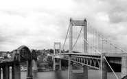
Which Side Of The River Tamar?
This photo is actually taken from the Devon side of the River Tamar, in St Budeaux, looking towards Saltash on the Cornwall side. In photos taken after the road bridge opened in 1961, you can tell which side is which, ...Read more
A memory of Saltash by
The Buildings Have Gone
The building to the right hand side has gone but the long wall remains. The church spire in the distance is all that remains of St Marks Church near to the Carfax. The rest of the church was demolished to make way for the new ...Read more
A memory of Horsham by
Summer Holidays At Tyn Y Morfa
In the early 60s we used to travel to Talacre for a fortnight holiday in a caravan. One year my parents didn't pre-book but we travelled from Liverpool on the off chance we would find a place. I remember my father ...Read more
A memory of Tyn-y-Morfa by
18 Two Meadows
As a Londoner, when my new husband was offered a job in Great Yarmouth in 1964, I was excited, although a bit apprehensive about moving to the small village of Hemsby. We bought a brand new house in a new subdivision at Two Meadows. It ...Read more
A memory of Hemsby by
Family Connections
Tracing previous generations living in Worle and Weston. My grandfather and great-grandparents lived in one of these houses at this time. The road has been renamed and renumbered so it is difficult to work out which one. But nice to have a general idea of the location.
A memory of Worle
Hornchurch, High Street Towards Upminster C.1950
The Kings Head on the left of the photograph was one of the pubs I would regularly drink in when I was in my twenties. I remember it being 'tarted up' at one time with fake beams made of chicken wire ...Read more
A memory of Hornchurch
Jack Rags
Hello’ I lived in Houston Road 50s 60s 70s there’s a little lane at the rear of Houston Road called Carter’s Ali two old tramps as we used to call them in them days used to walk up this little Ali one was called Jack Rags the other was ...Read more
A memory of Forest Hill by
A Schoolboy's View Of Bexleyheath In The Early 1950s
I went to school in Bexleyheath between 1950 and 1954. I believe the school was in Pelham Road but I can't be sure. Maybe there was a separate infants department in North Street? My first ...Read more
A memory of Bexleyheath in 1950 by
Your search returned a large number of results. Please try to refine your search further.
Captions
5,036 captions found. Showing results 409 to 432.
The stone half way down the other side of the road marked the entry to Mill Lane which led to Mill Street, the main entry road to the town for many centuries.

All the buildings in the foreground were demolished for the ring road. The library survives, but it is cut off from High Street by the ring road.

The medieval leper hospital of St Leonard's was in Melford Road, where Colneys Close is named after John Colneys, who founded the hospital in 1372.

Some ten years later than W164006 and W164004 (page 44), this photograph looks south along Wallasey Village with Leasowe Road going off to the right.

Apart from the Baker's Arms on Barkby Road corner and an extended bank, the village's main shopping area is now but a memory.

Note the symmetry of this early residential development on Lake Road East with its grand row of houses book-ended by conical towers.

We see the new St Mary's church from the north side of Longfleet Road, which is now very busy. To the right is the entrance to Parish Road, which is named after a former vicar.

Here we see East Mill and its mill pool, looking eastwards from the north bank of River Asker, towards houses beside East Road (centre).

Even as late as the early 17th century, there was no road linking Chatteris with Ely.

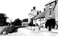
This is one of several short parades of shops along the main road through Penn. Built in the early to mid 20th century, it remains largely unchanged today.

The road curves towards the town centre, passing the end of De Vere Road. The shop in the distance is now a bigger 'One-Stop Shop'. At the far end are the two gabled bays of the Old Rectory.

The Three Salmons Hotel, which stands on the A471 to Abergavenny, looks much the same today, except that it has now expanded to occupy the premises across the road.

This shows a very deserted unmade road leading into town, more familiar to motorists today, who have to slow down at the top in order to join the Bath Road into Devizes.

The Sussex Turnpike Trust was set up in 1749 to maintain the road from Hindhead Heath to Chichester with a tollgate at Kingsley Marsh (now Green).

The increase of traffic along this road means that the junction is now almost impossible to recognise.

The only casualty since 1899 is the wall on the right, sacrificed for road widening at the junction with Hardwick Road. Sellwoods on the left had only just been built.

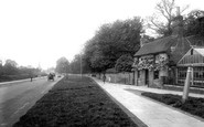
For most people, the village of Heswall is centred on this road, the A540, linking Chester with all the towns along the western side of the Wirral.

The road running beside Newlands Bottom is to the left of the valley at this date, unlike the present road, and is now a bridleway.

Standing on the corner of Canonbury Road and Grange Road, this windmill has a fascinating history.

This view was taken in Albert Road looking down Widnes Road.

Looking south down the main road towards Wilmslow, with the road over to Macclesfield going off to the left, affluent Cheshire is driving towards the viewer and the young couple wait for

The new road takes the land to the right of centre, and is only a few yards away from the apex of the obvious bend. The old road still marks the boundary of Dartmoor National Park.

The A3 London to Portsmouth road crosses the Farnham to Chichester road here, and then, as now, the crossroads are traffic-light- controlled.

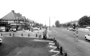
Cars queuing to come out of Lion Green Road by Thomas Ebbutt`s undertaker`s business anticipate the need for traffic lights at this junction of two busy A roads.
Places (26)
Photos (14329)
Memories (11058)
Books (5)
Maps (476)

