Places
26 places found.
Those places high-lighted have photos. All locations may have maps, books and memories.
- Cemmaes Road, Powys
- Six Road Ends, County Down
- Road Weedon, Northamptonshire
- Severn Road Bridge, Gloucestershire
- Roade, Northamptonshire
- Berkeley Road, Gloucestershire
- Harling Road, Norfolk
- Road Green, Devon
- Builth Road, Powys
- Cross Roads, Yorkshire
- Steele Road, Borders
- Cross Roads, Devon
- Four Roads, Dyfed
- Road Green, Norfolk
- Biggar Road, Strathclyde
- Clarbeston Road, Dyfed
- Five Roads, Dyfed
- Eccles Road, Norfolk
- Grampound Road, Cornwall
- Morchard Road, Devon
- Wood Road, Greater Manchester
- Four Roads, Isle of Man
- St Columb Road, Cornwall
- Clipiau, Gwynedd (near Cemmaes Road)
- New Road Side, Yorkshire (near Silsden)
- New Road Side, Yorkshire (near Cleckheaton)
Photos
14,329 photos found. Showing results 601 to 620.
Maps
476 maps found.
Books
5 books found. Showing results 721 to 5.
Memories
11,058 memories found. Showing results 301 to 310.
Wonderful Times Growing Up In South Ockendon
It’s been a real pleasure to read all the various memories of South Ockendon back in the 50s and 60s. I was born in Brixton and moved to West Norwood. My Mum & Dad both wanted to move out of ...Read more
A memory of South Ockendon by
Early Memories Of Southwick
I was born in Steyning in 1954. My father was a police constable and at only 2/3 months old we moved to the 'police station' in Whiterock Place in Southwick. The station consisted of 2 large semidetached houses with large ...Read more
A memory of Southwick by
Marian Barnes
Hello I am new here after googling Corringham Road, Stanford-le-hope. I was just wondering if anyone remembers my Mum, Marian Helen Barnes. She lived at 24 Corringham Road around 1954-1957. Unfortunately she has recently ...Read more
A memory of Stanford-le-Hope by
Shopping At The Parade
The Parade, Southborogh, was where my mother, Ivy, did most of her shopping. At that time you could buy pretty well everything you would need in the Parade. Trips into Tunbridge Wells were only taken if there was a need ...Read more
A memory of Southborough in 1953 by
A Dump Called Paradise
I lived in this house until I was 21. My father had already bought the property when this photo was taken and I was also born in 1955. My parents had no hot water, low ceilings, no bathroom or electricity when they moved in. ...Read more
A memory of Bersham in 1964 by
Special Times
Once the time had come for blackberry picking and whimberry picking, my lovely Uncle Fred took us down the valley roads, to get picking, ready for those lovely pies my grandmother would make. We would climb up beside these waterfalls, ...Read more
A memory of Brynmawr in 1953 by
Growing Up In Hornsey
I was born in Hornsey in 1923, and spent the first 10 years of my life living with my parents in the top flat at 257 Wightman Road. The ground floor was occupied by Mr and Mrs Dan Costigan. Mr Costigan was a bus driver, and ...Read more
A memory of Hornsey in 1920 by
W H Smith In Hatch End!
This view shows a branch of Smiths on the corner of Uxbridge Road and Grimsdyke Road on the left of the picture. It was a haven for schoolchildren buying ink for fountain pens and stamp album leaves! I loved to buy bottles ...Read more
A memory of Hatch End in 1960 by
St.Comgall's , Church Of Ireland.
This shows St. Comgall's before the addition of the spire; the church dominates the intersection of Hamilton Road and Castle Street, sitting in a roughly triangular plot encompassed by the aforesaid and Ruby ...Read more
A memory of Bangor by
Majestic Cinema
Glad someone remembers the Majestic Cinema at Fair Green. We lived in Norbury, just over the border in Croydon, but my Dad was a Cinema Manager with the ABC chain, and regularly did relief stints at the Majestic when the regular ...Read more
A memory of Mitcham by
Your search returned a large number of results. Please try to refine your search further.
Captions
5,036 captions found. Showing results 721 to 744.
The year after this picture was taken, a new line for the road was proposed.
On the south side of Western Road is the Recreation Ground; it was enclosed in 1885, having formerly been part of Hailsham common. In this view the road is off to the right out of shot.
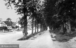
Known by locals as 'The Cages', the three rows of lime trees were planted on the north east side of the road in the early 1840s.
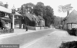
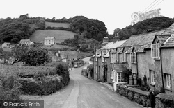
We are looking west as the A387 drops down into the hamlet to the bridge over the River Seaton at the bottom of the hill, before the road climbs up the other side on its way to Looe.
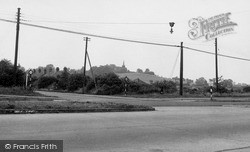
The A127 arterial road (in the foreground) was opened in 1925 by Prince Henry, and succeeded Wash Road as the main east-west route through Laindon.
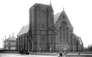
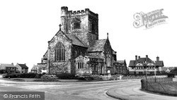
The church still stands in Bayswater Road at its junction with Groveland Road.
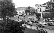
All the buildings in the foreground were demolished for the ring road. The library survives, but it is cut off from High Street by the ring road.
Stratford Road was first recorded in 1322, though it was just a trackway known as Shirley Street at that time. Shirley developed along it in linear fashion.
Stanway Road was created in the 1930s along with several other roads in the area, and is absolutely typical of the development which took place at that time.
Lord Windsor, Chairman of Barry Docks and Railway Company, gave this road its name. It was designed and built as better housing, with accommodation for live-in household staff.
Longridge stands about six miles from Preston on the Clitheroe Road. It still shows many of the signs of a country village, and is complete with its Market Square, as our photograph shows.
The photographer was standing towards the northern end of Hagley Road, looking towards Stourbridge.
Hiltingbury Road leads from Winchester Road to Hiltingbury Common, which during the Second World War and for some time after was covered with huts and used for various purposes - British troops, American
A landmark on the Bawtry-Thorne road, the Blue Bell Inn stands at the crossroads of the Doncaster-Epworth road in the heart of the low-lying Hatfield Moors, close to the RAF station at Finningley.
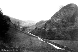
A horse and cart wends its way up a gated minor road through the Coniston Fells.
Even as late as the early 17th century, there was no road linking Chatteris with Ely.
We are looking across Irby Road and along Thigwall Road.
This follows the course of a much older road, the Roman 'Fosse Way', which runs from the 'colonia' of Lincoln to Axminster in Devon, built as a military road around 47 AD.
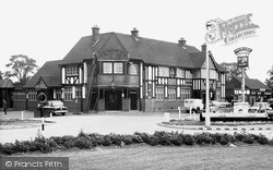
Opened in 1928, it replaced a previous Fortune of War (now a printer's on the Billericay road), which had itself been founded, supposedly, by a soldier returning from the Napoleonic Wars.
At the west end of the High Street, London Road curves away north-west downhill.
Opened in 1928, it replaced a previous Fortune of War (now a printer's on the Billericay road), which had itself been founded, supposedly, by a soldier returning from the Napoleonic Wars.
The medieval parish church, Ashtead Park house and its landscaped park, now part of the City of London Freemen's School, are south of this main through road, the A24 London to Worthing road.
It opened in 1884, and Dormans Park was laid out with houses in treed plots - the roads are still gravelled.
In the era of the stage coach, the George Hotel was classed as the best hotel on the Great North Road, and it is still one of the best in the area.
Places (26)
Photos (14329)
Memories (11058)
Books (5)
Maps (476)


