Places
Sorry, no places were found that related to your search.
Photos
134 photos found. Showing results 661 to 134.
Maps
896 maps found.
Books
4 books found. Showing results 793 to 4.
Memories
542 memories found. Showing results 331 to 340.
Very Very Happy Early Childhood
I spent eight years of my early childhood in Portree, my father James Argo was the Manager of the now Clydesdale Bank on the corner of the Square, my friend was Donnie Stewart whos father owned the largest store and ...Read more
A memory of Portree in 1920 by
Summer Days At Minnis Bay
In the early 1960s my dad would drive us down to Birchington in his Morris Oxford to visit my grandparents who lived in Lancaster Gardens. We would visit on a Sunday about twice a month and in the summer we would ...Read more
A memory of Birchington by
Woolacombe Bay Hotel
I was a boarder at Adelaide College, while my father lived in London, my mother worked at Montebello Hotel. I recall the town then was crowded with American service people, who as I can remember were very generous with their ...Read more
A memory of Ilfracombe in 1944 by
Rowing Our Boat
My children, Molly, Libby, and George loved taking turns with me rowing across from the shallower of the two beaches the short distance across the calm bay to the lifeboat station which as we got closer loomed large like ...Read more
A memory of Mother Ivey's in 2006 by
Little Green Buses Along The Prom.
For many years, Colwyn Bay U.D.C. ran a bus service along the promenade from Old Colwyn to just beyond the former pier at Rhos on Sea. Commencing in 1926, a small fleet of 5 'Guy' BB type vehicles with covered top ...Read more
A memory of Colwyn Bay in 1961 by
Boarding At The Visitation Convent
My brother and I attended the Convent as boarders from 1958 to 1961 after the death of our mother. We were pretty traumatised on our first day there but were gently looked after by the wonderful Sister Edith. I ...Read more
A memory of Bridport in 1958 by
Buses
At the age of fourteen I moved from Rhuthin to live with my gran, Ketura Roberts, who lived in one of the houses opposite the Castle Pub. The bus route was up Llysfaen Hill and past the Semaphore pub, this at the time had a butchers shop ...Read more
A memory of Llysfaen in 1960 by
Childrens Beach Events Mid 1950s
I can remember organised races and games, promoted by the publishers of 'Sunny Stories' and the Hulton Press comics, which took place on Viking Bay or Louisa? Bay. You needed to have a copy of one of the papers to ...Read more
A memory of Broadstairs in 1954 by
The Yogi Bear Test
Hi, I was born in 1960 next to Little Wakering church, my dad Dennis, mum Babs and big sis Sue. The Yogi Bear test refers to a large square of trees at the end of the Parry that you had to climb round without touching the ...Read more
A memory of Little Wakering in 1966 by
Reighton Gap
In the 1950s we had relatives who had a bungalow on the cliff top at Reighton, this was an old railway carriage that had been converted into a holiday bungalow, I can still remember the leather seats. I believe my parents, Tom and Edna ...Read more
A memory of Reighton in 1955 by
Captions
870 captions found. Showing results 793 to 816.
This is another view of Lower Eype from further to the south-west, closer to the cliff above Lyme Bay, looking inland to Mount Lane and St Peter's Church (centre).
This is another view of Lower Eype from further to the south-west, closer to the cliff above Lyme Bay, looking inland to Mount Lane and St Peter`s Church (centre).
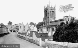
Here we have a detailed view of the premier pre- Domesday minster church of the Dorchester hundred. Its present fabric has grown from a cruciform building of the 11th century.
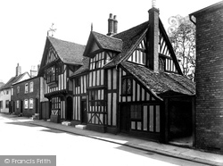
The Royal Arms of James I above a ground-floor fireplace may indicate its continuing official use into the 17th century.
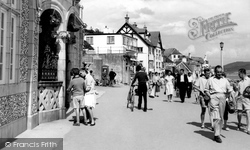
Seaside bustle on the promenade, built as the old Upper Walk between the town and the Cobb Harbour in 1817; it is now known as Marine Parade.
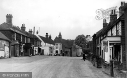
The second view looks along Waldron Road into the High Street, with the London road turning beyond the houses on the right; the nearest of these, Warnham Cottage, is no longer a shop but a
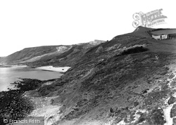
We are looking westwards to the snout of Goggin's Barrow (right), Black Head (centre), and Redcliff Point (left) above Weymouth Bay.
This ancient packhorse route, inland from salt- making pans and the Cobb landing place, is named for Sherborne Abbey, which owned Lyme's seaboard enterprises from Anglo-Saxon times.
All, however, make a point of listing a marble memorial to the life of Col Richard Nicolls who captured the Dutch Colonial city of New Amsterdam on behalf of the English Crown - and then renamed it New
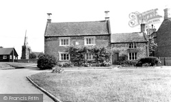
The view is dominated by a fine 17th-century stone-faced house of two bays under a stone-slated roof, with substantial end stacks. The lower, later wing has been given a modern door.
The town is named after the grange, or storage place for grain, belonging to the monks of Cartmel Priory.
Not far from the airport is North Stoneham Church, which has undergone many alterations since it was first built in the 10th century.
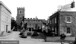
Close to the road, the solid but impressive ashlar tower dominates the immediate street scene with its substantial angled buttresses and crocketted finials; these are not 15th-century, but were added
This view is from the Royal Victoria Hotel, formerly Swanage Manor, which was named for the overnight visit of Princess Victoria on 7-8 August 1833.
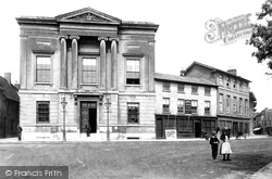
The Town Hall was built in 1826 on the site of the Exchange Inn, a property belonging to the Borough.
The name of this lane, which runs north from the junction of High Street and Lewes Road, refers to Sackville College.
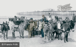
Donkeys are awaiting the arrival of the day's holidaymakers on the beach. A fisherwoman in a tall hat stands behind the donkey boys and their mounts.
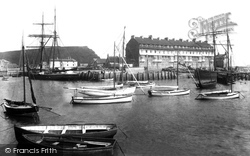
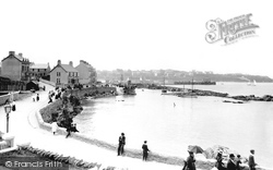
This is the basin of Bridport Harbour. East Cliff (centre left) rises to the south-east; the distinctive building is Pier Terrace, which is locally known as Noah's Ark (centre right).
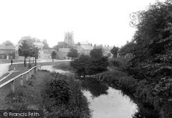
Catterick has three greens; this one looks along Sour Beck to the 15th-century parish church of St Anne, financed by the owners of nearby Brough Hall.
North of Fir Tree Road and just beyond Banstead railway station is Cuddington Park Golf Course; the name is a reminder of the parish and village of Cuddington, which was cleared for Henry VIII's Nonsuch
The central bay was destroyed at some time and has been rebuilt. The nearer range has been dendrodated to 1447-48, and the further to 1533-34.
Brighton made the seaside fashionable for the upper crust, and its wider popularity was settled when the railway made the connection in 1841.
The bay marks the natural harbour of this spot.
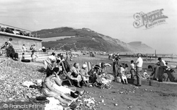
Below, a shingle beach with patches of pea-grit provides a spot for rest and relaxation between Raffey's Ledge and the Mouth Rocks, where the River Char enters the sea.
Places (0)
Photos (134)
Memories (542)
Books (4)
Maps (896)


