Places
26 places found.
Those places high-lighted have photos. All locations may have maps, books and memories.
- Cemmaes Road, Powys
- Six Road Ends, County Down
- Road Weedon, Northamptonshire
- Severn Road Bridge, Gloucestershire
- Roade, Northamptonshire
- Berkeley Road, Gloucestershire
- Harling Road, Norfolk
- Road Green, Devon
- Builth Road, Powys
- Cross Roads, Yorkshire
- Steele Road, Borders
- Cross Roads, Devon
- Four Roads, Dyfed
- Road Green, Norfolk
- Biggar Road, Strathclyde
- Clarbeston Road, Dyfed
- Five Roads, Dyfed
- Eccles Road, Norfolk
- Grampound Road, Cornwall
- Morchard Road, Devon
- Wood Road, Greater Manchester
- Four Roads, Isle of Man
- St Columb Road, Cornwall
- Clipiau, Gwynedd (near Cemmaes Road)
- New Road Side, Yorkshire (near Silsden)
- New Road Side, Yorkshire (near Cleckheaton)
Photos
14,329 photos found. Showing results 681 to 700.
Maps
476 maps found.
Books
5 books found. Showing results 817 to 5.
Memories
11,058 memories found. Showing results 341 to 350.
Hornsey & Crouch End Playing Fields
1890's to 1920s Alfred Baker & his family lived in The Grove, which became Lynton road and was few roads away from this photo's location. He worked as a groundsman at Crouch Hill Playing Fields, at first to look ...Read more
A memory of Hornsey by
Ardwyn, High Road
My Great Aunt (Grandmothers sister) lived here immediately on the LEFT of this photo at "Ardwyn" in the High Road, opposite the entrance to the Village Hall car park in 1950s/1960s. Her husband was Fred Bowey and one of their ...Read more
A memory of Byfleet by
Happy Days.
Looking at the photos brought back so many happy memories, I lived at Homefield Gardens across the Heath & went to the Methodist School from 1956 to 1963. Miss Fletcher was the headmistress & I think Miss Watts was my teacher ...Read more
A memory of Burgh Heath by
St Mark’s Primary School, Mitcham
I grew up in Mitcham in the 1960s. Born in 1962, we lived in Tonstall Road, close to the level crossing by Eastfields school. I went to St Mark’s Primary School from 1967 to 1971. I remember most of my teachers: Miss ...Read more
A memory of Mitcham by
2 High Street
I spent an idyllic childhood in Wargrave from 1944 until 1955/6. It was wonderful. We moved on to Twyford when I was 11 as our house was torn down and replaced by the fish shop. I wonder if the Chapel which was behind these houses is ...Read more
A memory of Wargrave by
Railway Info.
The furniture van to the left will have been carried to Barnstaple by rail. There were special low 'road vehicle trucks' onto which these vans could be loaded and moved long distances around the country. and it is standing next to the end loading docks at this end of the station.
A memory of Barnstaple in 1890
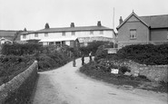
Donkey Halt.
The bungalow in the centre of the photograph is called Donkey Halt as when the carts of pilchards were taken up the hill by donkeys they stopped there for a rest before tackling the very steep hill to the main road at the top.
A memory of Crafthole by
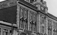
Golden Memories Of Childhood Days
Central Hall I believe used to house the big Saturday market!, Tooting was a Saturday trip out as a boy from Mitcham, I can vaguely remember many special days, going to the pictures, and the joke shop on the Mitcham ...Read more
A memory of Tooting in 1963 by
My Home Town
Memories, Used to go to school at Western Road, the cinema on a Saturday morning, Roy Rogers and Silver. Ahh memories, now I'm 60 and living in Norfolk. I remember fondly Huttons Fish Shop, Leos Ice Cream at the cricket green, the ...Read more
A memory of Mitcham in 1963 by
Motorbike Days
Nice to look at the old photos of Brackley as I was born here in 1963. I lived at 54 Manor Road for many years. I moved away for a while but it was nice to return. I used to ride motorbikes with a group of friends - Steve & Andy ...Read more
A memory of Brackley in 1983 by
Your search returned a large number of results. Please try to refine your search further.
Captions
5,036 captions found. Showing results 817 to 840.
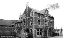
Situated along Ayston Road, to the north of the town, it was bought in 1895 by C R Haines who added a wing. Threatened with closure in 1925, it has survived and flourished ever since.
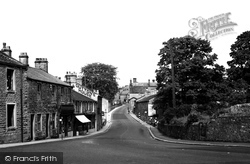
Entering the village from Clitheroe, the road dips to cross Heys Brook. Beyond Martin's Bank and the shops is the Black Bull Inn, which carries a date stone of 1855.
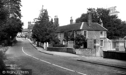
The elegant Georgian house on the right of the road has been converted to offices.
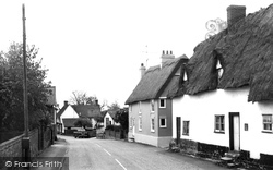
The farmhouses and cottages all have steps down to the street because the old unmetalled road to Cambridge had been gradually lowered by use.
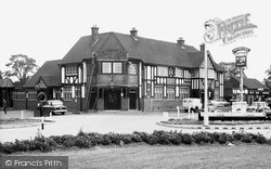
The Fortune of War stands on a roundabout on the busy Southend Arterial Road. It is an impressive building, and always attracted many customers.
The 16th century timber-framed Plough and Fleece public house on the left of the road was just one of the three pubs in the village.
This crossing is at the east end of Bury Road, with No 58 visible through the trees, just west of the traffic lights and junction of the roads from Bury and Norwich.
The busy trunk road to Norwich winds through the heart of Acle past many pleasing old houses.
There are now traffic islands in the middle of the road.
It is regrettable that these fine school buildings in Stoneyfield Road, opened in 1939, were sold in 1992 and the land is now covered by houses in Rossetti Gardens and neighbouring roads.
The First Developments The first houses to be built were in a small pocket in Vange; No 61 Redgrave Road was the first to be occupied - the Walker family moved in in June 1951.
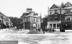
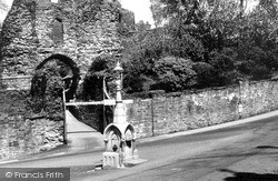
Today the wooden gates are gone, and so is the fountain in the road, erected by the Hender family in memory of their son Leonard, who drowned near Land's End in 1894.
Taken long before the days of amusement arcades and the bandstand, this photograph shows that Pier Road and the Crag consisted solely of dwelling houses, probably occupied mainly by the fishing community
The camera has been set up on a triangle of land at the junction of the A444 Burton Road with the road to Sheepy Magna, which drifts out of shot to the left.
In the 19th century, this road was known as Coldharbour Lane and was built up as the Avenue during the Victorian and Edwardian periods.
The half-timbered Kings Head inn in the background recalls the coaching age: Northleach was on the main London, Oxford, Gloucester and South Wales road (the main A40 road now by-passes the
The main road leads down past Holy Trinity church, which was built in 1836. The scene is similar today but the road is very busy with motor traffic.
For all its evocative name, Higher Bebington Road is quite short in length; it services Bebington High Sports College, the Higher Bebington recreation ground and the local branch of Wirral
This view is taken from Milford Road, with Farnham Road at the right curving past the former blacksmith's forge, which is now a cottage, The Old Forge.
Conduit Road runs north from Ock Street on the east side of the Albert Park estate, and the earliest buildings on it are this church group.
and is just in Sussex.The picture shows local shops with a proliferation of signs of all types outside; vending machines are attached to the shopfront.An obtrusive clutter of tall poles lines the road
The Gaumont Cinema on the opposite side of the road offers an almost brutalist contrasting elevation.
The half-timbered Kings Head inn in the background recalls the coaching age: Northleach was on the main London, Oxford, Gloucester and South Wales road (the main A40 road now by-passes the
The road heading off to the right leads to St Wilfrid`s Church, and not unsurprisingly is called Church Road.
Places (26)
Photos (14329)
Memories (11058)
Books (5)
Maps (476)


