Places
26 places found.
Those places high-lighted have photos. All locations may have maps, books and memories.
- Cemmaes Road, Powys
- Six Road Ends, County Down
- Road Weedon, Northamptonshire
- Severn Road Bridge, Gloucestershire
- Roade, Northamptonshire
- Berkeley Road, Gloucestershire
- Harling Road, Norfolk
- Road Green, Devon
- Builth Road, Powys
- Cross Roads, Yorkshire
- Steele Road, Borders
- Cross Roads, Devon
- Four Roads, Dyfed
- Road Green, Norfolk
- Biggar Road, Strathclyde
- Clarbeston Road, Dyfed
- Five Roads, Dyfed
- Eccles Road, Norfolk
- Grampound Road, Cornwall
- Morchard Road, Devon
- Wood Road, Greater Manchester
- Four Roads, Isle of Man
- St Columb Road, Cornwall
- Clipiau, Gwynedd (near Cemmaes Road)
- New Road Side, Yorkshire (near Silsden)
- New Road Side, Yorkshire (near Cleckheaton)
Photos
14,329 photos found. Showing results 741 to 760.


Maps
476 maps found.
Books
5 books found. Showing results 889 to 5.
Memories
11,058 memories found. Showing results 371 to 380.
The Hersham Flood – September 1968
During the 60s I lived in Surbiton and worked in Hersham. As I was getting ready to leave for work one morning in 1968, a radio broadcast warned of severe flooding along the Mole valley following heavy rains, and ...Read more
A memory of Hersham by
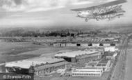
Banner Flying Over Croydon.
I remember so vividly the Croydon Airport building which, fortunately, is still there and protected for all to enjoy. I recall one particular day looking up into the sky from Scarbrook Road (where I was born at number 33 in ...Read more
A memory of Croydon by
After The War
I do not know the exact year that Doncaster had its first Royal visit after the Second World War had ended but all the school children in the parish were required to put on their best bibs and tuckers for school ...Read more
A memory of Intake in 1946 by
Vicarage Road Football Stadium And Watford Football Club
I first saw Watford play - in their old blue and white colours - at the end of the 1955-56 season. The only cover was the so called "Main Stand" and on the opposite touchline the "Shrodells ...Read more
A memory of Watford in 1955 by
Grove Cottages
I remember Grove Cottages and the families who lived in both No 1 & 2 in 1965. My parents were friendly with the Davies in No 2 and as a teenager I visited No 1 on many occasions along with all our crowd. The LeNoble ...Read more
A memory of Great Bookham in 1964 by
Station Lane
The first smallholding on the right hand side was where my relatives lived - Richard and Nellie Wiles. The house is still very much the same, but with some extensions to the house itself. The outbuildings are exactly the same. ...Read more
A memory of Holme in 1930 by
On The Way To The Cathedral School
I still see the journey from my home in Morecambe to start my senior school years. First the bus from my home on Regent Road to the Midland Hotel. Then, across to the station for the train to Green Ayre station. ...Read more
A memory of Lancaster by
Back In The 70s
From 1975 we lived in one of the council maisonettes, Baden Powell House, which are still opposite the parade of shops in Lower Belvedere. I remember it was such a great place to grow up, knowing all the neighbours by name and being ...Read more
A memory of Belvedere
The Chalet Hunmanby Gap
I holidayed at The Chalet, Hunmanby Gap every year for around 15 years from 1966 onwards. I believe it was owned by someone in my distant family (Auntie Mary?) who also lived on Gap Road. I absolutely loved our family ...Read more
A memory of Hunmanby Gap by
Edgecoombe, Selsdon 1957 61
I remember Selsdon well as my family lived at 68 Edgecoombe, the long road on the opposite side of the wood at Selsdon not to be confused with Selsdon Woods. We had two ways to get to Selsdon shops. Through the woods ...Read more
A memory of Selsdon by
Your search returned a large number of results. Please try to refine your search further.
Captions
5,036 captions found. Showing results 889 to 912.

Even the dogs are nonplussed - and the fact that they are happily standing in the middle of the road suggests that any traffic hazard in such a quiet backwater was probably very limited.

Dragwell, adjacent to A R Tarlton's chemist's shop (left), runs between Derby Road and Nottingham Road on the north side of the church, which stands prominently above the River Soar.

The new A55 road tunnel beneath the river diverts through-traffic from its streets. The quay is busy today with pleasure craft, rather than the commercial traffic of the past.

Linking Harrison Drive and Breck Road, Wallasey Village has always been just that; no Road, Drive, Way or other title, because it doesn't need it.

Bramley stands about four miles south of Guildford on the Horsham Road; it is a long village with a busy crossroads with Station Road (there has been no railway since the 1960s).

Frith's photographer has chosen the best bit of Bagshot to photograph: he is looking south-west along the High Street from its junction with Bridge Road towards the Square.

Little Bookham's tiny 12th- century church and manor house lie south of the Guildford Road.

This view of Station Road, by now renamed Station Way, shows that while the local branches of W H Smith and Boots the Chemists still occupy their premises below the flats of Cheam Court, the corner shop

On the extreme left are the premises of the Trustee Savings Bank - it moved across the road later in the 1960s.

The centre of Heswall was originally much closer to the shoreline, probably in the area around Village Road and St Peter's Church, but the advent of Telegraph Road - the A540 - has moved the commercial

This small town grew up on the course of the Roman road from London to Chichester, later known as Stane (or stone paved) Street.

This is locally known as the back road to Lincoln, and it looks a well surfaced village road.

The A12 runs through the village, with Chapel Road (leading to the Congregational chapel of 1778) to the left and Blythburgh Road to the right.

At the junction of Old Road and the main road, the A271, was this entrepreneurial former village smithy.

The older parts of Chipstead village are on the chalk ridge above the dry valley some 150 feet below, along which Chipstead Valley Road runs.

This view looks along Camelsdale Road.

We are looking south-west down Crofts End, the lane which leads from Crofts End itself at the top of the hill behind the photographer to the main through road.

At the turn of the millennium we long for those halcyon days as traffic now reaches saturation point, potholes get deeper and deeper, and road repairs are always carried out at the most inconvenient spot

The roads are more clearly defined, but it is still safe enough to ride a bicycle near the middle of the road.

This photograph shows the cross-roads, where the motorist could get some refreshment and petrol in those days of more leisurely travel. The road behind us climbs up to Hare Appletree Fell.

Cheesden Brook passes under Ashworth Road, flowing to the right to join Naden Brook as it leaves Carr, Gelder and Bamford Woods.

Ockley is a very fine village along the course of the Roman road from London to Chichester, which has been known from Anglo-Saxon times as Stane Street.

This village has grown around a road junction on the Horsham to Brighton road.

By the late 1950s it had become overwhelmed, and Newark Road, known as the bypass, was constructed on the east side of the village.
Places (26)
Photos (14329)
Memories (11058)
Books (5)
Maps (476)

