Places
26 places found.
Those places high-lighted have photos. All locations may have maps, books and memories.
- Cemmaes Road, Powys
- Six Road Ends, County Down
- Road Weedon, Northamptonshire
- Severn Road Bridge, Gloucestershire
- Roade, Northamptonshire
- Berkeley Road, Gloucestershire
- Harling Road, Norfolk
- Road Green, Devon
- Builth Road, Powys
- Cross Roads, Yorkshire
- Steele Road, Borders
- Cross Roads, Devon
- Four Roads, Dyfed
- Road Green, Norfolk
- Biggar Road, Strathclyde
- Clarbeston Road, Dyfed
- Five Roads, Dyfed
- Eccles Road, Norfolk
- Grampound Road, Cornwall
- Morchard Road, Devon
- Wood Road, Greater Manchester
- Four Roads, Isle of Man
- St Columb Road, Cornwall
- Clipiau, Gwynedd (near Cemmaes Road)
- New Road Side, Yorkshire (near Silsden)
- New Road Side, Yorkshire (near Cleckheaton)
Photos
14,329 photos found. Showing results 141 to 160.


Maps
476 maps found.


Books
5 books found. Showing results 169 to 5.
Memories
11,058 memories found. Showing results 71 to 80.
Wentworth County Primary School
As far as I can see, no-one has left a memory of my old primary school. So, let me start this off (if I may?): Living in nearby North Road, I attended this school from 1962-68. When I started at the Infants' School, ...Read more
A memory of Dartford by
Lost Opportunity?
I was born in Drayton in 1943 and was at Solent Road School and the Northern Grammar School for Boys. I then went to London University and subsequently worked abroad while returning to Portsmouth regularly where I have my UK Home ...Read more
A memory of Portsmouth by
Riding My Bike In Old Farleigh Road.
This photo shows my Dad teaching me, age 5, to ride my little bike right outside our house, No.12, where we lived from 1950 to 1972. Such a lovely quiet road then with just trees and allotments opposite. Not so today.....they have all been replaced by a giant Sainsburys!
A memory of Selsdon by
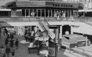
A Great Pub, Fit For An Emperor!
Ah the Forum! What a fine and individual pub! I often wondered why the brewers, Ind Coope, called their pub this! Anyone any ideas????? I was at Croydon college around the time this photo was taken and rather than going ...Read more
A memory of Croydon by
Such Memories
I lived in 14 west street from birth 1962. to 3 years , My great Aunt Jane Penny (Davies) lived there for years looking after a lady. When she died, the house was left to My aunt Jane. My mum and brother and me, moved just up the ...Read more
A memory of Millbrook by
25 Years In Beaconsfield.
Born in Wembley, I arrived in the New Town of Beaconsfield in 1957 aged 5. With my younger sister and my parents. I left home at 17 but returned occasionally until 1981 when my parents moved to Scotland. I lived in ...Read more
A memory of Beaconsfield by
Prince Philips Visit
I was born in Billericay in 1954 and lived in Church Road, Laindon . I remember my mother and grandmother taking me to see Prince Philip when he visited Basildon. I was only a small child but I do remember seeing him walking ...Read more
A memory of Basildon by
W.H.Smiths Richmond Road.
I worked in W.H.Smiths in 1955. So I could have been in the shop when this photo was taken. The shop opposite on the corner of Shute Road was called Crasters (haberdashery) where I used to buy many a pair of nylons etc. ...Read more
A memory of Catterick in 1956 by
1953 66
I was born in Hayes & lived on a council estate ,Kier Hardie Way. I had a happy childhood, lots of fields over the 'Greenway'& Kingshill Avenue. Went back in about 1985 & it was a bit shabby, then in 2000 & it all ...Read more
A memory of Hayes by
Rose View
1970 - 1984: As you look at this photo the last building on the right, the barn like cottage with the small window, is Rose View. My mum and dad bought it for £1,000 in 1970, and set to work modernising it as I was due 1971 and my brother ...Read more
A memory of Polgooth in 1970 by
Your search returned a large number of results. Please try to refine your search further.
Captions
5,036 captions found. Showing results 169 to 192.

Micheldever Road was a new turnpike in 1840 and would remain the main road from Winchester until town development after 1961 led to its abandonment. Half a mile behind the viewer is Ladies' Walk.

A horse looks with interest at the two little boys in the road. The old road to Camelford and beyond, later becoming the A39, climbs steeply up Gonvena Hill from the bridge.

Comparing this with the earlier pictures, the memorial has gained a chequered kerbstone and a rash of road signs.

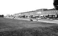
Frith's photographer is looking from the middle of the green towards Wharf Road, with the through road crossing the centre of the view.

Leafy Hyde Road, otherwise known as Walditch Road, cuts south-eastwards through the parkland of The Hyde. This sylvan setting is only half a mile from the bustle of East Street.

To the right of the Tower you can make out haystacks in the farmyard (now the top end of Rowley Road) and behind the Grammar School.

The narrow hedge-lined lane with unspoiled views over the Brighton Road valley remained until the late 1920s when the lane was widened and houses rapidly appeared.

In the early 1950s, the street lamps were being converted from gas to electricity; these in Lumley Road are the last gas lamps in use just before the changeover.

Children wait on the pavement and road edge to be included in the photograph. Women in long skirts walk along, or wait on the opposite pavement. Two horse-drawn vehicles travel along the road.

Still close to the Yorkshire county boundary and south- west of Harworth, Oldcotes village is situated at the crossroads of the A634 and A60; Main Street runs east from the A60 Doncaster Road

The road follows the line of the old Roman road which linked North Gate and Head Gate, both entrance points to the original Roman walled town.

Two cars are on the road to the right, part of the main road to Barrow-in-Furness.

The Black Swan Inn would have been a popular resting place for the cattle drovers who used the Bullock Road.

The houses in this road were the largest and most impressive in Barry, and were occupied by mainly business and professional people.

The roads leading out of Botley Square are all narrow; this one leading to Winchester is particularly so. The houses are all of an individual design. Some shops have encroached into this road.

We are approaching Chandler's Ford from Southampton along Bournemouth Road, altered from Southampton Road to avoid confusion with another road of that name.

There is Weedon-bec, Upper Weedon and Road Weedon. All of them lie close to Watling Street, the old Roman road which crosses the River Nene in this area.

Here we see East Mill and its mill pool, looking eastwards from the north bank of River Asker, towards houses beside East Road (centre).

Another recreation ground available to Rugbeians was the Whitehall Recreation Ground on Hillmorton Road, which housed a 28-ton, armoured First World War tank presented to the town in 1919,

The Lickey Hills are actually in Worcestershire, and so is this road junction, though only just. As the hills are owned by Birmingham, it is reasonable to include the area in this book.

The road past St Mary's church originally took an indirect course to avoid a marshy area, but in 1801 the marsh was drained and a more direct road was built.

Near the end of Hiltingbury Road, and on a comer with a new Ashdown Road, a public house called the Tabby Cat was built and thrived for some time.
Pelham Road runs all the way through the town; it is now built up on both sides of the road. The vehicles are up-to-date - a new Austin A30 van is delivering to the shop on the left.

The Old Rose and Crown is near the bottom of Rose Hill, a former Roman road which later formed part of the Birmingham- Bristol road; it became a toll road in 1726.
Places (26)
Photos (14329)
Memories (11058)
Books (5)
Maps (476)

