Places
36 places found.
Those places high-lighted have photos. All locations may have maps, books and memories.
- North Walsham, Norfolk
- North Berwick, Lothian
- North Chingford, Greater London
- Harrogate, Yorkshire
- Whitby, Yorkshire
- Filey, Yorkshire
- Knaresborough, Yorkshire
- Scarborough, Yorkshire
- Clevedon, Avon
- Weston-super-Mare, Avon
- Selby, Yorkshire
- Richmond, Yorkshire
- Ripon, Yorkshire
- Scunthorpe, Humberside
- Pickering, Yorkshire
- Settle, Yorkshire
- Skipton, Yorkshire
- Saltburn-By-The-Sea, Cleveland
- Norton-on-Derwent, Yorkshire
- Rhyl, Clwyd
- Chester, Cheshire
- Llandudno, Clwyd
- Grimsby, Humberside
- Durham, Durham
- Nailsea, Avon
- Southport, Merseyside
- Brigg, Humberside
- Colwyn Bay, Clwyd
- Redcar, Cleveland
- Bath, Avon
- Grange-Over-Sands, Cumbria
- Cleethorpes, Humberside
- Sedbergh, Cumbria
- Barrow-In-Furness, Cumbria
- Barmouth, Gwynedd
- Dolgellau, Gwynedd
Photos
2,569 photos found. Showing results 1,981 to 2,000.
Maps
9,439 maps found.
Books
Sorry, no books were found that related to your search.
Memories
1,548 memories found. Showing results 991 to 1,000.
Family Holidays In The 1950s
I was born in 1942 and brought up in Walthamstow in NE London. We were a working class family and Dad always managed to provide us with 2 weeks' holiday somewhere. How we came to holiday in Wroxall is still a bit of a ...Read more
A memory of Wroxall by
Neil Havelock
Greyhounds 1939, when did it close? Martinware end of Havelock. Dominion. Most us lived north. See southallknowhere site
A memory of Southall by
Falling In The Pond
Rod Swift remarked (in a previous memory) about falling in the pond - well I was one of these. Rod must be my cousin's son, as my aunt and uncle lived in the house referred to. Around 1953 on an icy cold day in winter, a ...Read more
A memory of Lingfield in 1953 by
Sheriff Hill
I lived in Southend Road from 1940 till 1947 then moved to Kent. My grandparents lived at 16 Charnwood Gardens. I lived with my mother and older brother Byron, my father was away at war and I never saw him until 1945. I went to ...Read more
A memory of Sheriff Hill in 1940 by
Littleton
My father was farm manager at Orange Court Farm from 1964-1967. We lived in one of the cedar wood bungalows put up in Littleton, I suspect in the early 1960s, by the More-Molyneux family for estate workers - they also owned the ...Read more
A memory of Guildford in 1964 by
St James Barton Bristol Bs1 The History
The old St James Barton area of the city was demolished in the late 1950s to make way for Bond Street and the bus station. The rebuilding of the city started almost as soon as the Second World War had ended. ...Read more
A memory of Bristol by
The Llandoger Trow History
Bristol's historic King Street. The Llandoger Trow inn on right of photograph.King Street is a 17th-century street in the historic city centre of Bristol. The street lies just south of the old town wall and was laid out ...Read more
A memory of Bristol by
Rock
Underdown was a magical place, a narrow island of rock left by quarrying at some time in the past. This photo is taken from the western end. At the eastern end there was a copse and the top of the island merged back into the side of ...Read more
A memory of Sampford Peverell in 1956 by
Living In North Street In 2008 After The Fire In 2005
This photograph is wonderful for me to see having just moved back into Bumblebee Cottage on the far right of the picture after the catastrophic fire on 22 December 2005 that destroyed 4 ...Read more
A memory of Bradford Abbas by
November 5th 1954
I, at the tender age of fourteen, arrived in Croglin on November the 5th, 1954. It was 'Bonfire Night' and as strangers in the village I did not know a single soul. However the bonfire for the celebrations had been situated in the ...Read more
A memory of Croglin in 1954 by
Captions
2,645 captions found. Showing results 2,377 to 2,400.
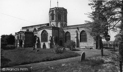
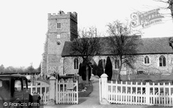
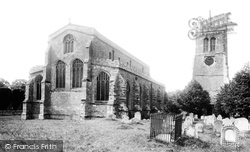
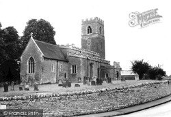
Among the monuments on the north side of the chancel is a Purbeck marble tomb with canopy and three hanging arches on twisted columns marked by an 18in brass on the short tomb chest.
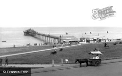
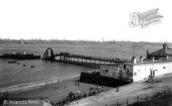
Tourists are ordering tickets for the twice-nightly end-of-the-pier show. Children are drinking from the outside fountain (right), and to top it all there is a horse-drawn ice cream cart.
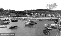
Across the inner basin from the quay (right) beside the Cobb Warehouses is the 17th-century North Wall (centre), which protects the harbour from easterly gales.
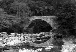
Forming a picturesque scene near Askham, the bridge arches over the River Lowther whose waters have their origin in the north-east Lakeland fells above Shap.
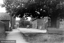
This small green is at the north end of the village - the Bull's Head pub stands on the left out of the picture.
It looks north over the wide, flat, formerly marshy valley of the River Arun and the Amberley Wild Brooks, and west to the narrowing valley as the river cuts through the South Downs.
On the north-east side of the county, Hose is situated close to the Nottinghamshire border in the Vale of Belvoir.
Located in a remote region north of Petworth, the village was originally formed in a clearing in the woods. The local wealden clay district is remarkable for large oak trees.
North Parade was one of these, but it was made much wider than the others to allow the local militia to use it as a parade ground.
650 years of shipbuilding on the Wear came to an end with the closure of North East Shipbuilders' Southwick yard in 1989.
By the 1830s over thirty miles of canal had been constructed, which was used to transport 50,000 tons of sea sand a year from the north Cornwall coast for use as fertiliser on inland farms.
Situated five miles north of Sheffield, the large parish of Ecclesfield was semi-industrialised by the late 18th century.
A mile or so north of Ampthill, we divert right to visit the ruins of Houghton House.
To the far left are the ivy-clad remains of Hillersden Hall, a Jacobean E-plan mansion with the church as the north wing.
In 1940, during war-time blackouts, the pier was hit again, very badly, by a ship ready to form a convoy to cross the North Atlantic.
This is the furthest north part of Buckinghamshire, beyond the stone-built market town of Olney, and not far from the Northamptonshire border.
The house was given more Gothic trim in the early 19th century, and is now a residential home for the elderly. The Priory was founded by Fulk Peynel (or Pagnell) in the early 12th century.
An expansive village, it sits on the River Devon, about a mile north of the Grantham Canal of 1797. This view looks south, away from the church.
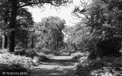
Sherwood Forest once covered over 100,000 acres between Nottingham and Worksop, although the great ducal estates of the Dukeries enclosed much of the north part for their parks.
Hendon was first recorded in the 10th century, but the Hendon we see in this photograph has very little in common with the original mediaeval centre about half a mile (as the crow flies) to the north.
The photograph looks north, with Pool House glimpsed on the extreme right, while the granite quarries are beyond the trees.
Dragwell, adjacent to A R Tarlton's chemist's shop (left), runs between Derby Road and Nottingham Road on the north side of the church, which stands prominently above the River Soar.
The not unlovely village of Saxelby is situated about a mile north of industrial Asfordby, and on a stream which empties into the River Wreake.
The north side of the Market Place was the drinking heart of Wisbech, whose taste for alcohol saw over one hundred inns, taverns and pubs recorded around the town.
Places (9301)
Photos (2569)
Memories (1548)
Books (0)
Maps (9439)


