Merry Christmas & Happy New Year!
Christmas Deliveries: If you placed an order on or before midday on Friday 19th December for Christmas delivery it was despatched before the Royal Mail or Parcel Force deadline and therefore should be received in time for Christmas. Orders placed after midday on Friday 19th December will be delivered in the New Year.
Please Note: Our offices and factory are now closed until Monday 5th January when we will be pleased to deal with any queries that have arisen during the holiday period.
During the holiday our Gift Cards may still be ordered for any last minute orders and will be sent automatically by email direct to your recipient - see here: Gift Cards
Places
3 places found.
Those places high-lighted have photos. All locations may have maps, books and memories.
Photos
1,093 photos found. Showing results 381 to 400.
Maps
27 maps found.
Books
Sorry, no books were found that related to your search.
Memories
489 memories found. Showing results 191 to 200.
The Anchor
I was born on the Anchor in 1941. The houses were set back from the road with rough patch of ground in front of them where Pat Collin's fair used to set up every year in the summer. From the canal bridge on the left was the pub, The ...Read more
A memory of Deepfields by
My Life In York In The 1940s
I now live in Gisborne in New Zealand and turned 70 on 29 September this year. Born in Sheffield I was evacuated to York in 1940 along with my mother (Mary) and older brother John. My dad, Reg, remained at his work in ...Read more
A memory of York in 1940 by
I Miss My Family Home
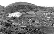
This picture is of my family home just under the quarry to the left. My father Glyndwr 'Pancho' Parry was one of the council machine drivers that had to fill in the canal between the Darren bridge and 'the now' cycle path ...Read more
A memory of Risca by
Wiseacre Croft And Area
I remember the Co-op milk and bread deliveries and also the laundry being sent off, mainly the sheets and towels as we had no washing machine or central heating so washing and drying was a problem especially ...Read more
A memory of Shirley in 1966
Charlie Bristow
It always seems a pity when someone's life ends and there is a decreasing memory of their place in the town as the years go by. Hence, if I may, I would like to share with current readers in the town the memory of one of its figures ...Read more
A memory of Thorne by
Walking Home From School
I remember walking to Brierley Hill Grammar school and back home to Pensnett most days, sometimes alone, sometimes with friends. We walked up Mill Street then down the High Street, with Chattin and Hortons, Woolworths to ...Read more
A memory of Pensnett in 1952 by
My Memories Of Salwarpe
I lived in the first house opposite the church, before we moved to Australia in 1963. Next door lived Dr Adenbrook (I think), next to the church lived the Hoods in the now college, mum worked for a Brenda & Bryan ...Read more
A memory of Salwarpe in 1960 by
Aerco
Aerco was started by my grandfather, Thomas Ricketts after the war. He was an engineer and Aerco sold and repaired early radios and the first TVs, hence the name Addlestone Electrical Radio Company! I believe there were two locations for ...Read more
A memory of Addlestone in 1949 by
Leigh Boys Grammar School
I attended Leigh Boys Grammar from Sept 1944 to 1950/51. I cycled from Culcheth to Butts Bridge then along the Canal towpath to School. There were still a few horse drawn barges then. Friends at School were ...Read more
A memory of Leigh in 1944 by
Coniston Rd
I lived with my grandparents on Coniston Road, the Kenny family. This was the happiest times of my life! Care free. Everyone was your aunty or your uncle, and you felt safe.. The canal was the pull of every child in the area, happy times.
A memory of Stretford by
Captions
713 captions found. Showing results 457 to 480.
Her body was dragged out of the canal two days later at the Bloody Steps in Rugeley, where her grave can be seen in the churchyard. Two of the crew were hanged and another transported.
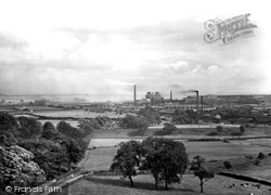
The railway runs along the embankment in the centre of the picture, and the Ulverston Canal passes in front of the ironworks on its way to the Leven Estuary beyond.
Never mind, you can always hire a barge on the nearby Oxford Canal.
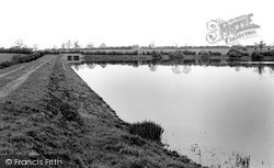
Welford Reservoir was constructed in 1837 to store and supply water to the Welford Arm which then fed the Leicester Arm of the Grand Union Canal.
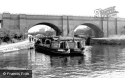
The left-hand one – the 'Stafford' – sports its Fellows, Morton & Clayton livery, a company that stopped trading when the canals were nationalised in 1948.
On this section of the Kennet & Avon Canal, the river Avon is crossed twice. This aqueduct at Avoncliffe is the first.
This area below the town's lock has been enormously improved since the Kennet & Avon Canal was re-opened throughout: boats now tie up here.
The left hand one - the 'Stafford' - sports its Fellows, Morton & Clayton livery, a company that stopped trading when the canals were nationalised in 1948.
A little east of the junction with the Oxford Canal is the bustling Braunston Marina.
Preston was a major cotton town, and the Lancaster Canal runs from Ashton Basin.
A lock linked the river and Nottingham Canal at the projection near the end of the walkway.
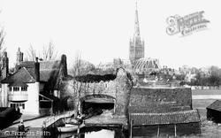
It was built on the spot where the specially dug canal for transporting stone for Norwich Cathedral - brought across from Normandy by Bishop Herbert de Losinga - joined the river.
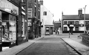
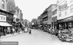
Virtually every shop in the picture has since either moved elsewhere in the city centre or closed down altogether: Marks and Spencer moved to New Canal, and Woolworths to the High Street.
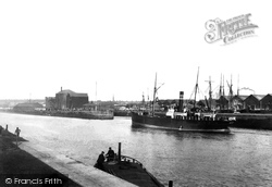
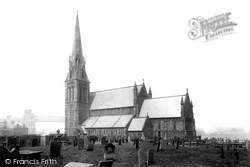
The Manchester Ship Canal runs just behind the church. The church, large enough to hold over 1,000 people, was built in the 1840s at a cost of £8,052.
The path extends for the full length of the canal.
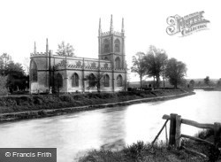
The church of St Lawrence is right alongside the Kennet & Avon Canal. This view today, a century later, is almost unchanged.
North of Daventry and close to the border with Warwickshire, Welton stands on a hillside above the Grand Union Canal. Its name comes from the springs and wells in the area.
By the time this photograph was taken, commercial carrying in narrow boats was almost at an end; it was kept going in many cases by early canal enthusiasts, for whom working long anti-social hours in all
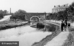
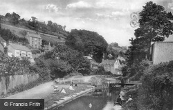
Here several small boys and girls are sitting beside the canal. In the past it was once busy with an incessant stream of barges laden with bales of cloth passing through this now-abandoned lock.
By the time this photograph was taken, commercial carrying in narrow boats was almost at an end; it was kept going in many cases by early canal enthusiasts, for whom working long anti-social hours in all
The lane to Lower Close was originally a canal, used for carrying stone for building the cathedral in the 12th century.
Horses grazing peacefully in a paddock act as a reminder of that rural past, and the Stourbridge Canal and the Staffordshire countryside are just a stone's throw away.
Several small boys and girls are sitting beside the canal.
The Lancaster Canal follows a sinuous course between Tewitfield locks and a splendid aqueduct carrying it across the River Lune, just outside Lancaster.
Places (3)
Photos (1093)
Memories (489)
Books (0)
Maps (27)


