Merry Christmas & Happy New Year!
Christmas Deliveries: If you placed an order on or before midday on Friday 19th December for Christmas delivery it was despatched before the Royal Mail or Parcel Force deadline and therefore should be received in time for Christmas. Orders placed after midday on Friday 19th December will be delivered in the New Year.
Please Note: Our offices and factory are now closed until Monday 5th January when we will be pleased to deal with any queries that have arisen during the holiday period.
During the holiday our Gift Cards may still be ordered for any last minute orders and will be sent automatically by email direct to your recipient - see here: Gift Cards
Places
36 places found.
Those places high-lighted have photos. All locations may have maps, books and memories.
- Burgess Hill, Sussex
- Brierley Hill, West Midlands
- Cotswold Hills, Gloucestershire
- Kelton Hill, Dumfries and Galloway
- Box Hill, Surrey
- Turners Hill, Sussex
- Cleeve Hill, Gloucestershire
- Biggin Hill, Greater London
- Beacon Hill, Surrey
- Mill Hill, Greater London
- Leith Hill, Surrey
- Scayne's Hill, Sussex
- Cross Hills, Yorkshire (near Silsden)
- Harrow on the Hill, Greater London
- Winchmore Hill, Greater London
- Northwood Hills, Greater London
- Walton on the Hill, Surrey
- Muswell Hill, Greater London
- Clee Hill, Shropshire (near Doddington)
- Berry Hill, Gloucestershire
- Forest Hill, Greater London
- Ide Hill, Kent
- Quantock Hills, Somerset
- Crays Hill, Essex
- Longfield Hill, Kent
- Crockham Hill, Kent
- Napton on the Hill, Warwickshire
- Herne Hill, Greater London
- Amersham on the Hill, Buckinghamshire
- Hill Ridware, Staffordshire
- Tan Hill, Yorkshire
- Forty Hill, Greater London
- Windmill Hill, Sussex
- Boyn Hill, Berkshire
- Wheatley Hill, Durham (near Peterlee)
- Horndon on the Hill, Essex
Photos
510 photos found. Showing results 1 to 20.


Maps
Sorry, no maps were found that related to your search.
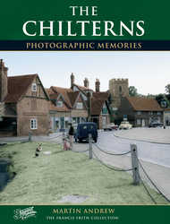
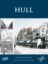
Books
3 books found. Showing results 1 to 3.
Memories
Sorry, no memories were found that related to your search.
Captions
18 captions found. Showing results 1 to 18.

In the mid-1960s the Bedfordshire branch of the Sporting Owner Drivers Club (SODC - known as The Sods) used a steep hill not too far from the location of this picture as the regular venue

Henry also gave land to the monks to build a hospital and chapel on Farley Hill.

Calton Hill can be seen in the distance.

Branthwaite Brow is one of the three streets which meet Kent Street as it leads up the steep hill opposite Miller Bridge.The others are Finkle Street and Stramongate.

Windmill Hill is just visible in the background.

Take the hills, for example. Steep gradients are not something that many people would connect with Essex.

He also wrote the inscription on both the Baxter and Hill statues.

Box Hill School has become one of the dominant features of the village; it was erected by Edward Gardener in 1870, and was then named Dalewood.

The picturesque village of Buriton stands in the shadow of Butser Hill, and by the pretty, tree-fringed pond lies the church, with its 13th-century tower watching over the tranquil scene.

The ground floor comprised a hall, a parlour, a buttery and a kitchen. Upstairs were many chambers, all magnificently furnished.

Pier Hill can be seen rising behind the foreshore buildings with the High Street stretching north from The Royal Hotel.

During the Great War, Cannock Chase was used as a training area for troops, and two military camps were established at Coppice Hill, near here, and at Brindley Heath, both connected by a railway.

A century on, the view of Church Hill in Marlborough Street is still easily recognisable, despite the two great complexes built on each side of the road, the Lloyds TSB Training Centre on the left and

Generally known as Hetty Pegler's Tump, named after a local landowner (Tump being a Cotswold word to indicate a small hill or mound), this Neolithic long barrow a mile to the north of Uley

The main axis of the principal roads consists of the Roman east-west artery, now the High Street, and one of the Roman north-south roads, now North Hill and Head Street.

A field known as Joiners Hill on the south corner of St Nicholas Lane at the entrance from High Road is shown on the 1839 Laindon Tithe Map, and it is thought that the route via Laindon High
I confess I am surprised at it, for I did not expect it; but God's will be done, and Your Lordships, I will not murmur at it. God forgive those that have sworn falsely against me.'

There was still a religious element, as the day started with a service for the Alderley Oddfellows at St Mary's, after which they paraded up the hill to the Wizard, where there was a mixture
Places (1006)
Photos (510)
Memories (0)
Books (3)
Maps (0)

