Places
26 places found.
Those places high-lighted have photos. All locations may have maps, books and memories.
- Cemmaes Road, Powys
- Six Road Ends, County Down
- Road Weedon, Northamptonshire
- Severn Road Bridge, Gloucestershire
- Roade, Northamptonshire
- Berkeley Road, Gloucestershire
- Harling Road, Norfolk
- Road Green, Devon
- Builth Road, Powys
- Cross Roads, Yorkshire
- Steele Road, Borders
- Cross Roads, Devon
- Four Roads, Dyfed
- Road Green, Norfolk
- Biggar Road, Strathclyde
- Clarbeston Road, Dyfed
- Five Roads, Dyfed
- Eccles Road, Norfolk
- Grampound Road, Cornwall
- Morchard Road, Devon
- Wood Road, Greater Manchester
- Four Roads, Isle of Man
- St Columb Road, Cornwall
- Clipiau, Gwynedd (near Cemmaes Road)
- New Road Side, Yorkshire (near Silsden)
- New Road Side, Yorkshire (near Cleckheaton)
Photos
14,329 photos found. Showing results 2,161 to 2,180.
Maps
476 maps found.
Books
5 books found. Showing results 2,593 to 5.
Memories
11,058 memories found. Showing results 1,081 to 1,090.
Binbrook, The Holiday And Life.
Onwards and upwards through the years, I had an aunty and grandmother who lived there. Ending up at No2 Mount pleasant after living in Low Lane. Lilly and Bill Stone, parents of my mother Jaqueline Stone (now ...Read more
A memory of Binbrook in 1956 by
The Shops And Doctors At Sandiway 1956
We first arrived in Sandiway in 1956. I remember getting off the bus at the top of Mere Lane and walking down towards our new home in Cherry Lane. The house was a 'tied house' belonging to the ICI and our ...Read more
A memory of Sandiway in 1956 by
Holidays In Saham Hills
Just after the war we visited Saham Hills quite regular from Hull. We stayed with an aunt and uncle of my father's by the name of Smith. He was called Charlie, his wife was Pat and they had a son who was called young ...Read more
A memory of Saham Hills in 1950 by
Do You Know Lilla Allan Bryant
I am looking for my paternal grandmother or her relatives. Her name is Lilla Allan (nee Bryant). She was married to my grandad Haydon Fraser Allan who owned Allans Bakery at 147 Windsor Road in Neath. They married in ...Read more
A memory of Neath by
May Be Its Me And My Brother And Mum
I think that that is my mum Gladys Haigh, and my brother Douglas who is 4 years older than me is beside my mum, I'm the one in the pram I think! We were going to meet my dad Jim Haigh, we used to live Main ...Read more
A memory of High Bentham in 1952 by
Growing Up In Tideswell
Memories abound about my childhood, jumping and leaping like a rabbit at Eastertime. I remember staying at my grandmother's (Norah Gregory, a marvellous woman from the no-moaner generation), or at my Great Aunty ...Read more
A memory of Tideswell in 1976 by
Childhood Memories Of Penrhyn Bay
My grandmother and grandfather lived at "Oaklands", in Maesgwyn Road, opposite a corrugated iron church. The road was unmade and beyond the church to the sea was a large meadow where cattle and sheep grazed. On ...Read more
A memory of Penrhyn in 1930
Shops
Picture shows the junction of Main Road with Crossways. I moved to Crossways aged 7 in 1961. The shop on the corner by the phone box was a Co-op, and the one on the far side of Crossways was a Post Office. From 1961 to 1970 I caught the ...Read more
A memory of Gidea Park in 1963 by
Happy Days
Oh the memories stored away!! Charlie's opposite Cove Green, going there for sweeties on a Sunday, Cove Green (not as good as Tower Hill swings though!), Mundays closing at 1pm on Sundays, Thorntons with its yellow facade, and wool etc, I ...Read more
A memory of Cove in 1965 by
Pappa India
Yes, I remember the time the Trident crashed near the "Crooked Billet" pub. I was driving a 116 bus and was on the bus stand in Staines. The journey to Staines from Hounslow was uneventful. I had about 20 minutes before ...Read more
A memory of Heathrow Airport London in 1972 by
Your search returned a large number of results. Please try to refine your search further.
Captions
5,036 captions found. Showing results 2,593 to 2,616.
The high-roofed White Hart, along the road, survives to this day.
Crown Hill was the setting for an unusual wager in 1936: a Grays confectioner was bet that he could not cycle backwards up the 1-in-7 road. He
North of the church the road runs along the medieval sea bank.
Station Road is readily recognisable as it drops away from the underground station towards Hale Lane and Mill Hill.
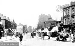
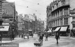
This is a classic photograph of a north London suburb around the turn of the century, with a mix of design and scale in the road-side buildings.
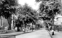
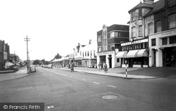
In this view the trees are more mature and obscure the long facades of this eleven hundred foot long road.
This was swept away in 1933 for the road improvements seen here, still pompous and vandal fresh.
East from St Peter's Hill, Avenue Road descends towards the River Witham, lined by middle-class late Victorian semi-detached villas.
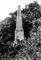
Situated in woodland near the Midhurst to Cocking road, the Cobden Monument was erected in memory of Richard Cobden MP, an advocate of free trade and an anti-Corn Law agitator.
By the time of this photograph, the view from the Beaconsfield Road had changed very little over the previous twenty years or so, except for the addition of the garage next to the parked vehicle (right
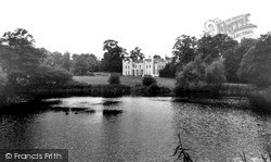
Wistow Hall sits comfortably by its artificial lake, even though Wistow Road, from Kilby to Kibworth Harcourt, runs directly past the front door.
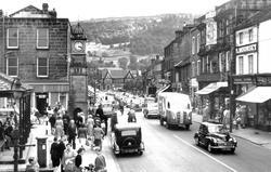
The bustle of what must have been a market day is evident in the thronging crowds around the clock-tower and the busy road.
This view towards the Ship Canal shows London Road free of today's endless stream of traffic.
The Scotland Road area can be seen in the distance - this was at a time before the impact of the building of the Cockhedge Shopping Centre in the 1980s.
This view looks north towards the cross-roads; the London- Holyhead telegraph poles are in situ. Urchins, horses and carts dominate the carriageway.
This junction of two streets marks the site of the former market place, with the stolid red-brick White Lion, on the extreme right, and the King of Prussia pub along the road on the left, ready to slake
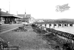
The iron bridge (demolished in 1978) brought the line from Exeter, and did not run parallel to the road bridge.
Turning north into the upper Exe valley, we enter the Exmoor National Park at Dulverton, on the Exford Road in the tributary valley of the River Barle.
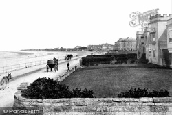
Beverley Cottage of the 1850s has a battlemented parapet, and beyond are two crescents, each flanking the junction of the promenade with Sea View Road.
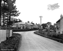
The scene has hardly changed at all, except that there are now more houses beyond the road. Like so many villages locally, the population has grown considerably in the last few years.
Being so near the old Roman road from Manchester to York, and being so well-placed on many routes, it has always had a reputation for putting up visitors and travellers.There was once a royal hunting
It is odd that the street lighting is only on the left side of the road, supported by the telephone poles.
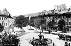
The western side was then demolished and rebuilt, but it was another seven years before the eastern side was pulled down to give the road the width which exists today.
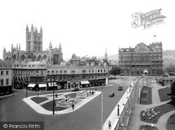
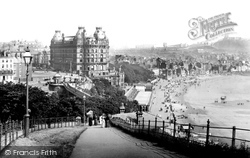
The iron footbridge spanning Valley Road can be clearly picked out to the left of and below the Grand Hotel.
Places (26)
Photos (14329)
Memories (11058)
Books (5)
Maps (476)


