Places
26 places found.
Those places high-lighted have photos. All locations may have maps, books and memories.
- Cemmaes Road, Powys
- Six Road Ends, County Down
- Road Weedon, Northamptonshire
- Severn Road Bridge, Gloucestershire
- Roade, Northamptonshire
- Berkeley Road, Gloucestershire
- Harling Road, Norfolk
- Road Green, Devon
- Builth Road, Powys
- Cross Roads, Yorkshire
- Steele Road, Borders
- Cross Roads, Devon
- Four Roads, Dyfed
- Road Green, Norfolk
- Biggar Road, Strathclyde
- Clarbeston Road, Dyfed
- Five Roads, Dyfed
- Eccles Road, Norfolk
- Grampound Road, Cornwall
- Morchard Road, Devon
- Wood Road, Greater Manchester
- Four Roads, Isle of Man
- St Columb Road, Cornwall
- Clipiau, Gwynedd (near Cemmaes Road)
- New Road Side, Yorkshire (near Silsden)
- New Road Side, Yorkshire (near Cleckheaton)
Photos
14,329 photos found. Showing results 3,181 to 3,200.
Maps
476 maps found.
Books
5 books found. Showing results 3,817 to 5.
Memories
11,058 memories found. Showing results 1,591 to 1,600.
Hatch End 50/60/70s Memories
As I’ve only just stumbled on this web page so offer excuses if it’s past its sell by date. I lived in Sylvia Ave Hatch End from 1951 (as a babe in arms) until I married and moved away in 1976. My recollections may now ...Read more
A memory of Hatch End by
The Way We Were
In 1946 my family Mum, Dad,brother Alex and sisters Jenny and Kay moved into a requisitioned house in Hollybush Hill. The house was called Surinam and it was a beautiful old house with a sweeping staircase and cellars ...Read more
A memory of Wanstead by
Rye Mill Cottages
My maternal great grandmother (or possibly Great Aunt), Mrs Curtis, was of Romani (Gypsy) descent and lived in one of the row of cottages that fronted the Rye (Pann) Mill on London Road, High Wycombe, opposite the Trinity ...Read more
A memory of High Wycombe by
My Time Living In Old Langho.
I moved to Old Langho in I think in 1954, I was an orphan I went to live with Mr and Mrs Pye. We lived at number 42 Larkhill, Mr and Mrs Pye where nurses at Brockhall hospital. There is a bit of a field between the ...Read more
A memory of Old Langho by
Visiting Salford Circa 1955 60
My Grandparents Henry and Alice Dorning lived on Brighton Street which on trying to trace the existence of has proved to be a struggle. I remember visiting them with my parents at the age of 5-9 years of and at the time ...Read more
A memory of Salford
A Very Happy Childhood At Westbury
My name is Andy Pike, getting on a bit now but lovely to read other folks memories of Westbury. Here are a few reminiscences of my childhood in Westbury on Trym in the 50's and 60's. Maybe this will ring a ...Read more
A memory of Westbury on Trym by
Blundellsands Beach.Prior To 1960
I was thirteen at the time and lived off Riverslea Road, which led down to a walled field on to the beach. My friends Derek Austin, Les Reece, Charlie Kelly, and a few others had built the Biggest Bonfire ...Read more
A memory of Blundellsands in 1953 by
The Day I Was Born
I was born on 22nd June 1948 at 95 Dryfield Road in the front main bedroom of my nans's house. We lived there until I was 8 when we left my nan's and moved to St. Johns Wood in London. My nan lived there until I was in my ...Read more
A memory of Burnt Oak in 1948 by
Memories Of Peel Green
I have lived in Peel Green all my life, it was a lovely area. I went to Godfrey Ermans and Winton Senior. I was the eldest of seven children and we lived in Rowsley Road, we used to play on Goddies Park and go over the ...Read more
A memory of Peel Green in 1950
Town Hall, Mitcham
I remember Mitcham very well. I lived in the Town Hall where my Dad was the caretaker. My surname then was Parkings. I used to go to Leo's and George's cafe with my friend Josie where I met my husband-to-be David Rogers. We spent ...Read more
A memory of Mitcham in 1956 by
Your search returned a large number of results. Please try to refine your search further.
Captions
5,036 captions found. Showing results 3,817 to 3,840.
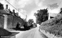
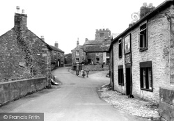
Some of the older buildings of the village present a pretty and tranquil picture below the wooded hillsides, although in 1955 the road through the middle of Staveley still carried all the traffic to and
In our post-industrial age you can now follow the same road out of Risca to the Dan-y-Graig nature reserve, which is situated on land given to the Gwent Wildlife Trust by the Risca
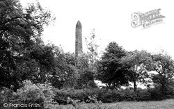
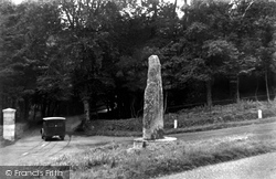
A little north of the attractive village of Naseby, on the Market Harborough road, this 40 ft high stone obelisk commemorates the Battle of Naseby at which the New Model Army routed the Royalists in 1645
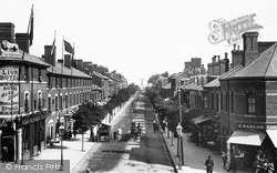
At the west end of Lumley Road there were a few shops in 1899, but the view is utterly transformed now from Roman Bank, a reference to the old Roman sea wall.
Ludford is a now a single-street village on the Louth to Gainsborough road at the head of the River Bain, which flows south through the Wolds to join the River Witham.
East of Lincoln, Wragby is a market town on the Horncastle and Skegness road which is very busy at weekends and in summer.
This 7-foot-tall inscribed stone stands on the B3269 road, and was moved to its present position from Castle Dore. It is reputed to be of the 6th century.
This is the Colsterworth Road, and the lane to the left is Lord's Lane - but which Lord it does not state.
The local council has already made a start on digging up the road and footpaths.
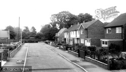
The Greedon Estate is situated on the north west side of the Seagrave Road. This is a particularly uninspiring view, but again it is a view so typical of peripheral village estates.
Flames jumped the road and damaged a thatched building opposite.
On the corner of Quay Road is Corner House of c1800 with black advertising panels (centre), now gone, alas.
However, since this view was taken, East Retford's inner relief road, Arlington Way, has been cut across the foreground; the three shops to the left of the Sherwood Rangers Inn, now simply
Just on the edge of the photograph (right) is George Green's smithy, demolished during road improvements in the 1970s.
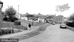
Another of the town's important roads, Crow Lane East was extended in the 1960s with the addition of a library, the original Technical School and a large estate of social housing.
As an approach to Junction 1 of the M53 motorway, Leasowe Road (A551) is now dual carriageway for much of its length.
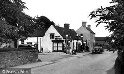
A village on the eastern edge of the St Leonards Forest at a high point on the London to Brighton trunk road. The Red Lion, c1550, is an old coaching inn.
We are on the Eastbourne main road, south of Uckfield. Halland Park Farm is the remains of the mansion built in 1595 to replace Laughton Place as the principal house of the Pelham family.
It is at a junction on the old Caton to Claughton road, which we can see going off to the left. The inn on the right is the Black Bull, and Leslie Speckling was landlord at the time.
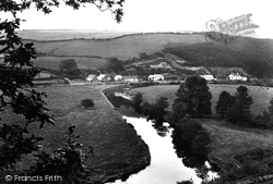
This is the River Torridge, viewed rfom the Bideford to Torrington road. Trees have grown, and it is not possible to see this view now.
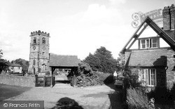
St Oswald's Church sits right at the end of a very rough cobbled road, hence the street is called The Cobbles.
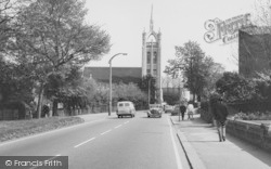
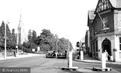
Centre white lines, street lighting and traffic lights control the road junction, and there is an official bus stop outside the church.
Here, at about that time, Frith's photographer looks north along the main Hindhead-Farnham road towards the Crossways: this is what the main crossroads in Churt is called, and so is the pub at the
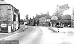
In the far distance the road curves into Ock Street, which is also lined by old buildings. Nearer to the camera, the High Street narrows at the junction with West St Helen Street.
Places (26)
Photos (14329)
Memories (11058)
Books (5)
Maps (476)


