Places
26 places found.
Those places high-lighted have photos. All locations may have maps, books and memories.
- Cemmaes Road, Powys
- Six Road Ends, County Down
- Road Weedon, Northamptonshire
- Severn Road Bridge, Gloucestershire
- Roade, Northamptonshire
- Berkeley Road, Gloucestershire
- Harling Road, Norfolk
- Road Green, Devon
- Builth Road, Powys
- Cross Roads, Yorkshire
- Steele Road, Borders
- Cross Roads, Devon
- Four Roads, Dyfed
- Road Green, Norfolk
- Biggar Road, Strathclyde
- Clarbeston Road, Dyfed
- Five Roads, Dyfed
- Eccles Road, Norfolk
- Grampound Road, Cornwall
- Morchard Road, Devon
- Wood Road, Greater Manchester
- Four Roads, Isle of Man
- St Columb Road, Cornwall
- Clipiau, Gwynedd (near Cemmaes Road)
- New Road Side, Yorkshire (near Silsden)
- New Road Side, Yorkshire (near Cleckheaton)
Photos
14,329 photos found. Showing results 3,841 to 3,860.
Maps
476 maps found.
Books
5 books found. Showing results 4,609 to 5.
Memories
11,058 memories found. Showing results 1,921 to 1,930.
Severn Beach 1937 To 1956
I was born in Severn Beach in 1937 and lived in number 11 Ableton Lane, later to become Church Road! I remember the Stockham family very well and the Scrivens, Mrs Lukins, and all along the road, Vowles, Grimes, ...Read more
A memory of Severn Beach in 1930 by
Strawberries For Tea
Every year on my birthday my mother and father made June 21st. (or the closest Saturday) a very special day for me. Since I was old enough to remember I had strawberries on my birthday. However, that was not all. The ...Read more
A memory of Buckhurst Hill by
Growing Up In Pembridge
I was born in 1960 at Glanarrow Cottages, Bridge St. All my early memories are of a happy childhood. I can remember the deep snow of 1963, when I opened the back door it seemed that the snow was halfway up it!!! I can ...Read more
A memory of Pembridge by
The Lynemouth Inn
We used to call it the hotel, it was the hub of the village, there was a bottle and jug at the side door and me dad would send me down to get a bottle of double maxim and let me have a little taste when I was just a bairn. We ...Read more
A memory of Lynemouth in 1967 by
Coleton Fishacre Near Kingswear
Just a five minute drive along Mt Ridley Road to the east of Kingswear will lead you to a glorious National Trust house and garden called Coleton Fishacre. I have two memories of my visit - the wonderful ...Read more
A memory of Kingswear in 2012 by
Teenage Years
I was born and grew up in Perth, going to Caledonian Road Primary School and then to Perth High School. I lived in South Methven Street until I was about 12 when we moved to Muirton. My teenage years were spent visiting coffee bars ...Read more
A memory of Perth in 1960 by
Old Quarry Court
Just to point out this photo is Quarry Court/Liverpool Road, near Royal Ave. Does anyone remember the old grave stone? It was moved to St Michs at the top of Ditchfield Road.
A memory of Widnes
Spitfire
I well recall the day I set off for school, it was sunny as I left the house by Black`s garage. As I approached the school, I noticed a large crowd opposite the school gates. A spitfire had come down between two houses without touching ...Read more
A memory of Callander in 1940 by
Family
My great grandmother, Mrs Burbidge lived in the house on Charwelton Hill, three fields away from the main road. Mother said a tin box was left by the road where post, bread and groceries were left. Later, in 1941 my grandfather, gran and ...Read more
A memory of Charwelton in 1940 by
I Lived And Worked Nearby
We lived as a family in Gonville Road with St Judes Church on the corner of Thornton Road, to the left of this picture. I remember the Pond when it was full of rubbish so this garden was an improvement when it was ...Read more
A memory of Thornton Heath by
Your search returned a large number of results. Please try to refine your search further.
Captions
5,036 captions found. Showing results 4,609 to 4,632.
The modern expansion of Groby as a Leicester suburb can be seen on the left, as the road swings towards Coalville.
The curving footpath was probably on the original road line from Pilton to Barrowden. The setting of the 14th-century battlemented tower and its crocketed recessed steeple is ideal.
To the right of this picture can be seen houses in Archer's Road, part of the development of Newtown in c1910.
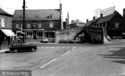
The 14th-century bridge was a three-road crossing point all those years ago. Now it is a unique part of Lincolnshire's history.
Both the new high-level road bridge and the old transporter can be seen on our photograph.
Also, the High Streets have the quaint name 'the Village', so we have a road named Liskard Village, Upton Village etc.
The street becomes East Road and was gated with a level crossing (in front of the thatched cottage) for the West Bay extension of the Bridport Railway, in use from 1884 to 1962.
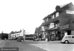
On the other side of the road, dispensing pharmacist N R Hilton is now trading as Hilton and Moss Chemists (right).
In the road are the corn rails - these were removed in 1929.
The Ridgway is one of the roads that was laid out to replace these lavender fields.
Little Chalfont, a name given the area by developers in the 1920s, grew up around Chalfont Road Station on the Metropolitan Line which opened in 1889, with a branch to Chesham opening the following year
Butting onto the pavement area on the left is the bulk of the Crown Inn, one of two coaching inns at the end of the old road to London. By 1950 the Corn Exchange was no longer in regular use.
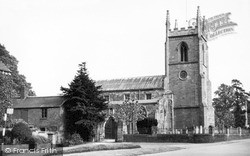
Close to the road, the solid but impressive ashlar tower dominates the immediate street scene with its substantial angled buttresses and crocketted finials; these are not 15th-century, but were added
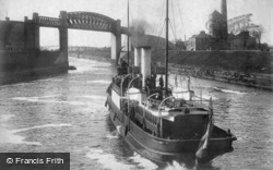
Beyond the viaduct is the Knutsford Road Swingbridge and the Latchford High Level Bridge. This was the last section of canal to be completed; the excavation was 55ft deep.
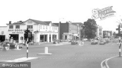
Frank Gates (left) had moved to this location by 1926 (having been in Chelmsford Road in 1922), and by 1937 was the main Ford dealer.
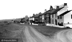
This is the road down to the shore (and Red Bank Farm). Red Bank is one of the spots from which you can cross the sands over to Kents Bank.
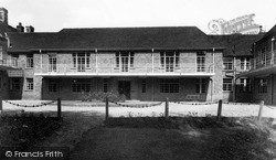
The old sanitorium was not big enough and one of the first acts of the new head, J F Wolfenden, was to build a new and large sanatorium on Stockerston Road.
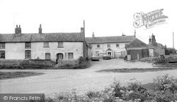
Situated on the main coast road, this public house is extremely convenient for tourists and the villagers.
London Road, the old A1 before the town was by-passed, becomes Lombard Street before turning right into Castle Gate with its many former coaching inns; it then turns left beyond the castle
It has trap doors for direct loading into the narrow barges, or 'cuckoos' as they were known, and a crane on the canal bank. It is now part of the Lock Tavern, which fronts the road.
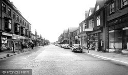
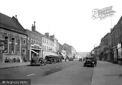
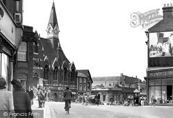
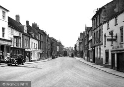
The High Street is looking remarkably quiet and empty – there are only a few vans and cars, and no road markings.
In 1981 they crossed the road to the building occupied here by E Harris, the chemist (second from the right).
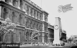
Once the site of a rambling royal palace largely burned down in the 1690s, the road gradually acquired government offices and the home of the prime minister in Downing Street - its entrance
The King's Road was famous for trendy clothes and antique shops; in the 1960s Minis and Triumph Herald convertibles cruised up and down, the pavements thronged with peacock-gaudy young men and women.
Places (26)
Photos (14329)
Memories (11058)
Books (5)
Maps (476)


