Places
36 places found.
Those places high-lighted have photos. All locations may have maps, books and memories.
- Shanklin, Isle of Wight
- Ventnor, Isle of Wight
- Ryde, Isle of Wight
- Cowes, Isle of Wight
- Sandown, Isle of Wight
- Port of Ness, Western Isles
- London, Greater London
- Cambridge, Cambridgeshire
- Dublin, Republic of Ireland
- Killarney, Republic of Ireland
- Douglas, Isle of Man
- Plymouth, Devon
- Newport, Isle of Wight
- Southwold, Suffolk
- Bristol, Avon
- Lowestoft, Suffolk
- Cromer, Norfolk
- Edinburgh, Lothian
- Maldon, Essex
- Clacton-On-Sea, Essex
- Felixstowe, Suffolk
- Norwich, Norfolk
- Hitchin, Hertfordshire
- Stevenage, Hertfordshire
- Colchester, Essex
- Nottingham, Nottinghamshire
- Bedford, Bedfordshire
- Bury St Edmunds, Suffolk
- Aldeburgh, Suffolk
- St Albans, Hertfordshire
- Hunstanton, Norfolk
- Chelmsford, Essex
- Bishop's Stortford, Hertfordshire
- Peterborough, Cambridgeshire
- Brentwood, Essex
- Glengarriff, Republic of Ireland
Photos
11,145 photos found. Showing results 4,741 to 4,760.
Maps
181,031 maps found.
Books
442 books found. Showing results 5,689 to 5,712.
Memories
29,069 memories found. Showing results 2,371 to 2,380.
Notes From The Frith Files.
This photograph shows residents waiting for the No.144 Midland Red bus from Malvern to Worcester outside the village shops. Far left is EW Bird's butchers, left is Cromptons newsagents, off picture further left is Procters ...Read more
A memory of Powick
Hundredth Anniversary Of Wordsworth's Death
I was born in Bridge Street and went to Fairfield School, or "Fairfield Junior Mixed" as it was called when it became Co-Ed in about 1948. I remember the whole class having to walk up to Harris Park and ...Read more
A memory of Cockermouth in 1950 by
My Memories Of Living In Westbury Leigh 1940 1944
The house shown in the foreground of this photograph was the home of my Uncle, Percy Drury. This was sometime around 1940/42, I do not know how long he resided there. I lived at 115 Westbury ...Read more
A memory of Westbury Leigh in 1940 by
View Down Onto Umberleigh Bridge, Showing Village Square
It is with great interest we see your picture of the village square, showing what is now the Post Office and largest post code sorting office in England. It also shows the Regency Gables Tea ...Read more
A memory of Umberleigh by
Moving Of The War Memorial
Note in this photo that the war memorial has been moved back and the wall lowered. Flats have been built on the Banstead house site. You could always see the green houses over the high wall from the top of the 164a bus. ...Read more
A memory of Banstead in 1956 by
Born In 1941 Redhill A Wonderful Place To Have Grown Up
I was born and raised in Redhill. It was a wonderful childhood and many great memories. I was born in 1941 at Thornton House. We lived on Ladbroke Road, and remember the fish and chip shop, ...Read more
A memory of Redhill in 1950 by
The Cadena Cafe
This shot of the High Street presents the signage for the Cadena Cafe, a chain of national cafes (in the 'Lyon's' mould) where shoppers met for coffee and light meals. I have fond memories of visiting the cafe with family and ...Read more
A memory of Worcester by
Building Relocated
Around the 1920s this building was known as Perry's Place and was located diagonally opposite the Black Jug, known then as the Hurst Arms. It was dismantled and moved to nearby Mannings Heath. It now forms the clubhouse and is ...Read more
A memory of Horsham in 1920 by
Your search returned a large number of results. Please try to refine your search further.
Captions
29,395 captions found. Showing results 5,689 to 5,712.
Heading north-west roughly parallel to the River Witham, we reach two small towns on either side of the River Bain, which meets the Witham a mile away at Dogdyke.
Even the wooden gate (centre) is newer, but of the same functional design.
How sad – this is the end of our photographic journey around this part of the Vale of Glamorgan.
Taking its name from the wife of Edward VII, the park was officially opened on 25 June 1902 – the date scheduled (but not kept) for his coronation.
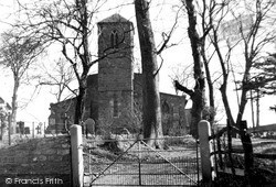
This is a closer view of the Church of St Thomas. One might almost call it a utility building.
One of the darkest deeds in English history took place in Saxon times, when King Edward was murdered, probably by order of his stepmother, in 978.
Mardy village in 1955 had far less housing than it does today. The semi-detached houses on the left of this picture were the only buildings at that date.
He is in the gown of an Alderman, and he was a Lord Mayor of London.
De Vaux Place 1928 On the Salisbury side of Harnham Bridge, De Vaux Place leads to The Close - the Harnham Gate is at the far end of the wall.
The coming of the railway in 1856 prompted a rapid expansion of this village: in 1851 it had a population of only 437, which within twenty years had grown to 3,577.
Originally called 'Ac stede', 'the place of oak trees', old Oxted now has the busy A25 sweeping through its High Street, and it is unlikely that the two mothers with prams would envisage making such casual
Silverdale is a beautiful limestone village in the midst of woods and craggy outcrops.
The Victorian stepped gables, porch and Tudor-style windows of Old Castle House beyond mask a timber building of c1600. The adjoining Victoria Cottage with round-topped windows is dated 1839.
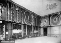
The King's Guard Chamber contains one of the world's greatest displays of weaponry.
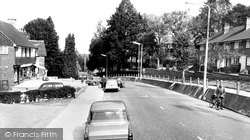
The street lighting has been upgraded, though the gradient of the road still forced the cyclist to dismount to push his bike.
This small elevated village lies about a mile to the north-east of Melton Mowbray on the A607 Grantham road.
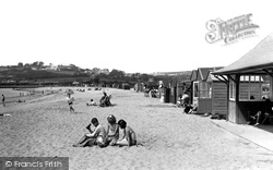
The huts are arranged just above the high tide mark along the length of Par Beach. Much of the sand has been derived from waste entering the bay from mines and china clay works inland.
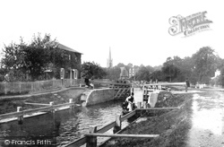
The pound lock replaced the hazardous flash locks in the middle of the weir in 1773.
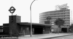
Simply elegant, this is the last of a superb series of 1930s underground stations extending along the northern section of the Piccadilly Line, including Arnos Grove, Southgate and Oakwood, all designed
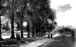
The Causeway leads from the town of Buntingford to the original, and now derelict, parish church of St Bartholomew, Layston.
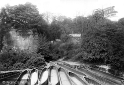
This view looks towards one of the entrances to the series of underground canals that extended to the Duke's pits at Walkden.
Just north of the village is Brewery House, home of Sir William Hooker and his son Joseph.
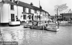
These charming houses are at the east end of the quay; the left-hand one, Ferry House, is a reminder of the Colne ferry that crossed the river here. To the right are the cranes of a boatyard.
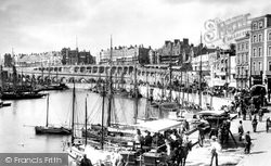
Part of Ramsgate's famous fleet of fishing smacks are moored in the inner harbour.
Places (6814)
Photos (11145)
Memories (29069)
Books (442)
Maps (181031)


