Places
8 places found.
Those places high-lighted have photos. All locations may have maps, books and memories.
Photos
77 photos found. Showing results 41 to 60.
Maps
49 maps found.
Books
Sorry, no books were found that related to your search.
Memories
1,425 memories found. Showing results 21 to 30.
My Schooldays 1952 54 Near Skipton
My Grandparents lived at 26 Otley Street in Skipton from the 1940 ( or earlier ) and I had first visited them in 1945 after VE day, They were Thomas Henry Jackson, my Grandmother Charlotte Jackson and their ...Read more
A memory of Skipton in 1952 by
Mid 1960s Mid 1980s
My parents David & Valerie, and younger brother Roger Angus lived at 'Rosevine' opposite the Rectory. The then vicar, Christopher Leach lived in the Rectory with his wife and children Godfrey and Hilary. Additionally, they ...Read more
A memory of Combpyne by
Life Around St Nicholas Church
When we were children we used to toboggan down St Nicholas Hill in snowy weather, which was wonderfully exciting as it is so steep. I was married in St Nicholas Church on 25th July 1959 which was an exceptionally hot ...Read more
A memory of Laindon in 1959 by
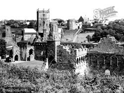
Mount Edgecumbe Ruins
One hundred years after this photograph was taken my husband and I visited these ruins during a holiday when we celebrated our Silver Wedding. We had came back to the West Country so that we could visit all our old haunts. We ...Read more
A memory of Plymouth in 1990 by
The Palace Cinema
The pub on the left of the picture was renowned for a few brawls in it's time, originally called The Globe (now known as Raferty's) I recall walking down Cambridge St and seeing a man being hurled through the window into ...Read more
A memory of Wellingborough in 1968 by
History Of Clayton Family 1700s
Descendants of George Clayton Generation No. 1 1. GEORGE1 CLAYTON was born 1788 in Pickhill, West Roxby, Yorkshire England. He married ANN MUDD 08 December 1806 in Pickhill, West Roxby, Yorkshire England. She ...Read more
A memory of Pickhill in 1860 by
Henry Tingey Ancester
My great grandfather Henry Tingey, was born November 18, 1819, in Biggleswade, Bedfordshire. He was the son of James Tingey and Elizabeth Boniss. James and Elizabeth, and family later moved from Bigglewade, Bedfordshire, ...Read more
A memory of Biggleswade by
Follansbee Aka Follingsby Or Foljambe Of Hamsterley Durham England
This isn't exactly a 'memory' as it is a fact relating to my ancestors, the Follansbee's of Hamsterley, County Durham, England. It is recorded that the Follansbee's (various ...Read more
A memory of Hamsterley by
The Howard Family Of Barnes And Hammersmith
My Great-Great-Grandad, Henry Howard, lived in the early 1800’s - a time of great rural depression - and so he left his Devon home to look for work in London with the result that several generations of my ...Read more
A memory of Barnes in 1870 by
The Convent
My father died the year after I was born and his employer Burton's, provided for myself and my three brothers to attend private schools, which is how I came from London to the Convent at the age of 4. I followed my brother Colin who ...Read more
A memory of Bridport in 1947 by
Captions
876 captions found. Showing results 49 to 72.
The higher gable beyond is Cross the florist, whose nursery was at Chapel Farm on Hollow Road.
Standing between the Dartford Road and Seal Hollow, and with its Club Hall visible on the north side, it was built by the Constitutional Club company for social and political meetings, and contained
The sea wind drops, the smoke rises upward from the chimneys, and a man looking at the church in the hollow knows it to possess the longest memory in Britain.'
During the early part of the 18th century, a local parson named Jonathan Darby from the parish of East Dean unofficially displayed a candle-burning lantern hung in a hollow carved out of the chalk
Following the building of St Anne's, Ansdell and Fairhaven were slower to develop, remaining an area of woodland and sandhills.
The photographer stood with his back to the impressive medieval castle motte to look across The Hollow into Borough Street and the town, with its excellent array of mainly 18th-century
The photographer stood with his back to the impressive medieval castle motte to look across The Hollow into Borough Street and the town, with its excellent array of mainly 18th-century
Moving northwards from the church along the Hollow, the path crosses Main Street into Sapley Road. It is difficult today to imagine that this is the sight that would have greeted travellers.
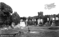
This view within the courtyard of the castle shows it after the 1770s stripping out to a hollow shell for the building of Herstmonceux Place, a house designed by Samuel Wyatt.
The hollow circular tower is open to the elements, and provides a good home for hundreds of pigeons. It is over 100ft high, and is divided into four storeys.
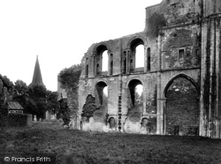
The west wall of the south transept is interesting, as it features Gothic hollow- walling in the middle storey.
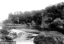
In the 18th century a hermit or holy man lived in a small hollow in the rock.
Following the Reformation, it ended up in the hands of a local squire. Later, it was owned by the Braddyll family, who did much reconstruction work before going bankrupt.
Rothwell's history dates back to long before the Danish invasion of the Dark Ages. 4,000 years ago Bronze Age settlers came to this area, followed by the Romans.
The A29 that runs in a straight line through the village follows the course of the Roman Stane Street.
The following year disaster struck the local herring fleet when the temporary light was somehow dislodged during a storm, leaving many of the boats blind.
By the 1980s the Conservative government had closed Britain's coal mining industry following a series of crippling strikes.
During the years that followed other wealthy Hampshire gentlemen followed his example. It was to be the very end of the century before the town became popular as a holiday resort.
During the years that followed other wealthy Hampshire gentlemen followed his example. It was to be the very end of the century before the town became popular as a holiday resort.
Frederick Barker was born at Baslow on 17 March 1808, and followed other members of his family by becoming a churchman.
Many estates of what we now call social housing sprang up around Britain following the war.
The raised bank followed the Taw from Castle Quay and turned right to follow the Yeo to Braunton Bridge. This area was another example of the work of R D Gould, the borough surveyor.
Though it is now widely accepted that the bridge was built in 1569, there is a theory that the structure is in fact older, and that the date of 1569 refers to its restoration following damage received
Crowghyll Park was opened to the residents on 31 May 1890 following a civic ceremony led by Mrs Titus Salt.
Places (8)
Photos (77)
Memories (1425)
Books (0)
Maps (49)


