Merry Christmas & Happy New Year!
Christmas Deliveries: If you placed an order on or before midday on Friday 19th December for Christmas delivery it was despatched before the Royal Mail or Parcel Force deadline and therefore should be received in time for Christmas. Orders placed after midday on Friday 19th December will be delivered in the New Year.
Please Note: Our offices and factory are now closed until Monday 5th January when we will be pleased to deal with any queries that have arisen during the holiday period.
During the holiday our Gift Cards may still be ordered for any last minute orders and will be sent automatically by email direct to your recipient - see here: Gift Cards
Places
Sorry, no places were found that related to your search.
Photos
Sorry, no photos were found that related to your search.
Maps
7,034 maps found.


Books
163 books found. Showing results 8,041 to 8,064.
Memories
22,913 memories found. Showing results 3,351 to 3,360.
Dog Walks
I remember walking our dogs Bradley and Monty here. It was always beautiful. We now live in Australia and Brad came with us. He passed away peacefully in 2011. Monty stayed at home and also had a long life. Bitter sweet memories
A memory of Bradford in 2000
Early Days
I was born and brought up in Pembroke terrace and with number of lads of like age wandered the mountains through theSaucy ap and over to overlook the Rhondda . We would climb up an run down hills,run through rivers and ply cowboys ...Read more
A memory of Ogmore Vale by
Corner Cottage. 1950 To Now
My parents moved to Blebo from Dura Den in 1950 when I was six. A windmill for electricity with 12 volt light bulbs. Paraffin lamps and a cesspool. It was several years before the pumping station at Clatto was built ...Read more
A memory of Blebocraigs in 1950 by
Glades End, Surf Crescent
Eastchurch cliffs My parents bought a plot of land on the Eastchurch cliffs in the 1940s and my father designed and had built our bungalow called Glades End in Surf Crescent. At this time, there were very few buildings ...Read more
A memory of Eastchurch in 1953 by
Greywell House, Callow Hill
My family lived in Greywell House from 1955 when I was 9 until about 1965/66. I attended Runnemede House School in Rusham Park Avenue in Egham for a few years then moved on to St Brigidine's Convent in Windsor. I ...Read more
A memory of Virginia Water in 1955 by
Burns Drive
My grandparents lived at 5 Burns drive in the early 70s.I remember walking with my grandad to studfall shops and down to corby swimming baths.My grandad was also m.c at the silver band club in the 60s.They moved to browning walk late 70s ...Read more
A memory of Corby by
General History Contacts And Contributions Welcome
William Evans born 1843 in Llanelli, Camarthen Wales moved to Bedlington Northumberland in 1861 and married Mabel Bell, in 1863. They first lived at the Barrington Colliery with their young ...Read more
A memory of Seaton Delaval in 1860 by
Julie Millburn, Park View.
HELLO AGAIN, CAN YOU REMEMBER THE PRISONERS OF WAR USED TO GET DROPPED OFF AT THE TOP OF THE STREET BY ARMY WAGON AND THEN PICKED BY TRACTOR AND TAKEN UP TO HANKEYS FARM UP THE NORE LANE TO WORK ON THE FARM. PLEASE ...Read more
A memory of Witton Gilbert in 1947 by
Pear Tree Estate
My family (the Millers) lived in Hillary Crest on the Pear Tree Estate. Dad, Bill, was an electrician in the mine (possibly Coppice). He also had a 2nd job at the Pub at the bottom of the Estate where he sold ales & played ...Read more
A memory of Rugeley in 1955 by
Happy Days
My auntie Pat and Uncle Les Lakin lived along here we as kids were always up here visiting them for tea and cakes it was posh up here we lived in Walkwood Road went to Crabbs Cross Primary, Mrs. Bradbury my fav. teacher lived at the ...Read more
A memory of Redditch in 1956
Your search returned a large number of results. Please try to refine your search further.
Captions
9,654 captions found. Showing results 8,041 to 8,064.

The Toll House at St Stephens was built in 1761 by the Launceston Turnpike Trust, which had come into being the previous year with the intention of 'widening and keeping in repair several roads leading
The Toll House at St Stephens was built in 1761 by the Launceston Turnpike Trust, which had come into being the previous year with the intention of 'widening and keeping in repair several roads leading

It was in the 17th century that Greenock developed as a port, providing a packet service to and from Ireland.

Here is a village at ease with itself, in the heart of stone country. On the extreme right is a single-decker bus which would now be an asset to any transport collection.

The view is dominated by a fine 17th-century stone-faced house of two bays under a stone-slated roof, with substantial end stacks. The lower, later wing has been given a modern door.

We are looking at the choir screen and the organ above it from the main body of the church. The choir where the Bishop and church dignitaries sat was beyond the screen, cut off from the congregation.

This is one of the main routes out of the city. Behind the horse and carriage is the old Yorkshire Penny Bank (1895). On the left is the Theatre Royal (1864), originally the Royal Alexandra Theatre.

We are looking down Cross Square to the magnificent Cathedral. On the left is the Grand Clothing Hall, a well-loved outfitters, built in 1906.

Bedford grew up at a ford over the River Ouse before the arrival of the Anglo-Saxons in the mid to late 5th century AD. It is certainly the river that gives the town its character now.

At the top of the High Street, the photographer looks south. The Lime Street/Lurke Street junction is beyond the Swan Hotel's handcart.

Half a mile north of New Mill is a complex of reservoirs; they were built by the Grand Junction Canal in the 1830s to store water for the Marsworth Flight of locks, whereby the canal descends from the

This is the original Adelphi Hotel: it was built in c1840 on the site of Adelphi Gardens by the Midland Railway Company, and was in direct competition with the London North Western Railway Hotel, which

Between Soham and Wicken once lay a large expanse of water called Soham Mere. It suffered from gradual encroachment by farmers over the centuries, and finally succumbed in the drainage of 1664.

Raglan Castle is an imposing, solid structure and was one of the last defensive castles to built in Wales.

Moving south-west, the tour reaches East Harting, a hamlet east of South Harting, the main village with the parish church.

This is looking northwards up South Street, to Stag House at the top end of West Street and the Town Hall (centre).

According to legend, Glastonbury Tor is Avalon, an earthly Celtic paradise, rich in fruits and crops.

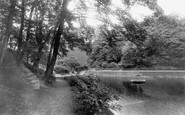
This ten-acre park was purchased by the council with the help of donations in 1904 from the landowner, Mrs Maynell Ingram of Temple Newsam House, Leeds.
Chalk stacks off Handfast Point, the north-eastern extremity of the Purbeck Hills, display the dynamics of coastal erosion.

Within 15 years of being built the bridge needed to be widened so that today it carries four lanes of traffic.

The road to the right of the Three Cups Inn is St Mary`s Street.

Heysham became the centre for travel to the Isle of Man, and in 1923 the Fleetwood services were transferred there.

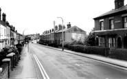
The High Street is distinctly low-key: the terraces of late Victorian shops are augmented by 1930s buildings, as we see on the left, and now several have been converted to take-aways.

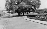
Descending from Chipstead into the next valley east brings us to Hooley.
Places (0)
Photos (0)
Memories (22913)
Books (163)
Maps (7034)

