Places
26 places found.
Those places high-lighted have photos. All locations may have maps, books and memories.
- Cemmaes Road, Powys
- Six Road Ends, County Down
- Road Weedon, Northamptonshire
- Severn Road Bridge, Gloucestershire
- Roade, Northamptonshire
- Berkeley Road, Gloucestershire
- Harling Road, Norfolk
- Road Green, Devon
- Builth Road, Powys
- Cross Roads, Yorkshire
- Steele Road, Borders
- Cross Roads, Devon
- Four Roads, Dyfed
- Road Green, Norfolk
- Biggar Road, Strathclyde
- Clarbeston Road, Dyfed
- Five Roads, Dyfed
- Eccles Road, Norfolk
- Grampound Road, Cornwall
- Morchard Road, Devon
- Wood Road, Greater Manchester
- Four Roads, Isle of Man
- St Columb Road, Cornwall
- Clipiau, Gwynedd (near Cemmaes Road)
- New Road Side, Yorkshire (near Silsden)
- New Road Side, Yorkshire (near Cleckheaton)
Photos
14,329 photos found. Showing results 941 to 960.


Maps
476 maps found.
Books
5 books found. Showing results 1,129 to 5.
Memories
11,058 memories found. Showing results 471 to 480.
Village Life
I was born in post-war Corringham into a large family that had been evacuated from the blitzed East End of London. I was christened and married at St. Mary's Church and I lived in Chamberlain Avenue (down the left fork of the ...Read more
A memory of Corringham in 1940
Early Memories
One of my earliest memories was the Coronation. In Northfield Road there was a dairy that opened up its premises for a street party. We used to go to the railway bridge off Burgess Road to watch the steam trains. I had forgotten ...Read more
A memory of East Ham in 1953
Hammett's Farm.
This building was known to us as Hammett's Farm, properly West Orchard Farm, in the Higher End area of St Athan. Arthur Hammett and his wife ran the farm and I occasionally helped to deliver milk from the farm around the village from ...Read more
A memory of St Athan
Family Connections.
This was my grandfathers favourite inn at the time the photograph was taken. He was coachman at the Manor House at Long Wittenham a short walk along the 'Maddy' (a road from the inn to Long Wittenham following the river ...Read more
A memory of Clifton Hampden by
Golfing Memories.
My late husband was the professional at Royal St Davids for many years and the only golfer so far to have been both Welsh Amateur Champion and Welsh Professional Champion twice. We lived at 'Plas Owain' which is the house just above ...Read more
A memory of Harlech by
Memories.
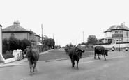
My mother ran Burraton Post Office from 1950 to about 1990 and sold Frith postcards. The cows are being driven by Mrs Cook, a farmer's wife, whose farm was about 300 yards behind the photographer in Liskeard Road, Burraton. The farm was ...Read more
A memory of Burraton by
Land Army Memories.
The white weatherboarded house was the farmhouse of the farm where my mother, Joyce Clark, worked along with another 3 girls in the Land Army during the Second World War. It was called Cogger's Farm. She was there whilst the ...Read more
A memory of Lamberhurst by
Shopping Memories.
My father was a greengrocer and his shop appears in this photograph on the left side going into the Rex Cinema arcade, a butchers shop was on the right side. During the war years and into the very early 1950s, he was the largest ...Read more
A memory of Bridgwater by
Family Memories.
I was amazed and delighted to see a photograph of my mother and grandmother. Nearest the camera is my grandmother, Mrs Archie Turner (1892-1974) who lived in Whitford Road, Birkenhead. Next to her is her eldest daughter, my mother, ...Read more
A memory of Parkgate by
Growth Of Wokingham
When my parents moved to Wokingham in 1950 I understand that it had a popululation of 5,000 and my memories are of a sleepy market town. I gather the population is now about 60,000 and it certainly shows when I return - it ...Read more
A memory of Wokingham in 1950 by
Your search returned a large number of results. Please try to refine your search further.
Captions
5,036 captions found. Showing results 1,129 to 1,152.

A horseman rides north-eastwards, along what is now St Andrew's Road towards Bradpole, when this was part of that parish before boundary changes brought the northern suburbs into Bridport borough.

This town on the old Great North Road was specifically created to trade on its location by the local landowner Idonea de Viponts as early as the 12th century, when the existing Roman road was diverted

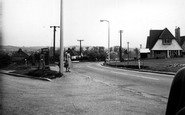
The road stretches towards College Town and Camberley.

The road stretches towards College Town and Camberley.

A view looking south along Queen's Road, the entrance to the pier is on the left. The church is a well-known landmark for those coming over in the ferry from Holyhead.

A superb view, taken from Royal Marine Road. The railway between Dublin and Kingstown was the first in Ireland, and was opened in 1834. Semaphore signals can be seen behind the bridge.

This delightful picture shows the road deserted save for a single pedestrian.

The unmetalled road has puddles from recent rain, and the pavements also appear rather muddy.

Situated on a steep hill on a road that comes from Sandsend, the village has a Saxon church; here are buried the bodies of seven unidentified sailors that were washed up on the tides.

Tramway construction is going on at the junction of Lewes Road and Elm Grove. The tracks curv- ing away to the right ter- minated by the race- course.

Opposite is Ashcombe Road and Ashcombe School.

This photograph shows Kings Road at the point where it meets Cemetery Junction, to the east of the town.

Grindleford follows the banks of the River Derwent, as this distant view from the Hathersage road shows.

Across the road from the Municipal Buildings is the old public library. This building is now a busy public house, for a new state-of-the-art library stands not far away.

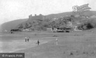
A view looking north along the coast road with the castle behind the photographer. This charming scene has captured women and children out walking, with not a wheeled vehicle to be seen.

Further along the Great North Road we find the Wheatsheaf pub facing the green, and the obelisk of the war memorial. In the distance are a number of shops, including the Eskimo.

Romsey Road leads westward away from the city centre and towards the rolling downlands of Hampshire.

There are no encroaching buildings and road systems yet in this view of the fortified Manor House, started in 1480 by Lord Hastings. It was never completed - Hastings was executed in 1483.

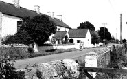
Milborne St Andrew is situated on the high road between Dorchester and Blandford Forum.

Castor stands on the junction of the two main Roman roads in this part of Cambridgeshire, Ermine Street and King's Street.

A fishing coble is being punted away from the beach, apparently loaded with lobster pots. Shellfish were - and are - an important local catch.

A Roman road ran this way. The Romans took a great interest in the New Forest. It supplied wood and charcoal to fire kilns for the manufacture of pottery or for the smelting of iron.

After the Second World War, old cars came back on the road and new production increased. The edge of the river was soon marked out for free parking. Note the hut spanning the mill race.

The pinnacled tower of Swanwick's parish church stands four-square at the end of Derby Road.
Places (26)
Photos (14329)
Memories (11058)
Books (5)
Maps (476)

