Places
36 places found.
Those places high-lighted have photos. All locations may have maps, books and memories.
- Cardiff, South Glamorgan
- Barry, South Glamorgan
- Penarth, South Glamorgan
- Rhoose, South Glamorgan
- St Athan, South Glamorgan
- Cowbridge, South Glamorgan
- South Molton, Devon
- Llantwit Major, South Glamorgan
- Chipping Sodbury, Avon
- South Chingford, Greater London
- South Shields, Tyne and Wear
- Ayr, Strathclyde
- St Donat's, South Glamorgan
- Llanblethian, South Glamorgan
- Thornbury, Avon
- Llandough, South Glamorgan
- Fonmon, South Glamorgan
- St Nicholas, South Glamorgan
- Jarrow, Tyne and Wear
- Penmark, South Glamorgan
- Font-y-gary, South Glamorgan
- Maybole, Strathclyde
- Yate, Avon
- Oxford, Oxfordshire
- Torquay, Devon
- Newquay, Cornwall
- Salisbury, Wiltshire
- Bournemouth, Dorset
- St Ives, Cornwall
- Falmouth, Cornwall
- Guildford, Surrey
- Bath, Avon
- Looe, Cornwall
- Reigate, Surrey
- Minehead, Somerset
- Bude, Cornwall
Photos
5,607 photos found. Showing results 81 to 100.
Maps
2,499 maps found.
Books
23 books found. Showing results 97 to 23.
Memories
1,580 memories found. Showing results 41 to 50.
1950s
I live in Hull but often went to stay at my grandparents (Bartlett) at 111 Corporation Road, Darlington as a child in the early 1950s and next door lived a lovely family and I used to play with their daughter Catherine. They had sons as ...Read more
A memory of Darlington in 1958 by
Rev Kenneth V Kenny Povey Nbsp C Of E
I am trying to find Kenny Povey, his mother lived in Little Sutton, Kenny was in Neston area, then I was told he was in Blacon area and then moved down south, would anyone have any idea of where he would be? Many thanks, Valerie Waring
A memory of Blacon by
Early School Years
My name is Andrea Parkinson. I was born in 1962, I went to Greetby Hill Primary School until I was 9 years old. The swimming pool was not ready when I left. My headmaster at the time was Mr Pilkington (I think). My family moved ...Read more
A memory of Ormskirk in 1972 by
Home Away From Home
I was a young adult when I arrived in Rochford on a Sunday afternoon in June 1978, to take up my position as student nurse at Rochford Hospital. I was from Cape Town in South Africa and the feel of this village promised ...Read more
A memory of Rochford in 1978 by
Swimming Above Stepping Stones Weir At Bothal
Our Mam being an Ashington lassie, we returned to her birthplace when Mam divorced my father who she met before the Second World War - that was when Mam was in London and working in 'service'. We were ...Read more
A memory of Bothal in 1949 by
Looking Back To The Early Days
I was born in rented 'rooms' at Wordsworth Road in 1936 and came to move with my parents to five different addresses at Easington before I moved away from the area, when I married in 1963. But although my ...Read more
A memory of Easington Colliery in 1900 by
Cherished Memories
Finding this site has brought many wonderful memories back to me. I was born in St Mary's Hospital, Croydon. My maiden name was Chappell. I lived in Purley Road, South Croydon not far from the Red Deer until 1957. Every Saturday ...Read more
A memory of Croydon in 1953 by
Burrow Hill Today
Burrow Hill School is now derelict. It closed in 1998 and I have just walked past the boarded-up site this afternoon. Although I have lived in Frimley Green since 1993 and seen one of its main buildings from within a ...Read more
A memory of Frimley Green by
Raf Radar At Inverbervie
I was based in Inverbervie from March 1957 till March 1958 with 977 Signals Unit of the Royal Air Force. 977 SU operated radar from an underground site on the hill a couple of miles north of the village. Height finding ...Read more
A memory of Inverbervie in 1957 by
Evacuation
I was 6 years old in 1941 and a native of Glasgow. During the worst of the German bombing at that time, my mother, brother and I moved to Auchnahyle Farm, which was farmed by my father's uncle and aunts, Bob, Mag and Jess Jamieson. My ...Read more
A memory of Pitlochry in 1941 by
Captions
2,476 captions found. Showing results 97 to 120.
This chapter ends at Great Houghton, south-east of Northampton. It is a small village with a few modern closes. The White Hart pub is little changed.
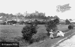
Seen here from the south-west, the sheer enormity of the late Victorian work is clear: the left-hand section is the much-restored medieval shell keep built for Henry II in the 12th century.
From the south and south-west, the minster's twin towers, set against a backcloth of Colehill trees, dominate the skyline and dwarf the rooftops of ordinary buildings.
Downstream beyond Marlow the Thames reaches Cookham, where it blunders about and divides into three channels before turning south by chalk cliffs.
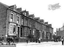
Laygate Lane is one of a number of sturdy Victorian terraces in South Shields; many of them were built speculatively by developers as the town expanded thanks to the coal and alkali industries.
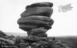
One of the strangest rock formations in the south-west, the Cheesewring near Minions on Bodmin Moor has been a place of pilgrimage for centuries.
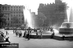
To the left is South Africa House, which was built on the site of Morley's Hotel in 1930; the architect, Sir Herbert Baker, attempted to complement the nearby St Martin-in-the-Fields.
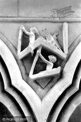
The Dean's chapel in the south quire transept has a 13th-century frieze of carvings in the spandrels of the arcading (that is, between the tops of the adjoining arches).
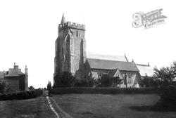
The church of St Mary the Virgin, standing on its mound on the edge of Romney Marsh and viewed here from the south-west, dates from the 13th and 15th centuries.
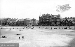
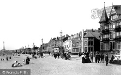
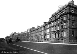
This fine sweep of buildings enhanced South Shore, where on 9 June 1923 the South Shore open air baths opened.
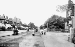
Victoria Road, leading to Heath Park on the south side of the railway, provides the photographer with a catwalk for an Edwardian fashion parade.
Rode church is at the south-east end of the village, the bulk of which is to the north-west towards the River Frome. This view was taken from the south-west.
Tattershall and Coningsby lie just south of the last slopes of the Wolds, with the flat Fens stretching away to the south.
The South Dock was opened in 1859 when copper-smelting and tinplate manufacture were major industries in Swansea.
A mile south of Nutfield, a new village grew up around the railway station on the Tonbridge line named South Nutfield.
Kelly's Directory for 1906 lists a South Downs Cottage, which at the time was the residence of a Mr Frederick Bernard Yahr.
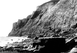
This infamous headland, at 536ft the highest cliff on the south coast, marks the point where the South Downs plunge into the English Channel.
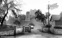
The tall, cylindrical keep with its six massive buttresses was built about 1180 by Henry II's half-brother, Hamelin Plantagenet, and still comes as a surprise as you approach this small South Yorkshire
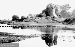
Situated two miles south-south-west of Bridgend, Ogmore was originally a ringwork with a timber palisade built in 1116 by William de Londres to guard crossing points on the rivers Ewenny and Ogmore.
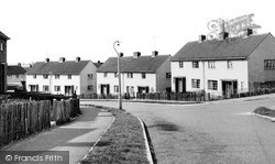
Wollaston expanded farther after World War II and this view is of former council housing, part of an estate built in the south-east of the town.
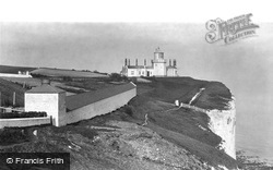
The South Foreland Lower Light 1898. Three hundred feet above the sea, this white-painted Victorian lighthouse housed a two-ton turntable operating the revolving light.
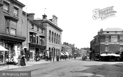
Wellington, about ten miles south-west of Taunton at the foot of the Blackdown Hills, is an attractive market town with its focus where South, Fore and High Streets meet.
From Bridgwater we head south-east into Sedgemoor to Othery, a village built on a low hill that rises 60 feet above the Moors.
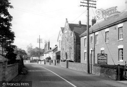
St Michael's has a south aisle dating back to the early 14th century, its windows with Y and intersecting tracery, but the brick tower with clasping buttresses is 1737.
Places (15471)
Photos (5607)
Memories (1580)
Books (23)
Maps (2499)


