Merry Christmas & Happy New Year!
Christmas Deliveries: If you placed an order on or before midday on Friday 19th December for Christmas delivery it was despatched before the Royal Mail or Parcel Force deadline and therefore should be received in time for Christmas. Orders placed after midday on Friday 19th December will be delivered in the New Year.
Please Note: Our offices and factory are now closed until Monday 5th January when we will be pleased to deal with any queries that have arisen during the holiday period.
During the holiday our Gift Cards may still be ordered for any last minute orders and will be sent automatically by email direct to your recipient - see here: Gift Cards
Places
36 places found.
Those places high-lighted have photos. All locations may have maps, books and memories.
- North Walsham, Norfolk
- North Berwick, Lothian
- North Chingford, Greater London
- Harrogate, Yorkshire
- Whitby, Yorkshire
- Filey, Yorkshire
- Knaresborough, Yorkshire
- Scarborough, Yorkshire
- Clevedon, Avon
- Weston-super-Mare, Avon
- Richmond, Yorkshire
- Selby, Yorkshire
- Ripon, Yorkshire
- Scunthorpe, Humberside
- Pickering, Yorkshire
- Settle, Yorkshire
- Skipton, Yorkshire
- Saltburn-By-The-Sea, Cleveland
- Norton-on-Derwent, Yorkshire
- Rhyl, Clwyd
- Chester, Cheshire
- Llandudno, Clwyd
- Grimsby, Humberside
- Durham, Durham
- Nailsea, Avon
- Southport, Merseyside
- Brigg, Humberside
- Colwyn Bay, Clwyd
- Redcar, Cleveland
- Bath, Avon
- Grange-Over-Sands, Cumbria
- Cleethorpes, Humberside
- Sedbergh, Cumbria
- Barrow-In-Furness, Cumbria
- Barmouth, Gwynedd
- Dolgellau, Gwynedd
Photos
2,953 photos found. Showing results 1,361 to 1,380.
Maps
9,439 maps found.
Books
39 books found. Showing results 1,633 to 1,656.
Memories
1,550 memories found. Showing results 681 to 690.
Bunny Pk
Anybody know ice house ruins north east corner left of church...memories..and Bunny Park 1940s and 50s.
A memory of South Harefield by
Shops.
My sister Christine lived in North Road from babes till 18-19 years old. I can remember the parade of shops, the chemist, Clair's hairdressers, Combes the bakers, Pickerings hardware store. There was a shop where we bought our shoes and I'm ...Read more
A memory of Bedfont by
The Best Years Of My Life
Happy memories indeed. For an eight year old living in the village in the mid 1950s it was heaven. Long summer evenings and school holidays playing in woods, open fields and on building sites. Or cycling (yes at ...Read more
A memory of Earls Barton in 1955 by
More Memories Of Waterrow
Dear reader, I have received some lovely messages since writing a few memories I thought I would add a few more. The Rock Inn I use to stay with my great uncle/aunty's public house, namely the Rock Inn, in 1958- 1965. ...Read more
A memory of Waterrow in 1960 by
Hounslow As It Was
I am a bit younger than the other contributers being 2 when I moved to Hounslow in 1950. I wasn't born there but regard Hounslow as my home town and well remember the Odeon (Saturday morning pictures) and later learning ...Read more
A memory of Hounslow in 1955 by
Childhood Memories
My Nan lived in Church Path (renamed Lillie Walk), they were all mainly Irish families living there, Nan's family all stayed in Fulham around North End Road. In the 1950s me and my sister were taken there to buy new shoes and ...Read more
A memory of Fulham in 1951 by
My Very Happy Childhood In New Haw Road!!!
We originally moved in 1957 when I was 5 from Thornton Heath in Surrey to Burleigh Road in Addlestone because my dad had started working for Peto Scott (TV makers) near Weybridge. Then in December 1957 my ...Read more
A memory of New Haw in 1962 by
Horden Memories
Hi, my name is Lorraine, my surname was Humphreys at the time I spent my early childhood in Horden with my nana and grandad, both sadly gone now. I lived at 90 Seventh Street, I went to school on the top road we used to call 'the ...Read more
A memory of Horden in 1971 by
Brownieside Cottages
My brother David and me - Jacqueline, were born in the row of cottages in Brownieside to our mum Jessie nee Bell and our Dad Harold Rose in 1942 and 1945. Dad was in the RAF and Mum was a nurse. I think we lived in the ...Read more
A memory of Brownieside in 1945 by
1955 1978
Growing up and living in Lindfield Avenue, playing football in the street or up at Blakelaw Park with my brother Ken. Later playing for Montague and North Fenham Boys Club under Dicky Almond (Big Dick). Some games later for West End ...Read more
A memory of Blakelaw by
Captions
2,676 captions found. Showing results 1,633 to 1,656.
We are on the upper River Medway north of the Ashdown Forest, near the Kent border. The 13th-century church of St Mary is on a knoll in the centre of the village.
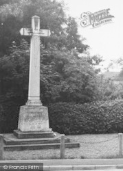
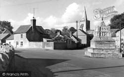
Looking north-west past the village cross, we see the church with its curiously plain tower and mean spire.
The mellow gritstone walls of the Peacock Hotel, on the A6 about four miles north of Matlock, are a landmark to visitors coming into the Peak District from the south.
On two acres of Whin Common, to the north, the poor were once permitted to collect gorse bushes as firewood. The Infant School (1840-1923) is now a recreation hall.
Just beyond is the North Eastern Railway's bridge over the Wear.
Oving Road leads west uphill from the north end of the High Street - the architectural quality does not fall off.
North Street was mainly residential in the early 20th century, with some splendid houses, including thatched cottages. They became derelict in the 1920s and were demolished in 1933.
The view is from Lockyers School looking down Blandford Road North.
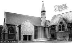
Between 1964 and 1965 the north side of the chapel was hidden by a modern extension with an ugly brick gable. The new Owen Window is, however, more praiseworthy.
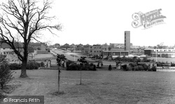
Taken from Coronation Park, this view looks north, away from the town centre.
Malton stands at the junction of roads above the Derwent Valley south of the North York Moors, and has been an important market centre since the Middle Ages.
On 24 June 1497 they reached the mainland of North America.
North of Bakewell, an ancient packhorse bridge crosses the water. For centuries, lines of horses would lumber over this bridge weighed down with freight. Often, lead would be the main load.
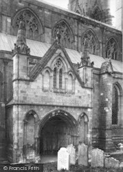
It has polygonal buttresses and a re-set Norman north doorway with one order of colonnettes and zig-zag moulding, which had probably been moved.
This village is just one mile from Boston Spa and even less from the Great North Road.
The north aisle was enlarged in 1888.
Once an important coaching town on the Great North Road, Wetherby went into decline for a number of years as long-distance stagecoach travel lost out to the railways.
A woman stands precariously on the deck of an early motor launch, but neither she nor the child is wearing a life jacket. Notice the corrugated iron boathouse on the right.
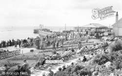
Both are large; the north one is the more select, and the south more popular – just a penny pier where dancing goes on all day in the summer.
Looking north to the church a sense of nostalgia is created by the old style 'T' junction road sign.
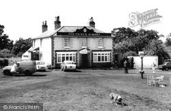
The Prince Albert stands further south on Horley Road, actually in South Earlsfield rather than Salfords, and north of the junction of Horley Road with Woodhatch Road.
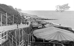
The north winds have taken their toll and bent the lamp-posts which illuminate this slope during the evening.
Other sites include the whole of Langness (which is designated a bird sanctuary), and the Ayres conservation area in the north of the island.
About one mile to the north-west is the bastle house of Low Old Shield, one of many fortified farmhouses built during the days of the Border raids.
Places (9301)
Photos (2953)
Memories (1550)
Books (39)
Maps (9439)


