Places
26 places found.
Those places high-lighted have photos. All locations may have maps, books and memories.
- Town End, Derbyshire
- Town End, Buckinghamshire
- Town's End, Somerset
- Towns End, Dorset
- Town End, Merseyside
- Town End, Cambridgeshire
- Town's End, Buckinghamshire
- West End Town, Northumberland
- Bolton Town End, Lancashire
- Kearby Town End, Yorkshire
- Town End, Cumbria (near Grange-Over-Sands)
- Town End, Cumbria (near Bowness-On-Windermere)
- Town End, Yorkshire (near Huddersfield)
- Town End, Yorkshire (near Wilberfoss)
- Town End, Cumbria (near Appleby-in-Westmorland)
- Town's End, Dorset (near Melbury Osmond)
- Town's End, Dorset (near Swanage)
- Town End, Cumbria (near Ambleside)
- Town End, Cumbria (near Lakeside)
- Town End, Cumbria (near Kirkby Lonsdale)
- Town End, Cumbria (near Ambleside)
- Town's End, Dorset (near Bere Regis)
- West-end Town, South Glamorgan
- Townend, Derbyshire
- Townend, Strathclyde (near Dumbarton)
- Townend, Staffordshire (near Stone)
Photos
23 photos found. Showing results 2,661 to 23.
Maps
195 maps found.
Books
3 books found. Showing results 3,193 to 3.
Memories
3,719 memories found. Showing results 1,331 to 1,340.
Playing In The Corn Fields
I am 65 now, but if I close my eyes I am 10, playing in the cornfields down by MileOak Secondary Modern School, with my brother Graham Burton and some friends, Richard Gere, Suesanne Birchill and Roger Birchill, and ...Read more
A memory of Mile Oak in 1957 by
Sparks Memories
The Jolly Waggoners was situated on the corner of Beggers Hill and Shortcroft Road. I lived with my family at number 28 just around the corner. My early memories were my dad, brother and I going down to the pub on a Sunday to play ...Read more
A memory of Ewell in 1960 by
Fond Memories Of Old Coulsdon
Remember Old Coulsdon well, moved there when I was 9 or 10 in 1963. My father worked for the CEGB in Croydon. We left Old Coulsdon in 1972 for South Africa where I still stay today. Went to Keston Primary and ...Read more
A memory of Old Coulsdon in 1964 by
Old Cottages
July 19th 2012 Vancouver Canada Oh ! My god what a shock I was evacuated to Horningsham in 1941 to live with my mother's aunt Jessie and her husband Billy. He had been gassed in WW1 and worked on the Longleat Estate as a ...Read more
A memory of Horningsham in 1941 by
Mill Dam
I lived on Thinford Street the mail road, behind us were the houses known as The Blocks which only had dirt tracks as roads, no tarmac. We had the church beyond the blocks which was made of impressive stone and on Thinford St we had ...Read more
A memory of Metal Bridge in 1949 by
What My Mother Told Me!
I remember my mother telling me that her brother had a similar experience to this around the 1920's (approx). He was riding his bicycle through the churchyard and saw, what looked like someone clinging to the wall in the ...Read more
A memory of Beccles in 1955 by
Barn Hill Pond
Myself and friends used the pond and Barn Hill a lot in the early fifties. I remember the row of poplar trees running up to the pond from Fryent Way. We mostly seemed to use the Kingsbury side of the Hill for our various ...Read more
A memory of Wembley Park in 1951
Howards Chip Shop
I was born in Elliott Street, moved to 10 South Street - my brother was born there in November 1943 - I was eight years old and an only child - I was so excited I ran around to Howards Chip Shop in the main street and got knocked ...Read more
A memory of Widnes in 1943 by
Primitive Methodist Chapel
The chapel shown on the right of the photo was the Primitive Methodist Chapel, which I attended as a child. The highlight of the year was the Sunday School Anniversary with Mr Kellington conducting the singing and ...Read more
A memory of Misterton by
Always My 'home' Town.
I was born in Bucklow Hill outside Altrincham in 1945. I lived at 60, Cromwell Rd, Winnington Park. At the age of 5 I started to attend Winnington Park Junior School. I was living with my grandparents at the time. My ...Read more
A memory of Northwich by
Captions
5,054 captions found. Showing results 3,193 to 3,216.
On the extreme left is Palmers, with John Bull tyres and cycle lamp batteries on display in the window.
This small town, now part of Wrexham, was a mainly working-class community supplying workers for the various industries and mines in the area.
Its monumentalising face-lift in 1905-6 to provide municipal headquarters and premises for the town's first public library and museum courted controversy.
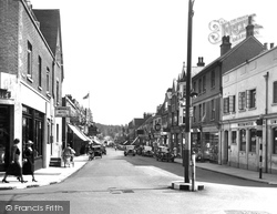
This is a comparatively modern scene in the High Street, showing two-way traffic and a variety of cars.
It's amazing to think that Halton is now the centre of the modern town once more; history has turned full circle.
The barracks and headquarters of the Green Howards closed in the 1920s, and the buildings were then used as an approved school.
Cleobury, pronounced Clibbery, was once a stronghold of the powerful Mortimer family; they also owned castles in, for example, Ludlow, Wigmore and Chirk.
Just this side of it can be seen the premises of Botley Garages, now a sports shop and a hairdresser's. The swinging AA sign has gone, replaced by one for the sports unit.
The Town Hall, built in 1766 by William Chambers and paid for by the Duke of Marlborough, has a prominent site overlooking the Market Place.
Bolton Road was the first paved road laid in Port Sunlight, and W H Lever named it after his home town as a reminder of his roots.
Between the wars the population of Billingham rocketed as the works was expanded for the production of methanol, chemical fertilisers, and petrochemicals.
The town was probably established as a port on the Wainfleet Haven by Bardney Abbey, but by the 15th century the haven silted up and the port declined.
This area has changed quite a lot, and has adapted to the extra traffic that has occurred during the past fifty years.
Its spectacular ramparts and ditches enclosed their community. The inner rampart would have had a wooden stockade.
Talgarth is a small town a few miles south of Hay-on-Wye. Its narrow streets today are almost always congested with passing traffic.
Notice the old Town Hall on the right hand side of the photograph – now sadly destroyed and replaced by an extremely bland 1960s building.
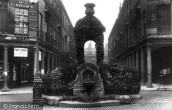
The colonnaded street behind, part of the 1789 Bath Improvement Act scheme, is an elegant piece of Georgian town planning.
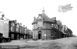
The Old Bank building, which stood at the junction of Chertsey Road, High Street and Broadway, failed to survive the post Second World War swathe of redevelopment which saw many of the town's Victorian
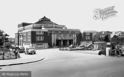
The Pavilion Theatre and Ballroom was established in 1928, and has remained popular with visitors ever since.
The only medical institutions listed on the Johnson & Green street plan of 1868 are the Convalescent Home & Sea-Bathing Infirmary, and the Hydropathic Hospital.
The only medical institutions listed on the Johnson & Green street plan of 1868 are the Convalescent Home & Sea-Bathing Infirmary, and the Hydropathic Hospital.
A closer view of Market Place, minus its Saturday morning stalls and with only the refreshment stand by the lamp- post facing onto the 17th- and 19th-century shops and offices.
The mill occupies an island between the two rivers, Thet and Little Ouse.
Until the 1960s, most people relied on public transport, and the green-liveried buses of United Counties carried workers and shoppers in and out of town on busy timetables.
Places (26)
Photos (23)
Memories (3719)
Books (3)
Maps (195)

