Places
36 places found.
Did you mean: street or streetly ?
Those places high-lighted have photos. All locations may have maps, books and memories.
- Heathfield, Sussex (near Cade Street)
- Street, Somerset
- Chester-Le-Street, Durham
- Adwick Le Street, Yorkshire
- Scotch Street, County Armagh
- Friday Street, Surrey
- Potter Street, Essex
- Boughton Street, Kent
- Newgate Street, Hertfordshire
- Streetly, West Midlands
- Shalmsford Street, Kent
- Green Street Green, Greater London
- Boreham Street, Sussex
- Park Street, Hertfordshire
- Cade Street, Sussex
- Appleton-le-Street, Yorkshire
- Hare Street, Hertfordshire (near Buntingford)
- Romney Street, Kent
- Trimley Lower Street, Suffolk
- Streetly End, Cambridgeshire
- Hare Street, Hertfordshire (near Stevenage)
- Brandish Street, Somerset
- Colney Street, Hertfordshire
- Langley Street, Norfolk
- Silver Street, Somerset (near Street)
- Street, Yorkshire (near Glaisdale)
- Street, Lancashire
- Street, Devon
- Street, Cumbria (near Orton)
- Street, Somerset (near Chard)
- Bird Street, Suffolk
- Black Street, Suffolk
- Ash Street, Suffolk
- Broad Street, Wiltshire
- Brome Street, Suffolk
- Penn Street, Buckinghamshire
Photos
21,808 photos found. Showing results 3,361 to 3,380.
Maps
1,622 maps found.
Books
1 books found. Showing results 4,033 to 1.
Memories
6,666 memories found. Showing results 1,681 to 1,690.
Family History
Hi, This isn't a memory, but in 1881-1883 my great-great-grandfather resided at 83 Station Street, he was a stationer. His name was John Thomas Haden.
A memory of Swinton in 1880
A Childs Memories Of Thaxted
I was only six years old when I was taken to Thaxted by my father, in 1941. We moved from Start Hill near Bishop's Stortford, reasons were the war and the Yanks which we will not enter into. The first thing that struck ...Read more
A memory of Thaxted in 1941 by
Caroline Street
My grandma was a Bell before she married Harry Davison and eventually went to live in South Market Street. She, her parents and siblings had lived at 32 Caroline Street, until they all married. Lizzie Maddison (my great-aunt ...Read more
A memory of Hetton-Le-Hole in 1950 by
Childhood In Penygraig
I was born at Llwynypia Hospital on June 10th 1947, lived at 6 Bishop Street, Penygraig, went to school at Penygraig Infants in 1950 and Hendrecafn Juniors, Tai Juniors, Craig-yr-eos Juniors and Seniors. Bishop Street is ...Read more
A memory of Penygraig in 1947 by
Menson Road
Can someone tell me where in Gowerton Mensen Road is. I lived in Gowerton until 1971. This looks like Mansel Street to me.
A memory of Gowerton by
Bert Price''s Shop
Bert Price's Shop was at the top of our street - Church Street. Bert Prices' shop sold anything and everything. From household buckets and dusters to DIY tools, firewood, fire lighters and paraffin for the heater in our ...Read more
A memory of Davenham in 1970 by
A Lifehood Of Memories During The 1950s
orn in 1942 at 23 Park Avenue, Northfleet, I went to Dover Road School then Colyer Road Secondary School. Churchill's dairy used to be opposite Colyer Road School and allotments where we had a plot. The ...Read more
A memory of Northfleet by
Houses In The Avenue
I lived in Woodlands Avenue and used to walk down The Avenue every day in term time to catch the bus to Kingston. At that time many of the big houses were still standing but one by one, probably as the owners died or ...Read more
A memory of Worcester Park in 1957 by
Great Lumley Memories
Chester-le-Street Heritage Group are building an archive of photographs and memories relating to Great Lumley and the surrounding area. If you would like to share your memories and/or allow us to scan your photographs ...Read more
A memory of Great Lumley by
Hairdressers Banstead High Street 1969 1973
I worked as a Saturday girl at the hairdressers opposite the church in Banstead High Street when I was 15 in 1969. It was called Nicolette then and I worked for Margaret and her mother Mrs Anscombe. ...Read more
A memory of Banstead in 1969 by
Captions
5,381 captions found. Showing results 4,033 to 4,056.
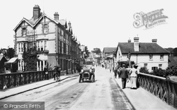
Caversham, Bridge Street 1908 59962 The Thames Valley Hotel on the left was built in 1891 and is now flats, while the Crown Hotel on the right was rebuilt when the present bridge was constructed.
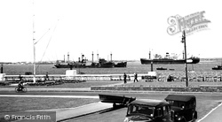
Here in the 1950s ships still pass on their way to and from the Port of London; this view is from the William Corey Promenade, as it is now called, close to the High Street.
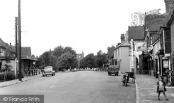
Headcorn stands on the River Beult and is a large village with a single broad, straggling street. On the right outside the George and Dragon is a motorcycle with an unusual basketwork sidecar.
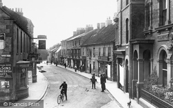
By 1909 the Cattle Market would have spilled out into the High Street. The Parish Council ingeniously annually auctioned the right to collect the manure.
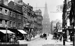
Described as a cross between a Renaissance palace and a medieval cathedral, the Town Hall opened at the head of Princess Street in 1863.
In this photograph we head north-east out of Market Square along Cambridge Street, once known as Bakers Lane, a road that haas seen much change since the 1950s.
It was now firmly on the map: its narrow crowded alleys and harbourside streets, its ruined abbey and its souvenirs made from jet, fossilised wood found in the local area, proved a magnet for day trippers
Much of old Plymouth town was destroyed, irreplaceable old buildings were lost, and street patterns were changed with the rebuilding.
The traffic signals at the Queen's Road/King Street junction were installed in 1954. Plenty of people are doing their morning shopping here before supermarkets became universal.
Much of old Plymouth town was destroyed, irreplaceable old buildings were lost, and street patterns were changed with the rebuilding.
Now called St Aldhelm's Methodist Reformed Church, this lovely little building stands alongside and open to a busy street near Corsham town centre.
Although there are many pleasant cottages in the vernacular brick and flint, the modest village street does not reflect Caister's illustrious history.
A member of the local constabulary is on point duty in Lord Street.
By the end of the Great War the town had lost many of its young men—they had marched away past the Steamer Hotel along Dock Street to the railway station.
Parsons Street, on the right, has some large Victorian houses looking over the churchyard.
The High Street leads to Shooters Hill, which was once a very swampy area. The buildings are shaped here to follow the curve of the road. The first shop on the right is now a florist.
Centre white lines, street lighting and traffic lights control the road junction, and there is an official bus stop outside the church.
The older fabric is more obvious from their backs, which can be seen in Stert Street beyond.
Behind, with a great slab of walling to the rear of the High Street, is the extension to the Congregational Church dated 1837.
The street is now a cul-de-sac, following the opening of the by-pass in the 1980s.
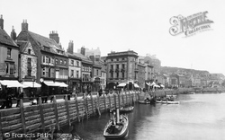
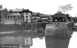
Seen here at low tide, the old stone-built quay is reached by Quay Hill from Arwenack Street. At the far end is North Quay with the harbour tug company's office building.
This view looks east along Main Street from beside Leyland Farm.
The minster's twin towers dominate most pictures of East Street, but Hawker's new drapery shop (centre right) comes a close second in this shot.
St Oswald's Church sits right at the end of a very rough cobbled road, hence the street is called The Cobbles.
Places (385)
Photos (21808)
Memories (6666)
Books (1)
Maps (1622)


