Places
36 places found.
Those places high-lighted have photos. All locations may have maps, books and memories.
- Bangor, County Down
- Newcastle, County Down
- Greyabbey, County Down
- Donaghadee, County Down
- Downpatrick, County Down
- Portaferry, County Down
- Dromore, County Down
- Hillsborough, County Down
- Downings, Republic of Ireland
- Killyleagh, County Down
- Ardglass, County Down
- Rostrevor, County Down
- Dundrum, County Down
- Newtownards, County Down
- Warrenpoint, County Down
- Ballygowan, County Down
- Ballywalter, County Down
- Ballyward, County Down
- Bishops Court, County Down
- Boardmills, County Down
- Culcavy, County Down
- Katesbridge, County Down
- Killough, County Down
- Millisle, County Down
- Portavogie, County Down
- Saul, County Down
- Seaforde, County Down
- The Diamond, County Down
- Audleystown, County Down
- Kearney, County Down
- Annaclone, County Down
- Ballyhalbert, County Down
- Ballymartin, County Down
- Clare, County Down
- Conlig, County Down
- Dollingstown, County Down
Photos
856 photos found. Showing results 1,241 to 856.
Maps
459 maps found.
Books
2 books found. Showing results 1,489 to 2.
Memories
8,167 memories found. Showing results 621 to 630.
Co Op
If I remember correctly, the buildings on the right hand of this photo was the Co-op, somewhere there was a butcher, there was always sawdust on the floor, they had the tubes that used to take the money away shooting around the shop it made ...Read more
A memory of Redhill in 1960 by
Farraline Hall
Moved to Farraline Hall, Errogie in 1950 from Leeds. Dad was estate manager. Me and my brother Jeff and sister Jennifer in the back of a 7 ton flat lorry, sat on mattress under canvas in the back of it. I went to Errogie school, had ...Read more
A memory of Errogie in 1950 by
Jtbells
This is the year I started on the building sites in 1963, I got a job on J. T. Bell's site in Whickam, the site hadn't been running long then as it was in the first stage. All the lads were mainly from Newburn, Lemington, and Throckley. If ...Read more
A memory of Newburn in 1963 by
Thomas Binns 1845 1921 No 1 The Green Later No 3 Grange Cottages
Hello - I would be very grateful for any information - especially photos - of my ancestor Thomas Binns who moved from Cowling to Micklethwaite c. 1898. He had built ...Read more
A memory of Micklethwaite in 1900 by
Will It Be Open?
My family moved from Bermondsey, where we shared my grandad's house, to Enfield, where Mum and Dad had managed to buy their own house (for £2,000) in 1960. It was some years before Dad could afford driving lessons and then a car. We ...Read more
A memory of London in 1966 by
The Back House
I was born in Sedgefield and lived in North Bitchburn until I was 7 years old, me and my twin sister Elizabeth and my mam amd dad who worked at the pipe yard. We lived in no 1a Constantine Terrace, it was the back half of ...Read more
A memory of North Bitchburn by
Penrhiwceiber Road
Looking on the left, just below 'Ceiber Hall' was a grocery shop, I think where the white blind is down, caled 'the Meadow Stores'. My brother Desmond James started work there as an errand boy delivering goods to the ...Read more
A memory of Penrhiwceiber in 1955 by
Why Was I Here?
I remember being sent to St Mary's Home when I was about 7 years old, I was taken by train, I can't remember by who, I was sent there because I was a sickly child, all due to not having enough food to eat at home, where things ...Read more
A memory of Broadstairs in 1953
How Times Have Changed
Looking back at old photographs Harwich & Dovercourt has certainly changed, the Phoenix Hotel is no longer, it has been replaced by luxury flats, the train ferry service has closed, the High Street seems like a ghost ...Read more
A memory of Dovercourt by
Dalelands
The car in this picture is parked outside my old home. I wonder, was it my Dad's car? Not many of us had cars then. I spent many hours under the lamp-post as it got dark, before I got called in. We were pretty safe to play out ...Read more
A memory of Market Drayton in 1960 by
Captions
2,242 captions found. Showing results 1,489 to 1,512.
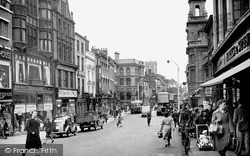
The local policeman appears somewhat under-employed as he directs a single car travelling down Boutport Street towards The Square.
Each day at dawn, strings of racehorses would pass gracefully up the hill, as they had 100 years earlier.
The house with the two dormers is Lawrence House, now the town museum, and at the far end we can see the gable of Eagle House.
The palace is thought to have been burnt down accidently in 1746 by General Hawley's troops.
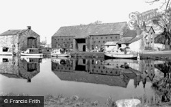
Down by the beck is the 17th-century corn mill, once owned by the Neville family of Middleham Castle. The mill closed in 1930 and lay derelict until 1977.
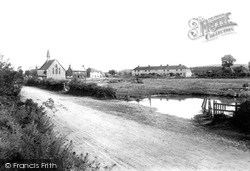
This view looks south-west down Loxwood Road towards the parish church, whose spire can just be seen amid the trees behind the last chimney-stack.
A toboggan ride also careered down the side of the glen, but it was closed in 1900 after an accident.
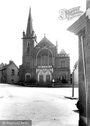
Situated in Market Street and close to Apiary Gate, the church design echoes that of Non-conformist chapels up and down the country.
Until 1928, when it was burnt down, the Hall stood at the east end of the village.
The original village was burnt down in the 1600s and had to be completely rebuilt.
In the 1920s and 30s Walter Collins printed a well-known series of sepia postcards of the town.
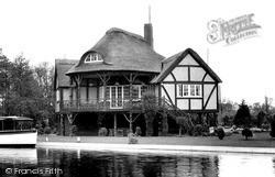
An interesting balcony has steps down to the garden, where leisure furniture and croquet hoops indicate a relaxed way of life. A motor launch is tied up at the private mooring.
By 1819 the designer John Rennie had constructed a canal from Kendal in the north down to Wigan, a canal remarkable for the ingenuity of its design.
Monk's Buildings 1894 From Angmering we head north across the Downs to Storrington, now a large village that started its expansion in late Victorian and Edwardian times.
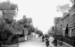
of what had become the longest reign on record, Victoria Grove encompassed the social and architectural extremes of the era, ranging from the exuberant St Hilda`s School (left) to staid town
Opposite, the Port Bredy Guest House takes its name from that used for the town in the Wessex novels of Thomas Hardy. Victoria Grove branches off between the trees (right).
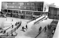
THE opening of a new shop was almost a weekly occurrence when Basildon town centre sprang into life in the late 1950s to early 1960s.
This view looks south down the High Street from near High Bridge. The 11th-century tower of St Mary le Wigford church peers out amid the later commercial architecture.
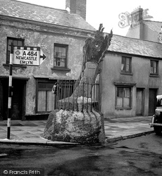
The old stump of this tree known as Merlin's Oak is still kept in the town's civic hall.
The spire was struck by lightning in 1854 and the steeple had to be pulled down, but all was restored and the church extended in 1882.
Looking down New Street to the Moot Hall, we can see on the right a brick Georgian house where many BBC trainees lodged in the 1960s.
The recent news is that spa water has been found about six hundred feet down, and the Golf Hotel is about to resurrect the spa baths sometime during 2005.
Bridge Stores (right of centre) advertises Colman`s Mustard in much more basic style than the Victorian sign that used to look down on the central part of the street.
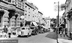
This photograph is taken from the junction of Market Street and Upper Market Street, looking down towards the High Street.
Places (198)
Photos (856)
Memories (8167)
Books (2)
Maps (459)

