Places
17 places found.
Those places high-lighted have photos. All locations may have maps, books and memories.
- Bridge End, Oxfordshire
- Bridge End, Lincolnshire
- Bridge End, Essex
- Bridge End, Bedfordshire
- Bridge End, Clwyd
- Bridge End, Warwickshire
- Bridge End, Surrey
- Bridge End, Durham (near Frosterley)
- Bridge End, Northumberland (near Hexham)
- Bridge End, Hereford & Worcester (near Tirley)
- Bridge End, Hereford & Worcester (near Bosbury)
- Bridge End, Shetland Islands
- Bridge End, Cumbria (near Carlisle)
- Bridge End, Northumberland (near Hexham)
- Bridge End, Devon (near Kingsbridge)
- Bridge End, Devon (near Sidmouth)
- West End, Yorkshire (near Pateley Bridge)
Photos
40 photos found. Showing results 201 to 40.
Maps
520 maps found.
Books
2 books found. Showing results 241 to 2.
Memories
1,928 memories found. Showing results 101 to 110.
School At Burslem Junior Tech
I lived in Blythe Bridge and travelled to school at the Burslem Junior Technical College in Moorland Road, Burslem over a period between 1943 to 1945. The journey by train on the old loop line was a lot of fun. I ...Read more
A memory of Burslem in 1944 by
My Memories Of Selly Oak And Bournbrook
I was born Anne Shirley Crofts back of 622 Bristol Road (opposite where Aldi is now) in July 1944, brother Ronnie was born 1940, sister Vivienne was born 1942, and Alan was born 1947, between Riverton Road ...Read more
A memory of Selly Oak in 1954 by
Lawrence Family In East Molesey
On a holiday from Australia, today my husband and I visited East Molesey & Hampton Court. My mother's paternal family were the Lawrence's - Edward was a master butcher and had a shop in 156 Walton Road (now ...Read more
A memory of East Molesey by
Bicycles And A Happy Hunting Ground.
Being the offspring of parents otherwise engaged, and only partially supervised by a succession of Nannies, whose only concern was that we should be clean and respectably dressed when we got up to mischief, ...Read more
A memory of New Milton in 1950 by
Boyhood Days
My aunts and uncles lived in East Howle and I was a regular visitor around and before 1950. The two families lived opposite one another in what I think may have been "railway cottages" and my cousins totalled 9. In those days you ...Read more
A memory of East Howle
Poetry
This poem was sent to mac by Mrs S. Holmes: Death of Chelmsley Wood The sheer delight of summer afternoons, As through the fields in cotton frocks we walked, The long grass licking at our gangly legs, While we in deep contentment ...Read more
A memory of Chelmsley Wood in 1995
James Joseph Irvine (Autobiography) 1911 1990
Stretching over about a mile on the A68 road to Edinburgh from Darlington, lies the small mining town of Tow Law. Approaching it from Elm Park Road Ends, on a clear day, as you pass the various openings ...Read more
A memory of Tow Law in 1930 by
Boyhood Memories
I was born in 89 Abbot Street, just off Sunderland Road, in 1932, then we moved to the Gateshead end of Redheugh Bridge. When the Second World War started we moved to 20 Brussel Street. The Davidson family lived in the flat ...Read more
A memory of Gateshead in 1940 by
Old Manor Cafe
My memory of Blackwater started when I was 14, for those of you who don't know what the Old Manor was, it was a transport cafe, which stood on what is now a supermarket site, on the right, at the junction with Rosemary Lane. In ...Read more
A memory of Blackwater in 1960 by
46 Bridge Road, Cove
46 Bridge Road at Cove is very significant to me because I was born in Bridge Road, no 46, on 29th June 1943, in the photo of Bridge Road it is the second house on the left, opposite Cove Supply Stores, so I'm sure my mother would ...Read more
A memory of Cove in 1943 by
Captions
1,770 captions found. Showing results 241 to 264.
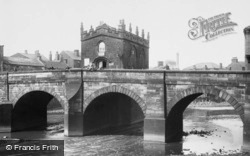
The Chapel of Our Lady standing on Rotherham Bridge dates from the 1480s, and is one of only three such chapels in England.
A long bridge and foot-ferry lead across to neighbouring Teignmouth. The stretch of water between and Shaldon's sandy beaches are crammed with boats of every description.
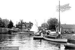
The bridge at Potter Heigham has headroom of only six feet at high tide.
The GWR had just taken over the running of the canal and had set up a bridge-building section specifically for canal work.
This view was taken from the iron bridge, and shows the backs of various High Street and Moulsham Street properties. Some of them had their own landing stages.
Here we see the old bridge and the mill.
Its landmark features are the ancient Barton Bridge in the centre, also known as Packhorse Bridge, and the spire of the parish church of Holy Trinity to the left.
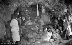
Stump Cross Caverns, on the summit of Greenhow Hill on the road between Pateley Bridge and Grassington, were discovered by lead miners seeking new veins of the then precious ore.
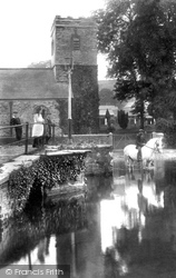
An old packhorse bridge and ford span the tranquil Kensey river, making it the perfect spot for peaceful contemplation. A grey horse cools its feet in the stream, which is still as a mill pool.
This wonderful view from the walls was taken before the onslaught of the motor car, and when gas lamps were still in place.
The photographer took up his position on the 13th-century road bridge and pointed his camera south towards Haddon Hall.
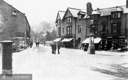
This view looks towards Matlock bridge, and tells of a time when local straw-hatted local people could stand in the middle of the street to have a leisurely conservation.
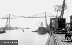
Before the commissioning of the transporter bridge a ferry operated across the Tees to Port Clarence.
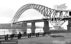
To give the bridge just one coat of paint requires 6,000 gallons of paint.
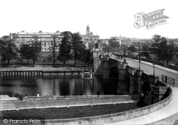
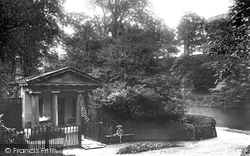
The original Count's House was about 100 yards nearer to Prebend's Bridge and was the home of Count Boruwlaski, a Polish dwarf who stood just 39 inches high.
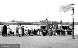
Southampton's famous Floating Bridge enabled foot passengers and traffic to cross the Itchen between the city and the south-eastern suburb of Woolston.
Southampton's famous Floating Bridge enabled foot passengers and traffic to cross the Itchen between the city and the south-eastern suburb of Woolston.
The photograph shows Colt Hill Bridge and the rear of The Bridge House.
In earlier days this route marked the only highway in and out of the Forest from this direction.
The 'island' formed by the moat is entered over a 16th- century bridge and through a fine 15th-century Wealden sandstone gatehouse, seen here from within the moat; the house is out of view
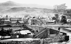
This view, taken from the station, shows the town and Cadair Idris, the River Wnion, the famous 17th-century bridge and tollhouse, and the tower of St Mary's church.
This branch of the river passes through the Mill Brewery, at this time owned by Linolite Limited, and on to the weir by St John`s Bridge and the Avon Mill, eventually joining the other
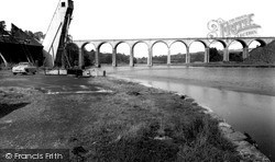
The fine viaduct behind was built across the River Tiddy in 1908 to replace an earlier bridge, and still carries the main line railway.
Bickleigh lies between Shaugh Bridge and Plymbridge in the valley of the Plym.
Places (17)
Photos (40)
Memories (1928)
Books (2)
Maps (520)


