Merry Christmas & Happy New Year!
Christmas Deliveries: If you placed an order on or before midday on Friday 19th December for Christmas delivery it was despatched before the Royal Mail or Parcel Force deadline and therefore should be received in time for Christmas. Orders placed after midday on Friday 19th December will be delivered in the New Year.
Please Note: Our offices and factory are now closed until Monday 5th January when we will be pleased to deal with any queries that have arisen during the holiday period.
During the holiday our Gift Cards may still be ordered for any last minute orders and will be sent automatically by email direct to your recipient - see here: Gift Cards
Places
26 places found.
Those places high-lighted have photos. All locations may have maps, books and memories.
- Town End, Derbyshire
- Town End, Buckinghamshire
- Town's End, Somerset
- Towns End, Dorset
- Town End, Merseyside
- Town End, Cambridgeshire
- Town's End, Buckinghamshire
- West End Town, Northumberland
- Bolton Town End, Lancashire
- Kearby Town End, Yorkshire
- Town End, Cumbria (near Grange-Over-Sands)
- Town End, Cumbria (near Bowness-On-Windermere)
- Town End, Yorkshire (near Huddersfield)
- Town End, Yorkshire (near Wilberfoss)
- Town End, Cumbria (near Appleby-in-Westmorland)
- Town's End, Dorset (near Melbury Osmond)
- Town's End, Dorset (near Swanage)
- Town End, Cumbria (near Ambleside)
- Town End, Cumbria (near Lakeside)
- Town End, Cumbria (near Kirkby Lonsdale)
- Town End, Cumbria (near Ambleside)
- Town's End, Dorset (near Bere Regis)
- West-end Town, South Glamorgan
- Townend, Derbyshire
- Townend, Strathclyde (near Dumbarton)
- Townend, Staffordshire (near Stone)
Photos
26 photos found. Showing results 761 to 26.
Maps
195 maps found.
Books
160 books found. Showing results 913 to 936.
Memories
3,720 memories found. Showing results 381 to 390.
The Bringing Of Buckland Lower Lodge Into The 20th Century.
I am Jeannette McNicol (nee Elliott). My brother John and I moved there with my parents ,when I was 13 years old and he was 12. I had found the house when we were having a ...Read more
A memory of Buckland in the Moor by
Stoke Road Blisworth.
We moved to Stoke Rd Blisworth 1975 six new houses were built opposite the post office,Mr & Mrs Freestone lived across the road they made us very welcome on one occasion Mr freestone removed a window when my wife locked ...Read more
A memory of Blisworth by
The Winter Of 1963 4 When Petts Wood Was Cut Off By Floods
I lived in Town Court Crescent with my parents, Norman and 'Babs' Treliving, from 1957 until 1974. The house was one of many designed by the architect Basil Scruby, whose name was carved ...Read more
A memory of Petts Wood by
My First Home Of My Own
I MOVED TO STEVENAGE LIKE MOST YOUNG PEOPLE AT THAT TIME TO GET A HOUSE YOU HAD NO CHANCES ELSEWHERE MY BROTHER ALREADY LIVED THERE SO I WAS ABLE TO LODGE WITH HIM GOT A JOB AT BEA SYSTEMS AS AN AID STOREKEEPER HAVING BEEN ...Read more
A memory of Stevenage
Woolworths
As a 14 year old I was a 'Saturday girl' at Woolworth's in 1961. I was on the glass counter, selling everything from vinegar bottles with plastic tops, ashtrays, jugs etc. The number of items displayed on the sloping counter was enormous ...Read more
A memory of Woolwich by
Memories Of Skelmersdale 1973
I taught at Glenburn High School, Skelmersdale in 1973. I found lodgings with Mrs Smith, a retired lady, in a terraced house in High Street, Old Skelmersdale on the basis of bed and ...Read more
A memory of Skelmersdale by
Memories Of St Michaels School Sunninghill
I went to St Michaels C of E school in Sunninghill 1960 to 1964, I remember the head master Mr Steele he drove a Morris Oxford MO, I also remember Miss Pope she always wore the same brown shoes. The canteen ...Read more
A memory of Ascot
Normanton Memories
i was born and grew up in park row, near the pit where my dad worked all his life, my parents were Elsie and Crispin Ellis, I went to normanton common and normanton modern school from where i left in 1963, i love normanton, but the old town before the motorway.
A memory of Normanton by
My Years In Tring
I was born at Aylesbury Hospital in 1948 and lived briefly at Pitstone, then Tring in Park Road and later Western Road. My Parents, Grandparents and many other relatives lived in the town. I attended Gravelly infant school in Park ...Read more
A memory of Tring by
Brierley Hill Girls Memories
I was born in Chapel Street, in 1947. My uncle, Len Gray, had a newsagents in the town, near the bus stop by the Old Post Office, as was. My Grandad used to sell papers on the Five Ways and as a girl I would stand ...Read more
A memory of Brierley Hill
Captions
5,111 captions found. Showing results 913 to 936.
Devonport stands to the west of the city of Plymouth, and is the newest of the three towns that make up Devon's largest urban area.
West Street 1930 This town was a considerable port in the middle ages, but the silting up of its ancient harbour led to a decline in trade.
To the right, Winchester Road rises to leave town; to the left it enters town.
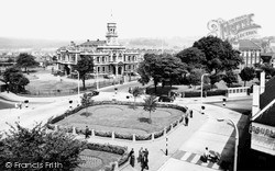
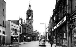
Llanelli is still very much alive, and Town Hall Square is laid out in a most symmetrical and pleasing manner. It possesses a rather grand neo-Jacobean Town Hall with a highly decorative clock tower.
KIDDERMINSTER has been fortunate in that it has always been a relatively compact town, despite its expansion during the 18th and 19th centuries.
The Townley family owned the hall for over 500 years; it was given to the people of Burnley by the last occupant, Lady O'Hagan, the widow of Lord O'Hagan, former Lord Chancellor of Ireland.
The narrow streets of Cowes are typical of many southern English coastal towns, designed for use rather than ornament.
The narrow streets of Cowes are typical of many southern English coastal towns, designed for use rather than ornament.
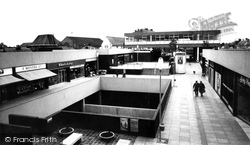
Here we see another view of the bleak and unappealing shopping precinct, constructed when the town's population numbered less than twenty thousand people; it appears less incongruous when viewed alongside
In the 1950s Kettering was still an important boot and shoe town, specialising in heavy work boots. It also had a significant engineering and clothing industry.
A bustling and lively shopping street but not yet choked with motor traffic.
This town was almost completely formed and defined by the production of coal.
The Market House (or Town Hall) with its clock and bell turret was built in the 18th century by extended and largely reconstructed by Lord Chesham in 1856.
At the close of the 19th century, Alton bore the stamp of an old country market town, with its bustling streets and striking shop fronts. Opposite the King's Head is the town's market square.
Blackburn Road is at the very heart of the town. The first building on the right is the Market Hall, and next to that, in the centre of our photograph, is the Town Hall.
Wales's oldest university is located here; it was established in 1822, and has brought a cosmopolitan complexion to this ancient and most distant of towns.
Like many of the town's churches, it is built from salvage from the Roman town: bricks for arches, quoins and bands, and rubble and septaria (inferior stone nodules) for the rest.
The coming of the railway made Horsham a natural target for expansion, helping to boost the town's economy.
This view shows a virtually-deserted High Street in the undistinguished former colliery town of Normanton, three miles north of Wakefield in South Yorkshire.
The town of Little Walsingham grew up to serve the many thousands of pilgrims that came to the priory; it has more early 17th-century houses than any other town in Norfolk.
The many prams and push-chairs were a typical sight in Harlow, leading to its nickname 'Pram Town'.
Thrapston is a small medieval market town engulfed in 19th- and 20th-century housing and factories.
Designed by Thomas Robinson and completed in 1887, the red-brick town hall deserves a more spacious and prominent setting than Market Street.
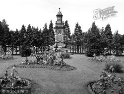
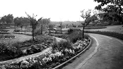
Described as a new lung for the town, these recreation grounds and ornamental gardens were constructed from derelict land next to the railway embankment.
Places (26)
Photos (26)
Memories (3720)
Books (160)
Maps (195)

