Places
4 places found.
Those places high-lighted have photos. All locations may have maps, books and memories.
Photos
Sorry, no photos were found that related to your search.
Maps
11 maps found.
Books
Sorry, no books were found that related to your search.
Memories
227 memories found. Showing results 41 to 50.
The War Years In Consett
I was born in Consett at 11 Newmarket Street in June 1933, though my parents were living in Norfolk and later on in Middlesex. I was sent back to live with aunts when the Blitz really got going. I went to the CofE ...Read more
A memory of Consett in 1940 by
Fox & Hounds Ramsden Bellhouse
I just found the Ramsden Bellhouse site and wrote in the guest book. My memories of Wickford are shopping there, watching cricket, catching the bus. I worked in London and more than once getting off the train in ...Read more
A memory of Wickford in 1950 by
Staying In Trinant
I am 46 and my nan lived in Trinant. Me and my sister used to visit her throughout the year but every summer for 2 week we stayed with her in her flat. We had working parents and to have a stay-at-home adult was bliss. ...Read more
A memory of Llanhilleth by
Early Accommodation For Leveringtons Fruit Pickers
It was after World War 1 that strawberry growing became important around the Wisbech area and as strawberry prices continued to rise so more and more strawberries were planted. Eventually, ...Read more
A memory of Leverington in 1920 by
Baldock Hostel
I lived in the hostel in the 1960s and liked the area very much. I was a member of the working man's club, the cinema always had up to date films. The town boasted good pubs, there was plenty of work in nearby Letchworth. I had ...Read more
A memory of Baldock by
Radlett Prep
I attended Radlett Prep between 1958 and 1965. It was located in a converted three floored Edwardian house on the corner of Hillside Avenue and Aldenham Grove, and has since been converted back to a private residence. Aldenham Grove ...Read more
A memory of Radlett by
1960s
I lived in Connaught Avenue, and went to Grove Road school (up to 1963). I had 3 local friends. One lived on Hounslow Heath in a prefab (now Frampton Road). We weren't allowed to go to the fairs there. I did see grass snakes though! Near ...Read more
A memory of Hounslow in 1963 by
The Castle Lawn
I have a clearer copy of this photo in the book on Sevenoaks and Tonbridge and have studied it with a magnifying glass. I was one year old in 1951 (and according to my parents, already walking at 9 months). The posture of the ...Read more
A memory of Tonbridge by
Growing Up In Sutton
We lived at no 6 Greenfields, Sutton. My nan lived at four with my grandad Tom - in fact it was my family which helped forge Sutton village. I remember many families; Mr and Mrs Harland who ran the village ...Read more
A memory of Sutton by
Eastgate
To the right-hand side of the flats was another parade of shops called Eastgate. Here there was Mrs North, the fishmonger, and Apps, the papershop, as well as a hairdresser and greengrocer and petshop where l had my first Saturday job. ...Read more
A memory of Nork in 1965 by
Captions
141 captions found. Showing results 97 to 120.

Street lighting has been improved, and there are seats from which to enjoy the scene.

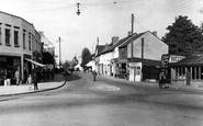
It is ten years after G66010, and more cars are evident. This view is flanked on the left by the shop front of Greenwoods chemist's and druggist's shop.

Knowledge of the swift tides and currents in this area is vital, and that is why there are more fishermen using this beach than tourists, who have heeded the warning.

West of the Market Square the road divides: the left hand road goes to Long Sutton, the right fork heads for Langport.

There are two tarns on the part of the moor by Ilkley shown in 45157A, pages 68-69, both within easy walking distance of the town.

Just beyond the west tip of Nag's Head Island is the Malthouse (creeper-clad) and Fairlawn Wharf to the right, now housing and formerly warehouses and barns.

This picture is of the same road as photograph W64009, but dates from ten years later and is taken from the other direction.

The church and a cluster of old houses are at the top of the hill, and more old buildings are on the river bank, east and west of the Bognor Road river bridge.

Between the wars, Worthing lost its wonderful town hall and theatre.

The huge building is set in a park of over 3,000 acres, which on certain days in the summer are opened to the public.

Hest was part of Bolton-le-Sands, and was a hamlet near Morecambe Bay. Hest Bank was the seaward side of the village, right at the southern side of the mouth of the River Kent.

The Apex stands in the fork of the junction between the High Street and Church Street, both of which lead down to old landing stages on the Great Ouse. Today, little has changed.

Moving south-east and still within Wonersh parish, we reach Shamley Green, in 1965 still a remote Surrey hamlet loosely built around its triangular green.

Ten years has made a tremendous difference in the appearance of both street and market day. The stalls are more tidy and professional in the goods on display.

We are now further along Leigh Road and looking back towards the station. Trees planted c1900 are now mature, and more modern lighting has been installed.

Beyond this there are now modern houses. The overhead electricity wires and poles remain and the slate roofed house behind, quirkily named Toad Hall. There are more modern houses on the right.

On the far side of the Severn, a boathouse and rowing boats indicate a swing to tourist trade.

Not a hatless head to be seen as the open-top tram, en route to Frindsbury across the river, passes the lantern and railings of Eastgate House, threatening conflict with horse-drawn traffic.

Lakeside is the settlement furthest away from the Lakeland mountains, but it is historically important as the entry point for large numbers of Victorian day visitors who came up from Lancashire by way

Farther along are more barrels and boxes. Outside the lower building next door, now a private residence, is a display of spades.

Ingoldmells has had millions of pounds spent on its redevelopment, and more is promised for the future. This makes it difficult to recognise a place like this.

The river has long been used for boats trading upstream and, more importantly, downstream, where the Stour links up with the River Severn and thus with the ports of Gloucester and Bristol.

The new parish was carved out of St James' parish as more and more houses and industry were attracted to the Burnley Road area.

On the left is the Three Mariners pub, an 18th- century building, but standing beyond it now are overscaled two-storey offices.
Places (4)
Photos (0)
Memories (227)
Books (0)
Maps (11)

