Places
7 places found.
Those places high-lighted have photos. All locations may have maps, books and memories.
Photos
56 photos found. Showing results 101 to 56.
Maps
55 maps found.
Books
Sorry, no books were found that related to your search.
Memories
646 memories found. Showing results 51 to 60.
Bicycles And A Happy Hunting Ground.
Being the offspring of parents otherwise engaged, and only partially supervised by a succession of Nannies, whose only concern was that we should be clean and respectably dressed when we got up to mischief, ...Read more
A memory of New Milton in 1950 by
Boyhood Days
My aunts and uncles lived in East Howle and I was a regular visitor around and before 1950. The two families lived opposite one another in what I think may have been "railway cottages" and my cousins totalled 9. In those days you ...Read more
A memory of East Howle
Poetry
This poem was sent to mac by Mrs S. Holmes: Death of Chelmsley Wood The sheer delight of summer afternoons, As through the fields in cotton frocks we walked, The long grass licking at our gangly legs, While we in deep contentment ...Read more
A memory of Chelmsley Wood in 1995
Boyhood Memories
I was born in 89 Abbot Street, just off Sunderland Road, in 1932, then we moved to the Gateshead end of Redheugh Bridge. When the Second World War started we moved to 20 Brussel Street. The Davidson family lived in the flat ...Read more
A memory of Gateshead in 1940 by
46 Bridge Road, Cove
46 Bridge Road at Cove is very significant to me because I was born in Bridge Road, no 46, on 29th June 1943, in the photo of Bridge Road it is the second house on the left, opposite Cove Supply Stores, so I'm sure my mother would ...Read more
A memory of Cove in 1943 by
A Magical Time
My name is Peter Weeks and I lived on Llanwoanno Road. Every Sunday I would cross this bridge with my elder brother Kenneth, on our way to the Baptist Chapel. This was the time of steam trains. We could hear the trains comming ...Read more
A memory of Mountain Ash in 1964 by
My Memories Of Mossband
I lived with my parents at 28 The Green, Mossband from around 1942 (when I was one year old) until 1949, when my Father, Edward Lovie (a WD constable) died from throat cancer. My memories are all fairly traumatic and ...Read more
A memory of Mossband Ho in 1940 by
A Wartime Child
I was born in 1935 at 25 Cambridge Road, maiden name Lee. There were six of us, parents, 2 older sisters, Beryl and Gwen, and grandmother. I remember many of the shops from the late 30's to the early 50's when we moved to ...Read more
A memory of North Harrow in 1930 by
Peartree Close
I was born in Burgess Hill in 1955 and lived at 18 Peartree Close. There was a rough track behind the house with rear access to garages, and we spent loads of time playing up and down this track and in the woods beyond. I ...Read more
A memory of Burgess Hill in 1955 by
Love That Place!
Born at Petersfield in 1940, my first home was Berry Cottage, down Sandy Lane, opposite Sibley's farm. Berry cottage had only 4 rooms (2 up and 2 down), no running water, only a well and later a tap down in the lane. I remember ...Read more
A memory of Rake Firs in 1940 by
Captions
334 captions found. Showing results 121 to 144.
The ford that gave Allerford its name lies beside an ancient, two- arched packhorse bridge.
The castle itself has long since disappeared - it was of timber, and dated from early Norman times. A brick bridge over the moat remains.
This bridge is owned by the Drainage Commissioners, and has been rebuilt to give the river two feet more room.
Going north to the Godstone to Reigate road, that part of the A25 that runs along the greensand ridge south of the North Downs, we reach the village of Bletchingley.
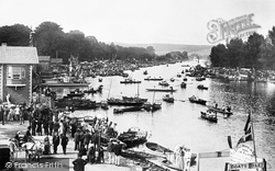
The world-famous regatta takes place on a scenic stretch of the Thames between Henley Bridge and Temple Island, site of an elegant Georgian folly.
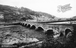
A much earlier bridge was replaced by this one in 1853; at that time, the harbour was being improved for the export of copper ore and import of coal.
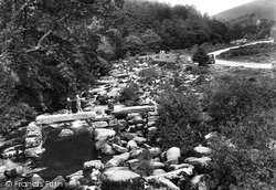
The meeting of the East and West Dart rivers has drawn tourists for as long as transport has been available.
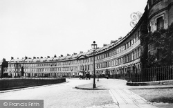
Along the ridge, Somerset Place and Lansdown Crescent curve sinuously to great architectural effect, with grand views across the city.
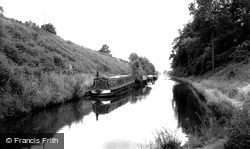
The long straight character of the Shropshire Union canal is plain to see here. The builder, Thomas Telford, believed in cutting through hills and bridging valleys.
Perhaps its name implies that there was once a ferry crossing here long ago. In 1802, however, a wooden toll bridge was built nearby which is still in regular use today.
Long before this picture was taken, the northern Severn had effectively been closed to navigation at two to three hundred yards above Stourport Bridge.
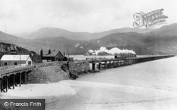
This famous bridge spans the Mawddach estuary. A train is heading south. The railway was built as part of the Cambrian railway, with two stations, Barmouth and Barmouth Junction.
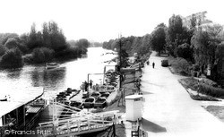
Boating was extremely popular in this reach upstream of the bridge, a popularity which lasted until relatively recent times. Bale's Garage (now long gone) is clearly visible in The Square.
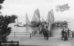
This photograph, taken from the bridge at Clare House Pier, shows a busy scene, with eight boats of varying sizes gathered around.
The blurred images of the children in the foreground remind us of the long exposure times photographers needed in those days.
Waddington is now noted more for its large Royal Air Force station to the east of the village, but it grew up on a diversion of Ermine Street to the western scarp of the limestone ridge.
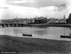
The majestic cathedral overlooks the bridge designed by John Gwynn in 1781, replacing a medieval structure built c1313, which was upstream from the present site.
This famous bridge spans the Mawddach estuary. A train is heading south. The railway was built as part of the Cambrian railway, with two stations, Barmouth and Barmouth Junction.
We are near the long stone road bridge to Houghton, built in 1875 and crossing the tidal River Arun. Vinson's was a popular riverside tea rooms and garden. There is still a tea garden on the site.
The ladies' long frocks in this photograph must have been impossible to keep free of stains.
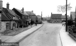
Washington's village street was formerly an ancient road that ran along the greensand ridge.
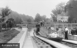
The wooden elevator ramps have now long gone, but their concrete runways remain. The bridge has been rebuilt; on the right is the Boulters Lock Hotel, which is still thriving.
The Chesterfield Canal begins at the distant hump-backed bridge beyond a moored motor cruiser. The 'Trent Valley Way' long-distance footpath stretches from here to beyond Nottingham.
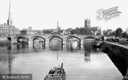
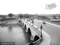
Note the Malvern Hills in the distance, and the tower of St John's Church, adding interest to this view of Worcester Bridge, which had been substantially widened just a few years before the picture was
Places (7)
Photos (56)
Memories (646)
Books (0)
Maps (55)

