Places
17 places found.
Those places high-lighted have photos. All locations may have maps, books and memories.
- Bridge End, Oxfordshire
- Bridge End, Lincolnshire
- Bridge End, Essex
- Bridge End, Bedfordshire
- Bridge End, Clwyd
- Bridge End, Warwickshire
- Bridge End, Surrey
- Bridge End, Durham (near Frosterley)
- Bridge End, Northumberland (near Hexham)
- Bridge End, Hereford & Worcester (near Tirley)
- Bridge End, Hereford & Worcester (near Bosbury)
- Bridge End, Shetland Islands
- Bridge End, Cumbria (near Carlisle)
- Bridge End, Northumberland (near Hexham)
- Bridge End, Devon (near Kingsbridge)
- Bridge End, Devon (near Sidmouth)
- West End, Yorkshire (near Pateley Bridge)
Photos
40 photos found. Showing results 1,321 to 40.
Maps
520 maps found.
Books
2 books found. Showing results 1,585 to 2.
Memories
1,925 memories found. Showing results 661 to 670.
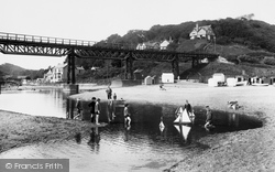
Tin Boats On The Cray
My friends and I spent many happy hours in a tin boat that my brother made for me, paddling up and down between the two bridges at riverside Crayford. Often we would use our nets to catch sticklebacks and shrimps but always ...Read more
A memory of Crayford in 1952 by
After School
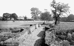
This little ford and bridge over the silver Darent river was, and still is, my favorite place in England. When I attended the Sutton at Hone Primary School in 1947 -1953 we often took nature walks down the gravel path beside the ...Read more
A memory of Sutton at Hone in 1952 by
What Went On
This is from about the 1950s. Along Grange Road was a huge piggery and it was owned by the Liddle family, by, did it pong. Further along you came to the railway crossing with the sign STOP, LOOK, LISTEN in red, this was where the ...Read more
A memory of Newburn in 1952 by
The
The bridge from which this photograph was taken was a "humpitty-backed" stone bridge where a pair of arches spanned the river and a smaller arch crossed the "lade". The bridge was in service from about 1840 until the new bridge was ...Read more
A memory of Bridge of Allan in 1952 by
Leaving Home 1952
November 17th 1952 I left home from Earlestown Station for Liverpool to join the Royal Navy as a boy seamen. I proceeded to St. Johns Lane then onto the train headed for London and Ipswich and eventually to HMS Ganges ...Read more
A memory of Newton-le-Willows in 1952 by
Happy Home
Halfway, with Uncle Idwal and Auntie Lal, was full time home from about 1951 to 1954 whilst mum was in hospital. She died in 1954 and I returned to live in Chester with Dad though I spent holidays at Halfway up to about 1964, ...Read more
A memory of Halfway Ho in 1952 by
Croxall Mill, Yoxall, Alrewas, Burton On Trent, Staffs
In the 1950s my parents and I were frequent visitors to friends made during the war years. They lived near Branston Road, Burton, and were business people. John, his wife Doris, and their daughter ...Read more
A memory of Alrewas in 1952 by
Life At Broadclyst Station
What a lovely life. Playing in the station, the copse and by the river at Double Bridges. We lived in Alexandra Terrace and the first house opposite the Inn was run by Mrs Wicigrin (spelling?). We used to play in the ...Read more
A memory of Broadclyst in 1952 by
Memories Of An Old Visitor!
My grandfather, Frank Green, lived next door to Stevens shop in Ten Mile and was the local baker working from Hilgay High Street, with his family. He supplied most of the surrounding fens and West Derham etc.. with ...Read more
A memory of Ten Mile Bank in 1952 by
Diving Of The Bridge
I lived in Belgrave Rd, Loughor from 1946 to 1957 and would often visit the sandy beach near the bridge with my mam and dad, David Howell Evans and Jenny Evans. I remember my father's brother, Uncle Elfed, diving off the ...Read more
A memory of Loughor in 1952 by
Captions
1,770 captions found. Showing results 1,585 to 1,608.
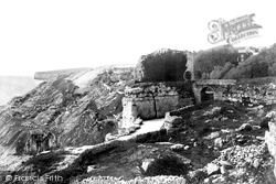
This is Portland's rugged eastern seaboard, south-westwards from Gilbert Castle and Castle Hayes (foreground) to medieval Rufus Castle and Gallops Weare (centre); God Nor is the headland above Freshwater
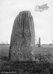
They lie in a north-south axis on the western edge of the town; they measure as high as 22ft 6in, and are as big as the stones at Stonehenge.
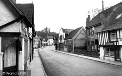
Bridge Street, looking east. Sweet jars are clearly visible in Furr's window. Three doors up is J B Crone, a furniture dealer; next door, W H Walker sells cycles.
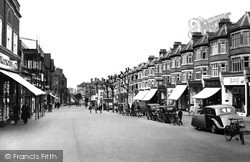
This view looks north along Woodcote Road towards the railway bridge. The station is on the left, but is concealed by the distant shops.
They lie in a north-south axis on the western edge of the town; they measure as high as 22ft 6in, and are as big as the stones at Stonehenge.
In the distance is the broad concrete bridge installed in 1927-28 carrying the four-lane by-pass south to Belmont and north towards London.
Bridge House, the Post Office Stores and the adjoining houses (centre bottom) follow the curve of the street, named after The Swan Inn.
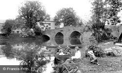
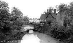
On the south-east side of the village the five-arch stone bridge, perhaps of the 16th century, steps quietly across the very reedy Rotherby Brook.
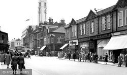
This view was taken looking north along Bridge Street towards the Market Place – indeed, in the left centre of the view we can see the cupola and stair tower of the Town Hall.
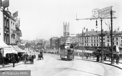
Car No 118 of the Bristol Tramways & Carriage Co heads for St Augustine's Bridge.
The hotel stands on the north bank of the River Leven, by the bridge.
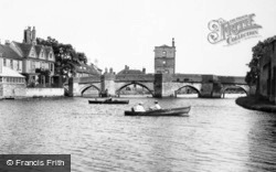
The bridge across the Ouse at St Ives was built in medieval times.
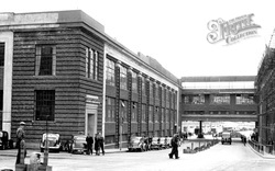
The building to the left is K Block; it housed the greater part of the marketing and sales functions for the company.
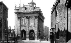
Frith's Victorian photographer was in the lane leading to the abbey gateway, and looking across the Market Place to what is now undoubtedly the finest building in Abingdon: the Town Hall.
On the south-east side of the village the five-arch stone bridge, perhaps of the 16th century, steps quietly across the very reedy Rotherby Brook.
As one of four major thoroughfares leading to the Town Centre, and formerly called Tower Hill, Manchester Street's importance was typified by the presence of many privately-owned shops and businesses and
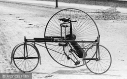
Victorian engineering may have had its successes with its railways, bridges and steamships, but not every invention made it into the handbook or classic designs.
The wooden bridge spans the spur to the Delph. Here, iron ore deposits colour the water bright orange. There were two canal and tunnel systems, one set higher than the other.
It was a popular place for holidays when this picture was taken, even though the village was disfigured by a ruin of an alum works and an iron bridge carrying the LNER railway line from Whitby to Saltburn
Only this church and Westminster Abbey have the honour of holding the relics of the saint to whom it is dedicated. St Wite was killed on an Anglo-Saxon mission to Germany.
Quarrying for limestone and copper brought new people to this quiet agricultural village - mines were still operating in the 1920s. Now Melsonby is a well-kept residential village.
The earliest tourists to the Lake District were overwhelmed by the 'horrid' and 'frightful' nature of the mountains and crags, which frowned down on them as they negotiated the passes.
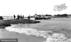
The lifeline between Poole and Purbeck, crossing between Sandbanks (right) and Shell Bay (left), is the Floating Bridge.
The Augustinian Priory of St Mary and St Thomas the Martyr was founded c1200 by Robert fitz Richard (d1213).
Places (17)
Photos (40)
Memories (1925)
Books (2)
Maps (520)

