Places
26 places found.
Those places high-lighted have photos. All locations may have maps, books and memories.
- Cemmaes Road, Powys
- Six Road Ends, County Down
- Road Weedon, Northamptonshire
- Severn Road Bridge, Gloucestershire
- Roade, Northamptonshire
- Berkeley Road, Gloucestershire
- Harling Road, Norfolk
- Road Green, Devon
- Builth Road, Powys
- Cross Roads, Yorkshire
- Steele Road, Borders
- Cross Roads, Devon
- Four Roads, Dyfed
- Road Green, Norfolk
- Biggar Road, Strathclyde
- Clarbeston Road, Dyfed
- Five Roads, Dyfed
- Eccles Road, Norfolk
- Grampound Road, Cornwall
- Morchard Road, Devon
- Wood Road, Greater Manchester
- Four Roads, Isle of Man
- St Columb Road, Cornwall
- Clipiau, Gwynedd (near Cemmaes Road)
- New Road Side, Yorkshire (near Silsden)
- New Road Side, Yorkshire (near Cleckheaton)
Photos
14,329 photos found. Showing results 1,621 to 1,640.


Maps
476 maps found.
Books
5 books found. Showing results 1,945 to 5.
Memories
11,058 memories found. Showing results 811 to 820.
Cargo Fleet
When I look back, they were probably the best years of my life though I didn't think so at the time, my mam had parted from my dad, I was 12, had never heard of Cargo Fleet, had lost my dad and was taken to this place Id never ...Read more
A memory of Cargo Fleet in 1968 by
Heswall Childrens Hospital Circa 1979 1980
I was in this hospital for a couple of years when I was around 4 years old! (Hence the vagueness.) I recall the wards (dorms) and I recall bouncing from one bed to another along the entire length of the ...Read more
A memory of Heswall in 1979 by
Lingfield
Jean Chambers mentioned the bomb dropping on the school in 1943 - my parents shop (John Banks Outfitters) was almost opposite the school and I was born at the end of 1943 being given my second name of "Heather" after Heather Lumsden ...Read more
A memory of Lingfield by
Hove Town Hall Fire
I think it was 1964 that the Town Hall burnt down. I remember it well. I was about 11 at the time. I do remember that at the back of the TH, was the Police Station. My brother and I got in some "trouble" and the two of us ...Read more
A memory of Hove in 1964 by
Those Were The Days 6
Continuing up the street on the right was a long parade of various shops and we come to Salisbury Ave on the corner was a large modernistic furniture shop later the shop nest door became a KFC and across the street next to ...Read more
A memory of Barking in 1950 by
Those Were The Days 2
It didn't change until the sixties when the station was rebuilt and opened by Her Majesty Queen Elizabeth 11 in 1961. I watched the whole building project from start to finish from the comfort of my bedroom window. When it ...Read more
A memory of Barking in 1950 by
Post War Memory
My Nan and Grandad lived near the corner of Chamberlayne Road and Bleinham Road - 108 Chamberlayne Road - Mr and Mrs Ayley. Grandad kept ferrets and racing pigeons in the back garden.
A memory of Eastleigh in 1950 by
Memories Of St. Margarets Church
Fond memories of St. Margarets Church in Uxbridge, Middx. My home was Harefield Road , Uxbridge. and we were married by the Rev: Bruce Eadie. He asked us to go to Westminster to obtain a special license because ...Read more
A memory of Uxbridge in 1952 by
Willingdon
My grandparents lived near the British Queen on Eastbourne Road near the tiny grocers store and I have happy memories of spending summer holidays on the downs and Donkeys Hollow picking bluebells. I would love to hear from anyone who ...Read more
A memory of Willingdon in 1951 by
Your search returned a large number of results. Please try to refine your search further.
Captions
5,036 captions found. Showing results 1,945 to 1,968.

Our Lady of Lourdes' Church is situated on Leasowe Road, Moreton. Built in 1957, it features a strong architectural style.

Milnthorpe had been an important stopping place for north or south- bound traffic since the 18th century, and there were numerous coaching inns along the main road.

A horse must have recently passed by, as it has left a deposit on the side of the road.

St Georges Road is to the left, opposite Obelisk Street.

We can see the monument topped by a dragon marking Temple Bar on the City boundary in the middle of the road.

These cottages lie on the road down from the school, one of the first church schools in Somerset. The thatch looks so picturesque today.

The houses of Clapham Common North Side, part of the busy A3 London to Portsmouth Road, are visible through the trees.

The King's Head still stands beside the road, which drops north from the village to the moors below. A cottage on the left was once home to the blacksmith; his forge stood beyond the pub.

The Tilling Bourne quietly adds its own liquid note to this peaceful scene as its flows past The Compasses, one of two pubs in this small village on the main Guildford to Dorking road.

Work began immediately on this new church in London Road

Again, the flint walls remain, and the brick pavings on the right survive, but the pillar box on the corner of Blackwater Road has been replaced by a modern one.

This haven of tranquillity lies just a quarter of a mile from the main road down a wooded path, but many people feel that it has been spoilt by concrete buttresses and notice boards.

This village lies along the Itchen, where many old buildings can be found - the wide river fills one side of the road. Since the 1960s the village has expanded with new estates.

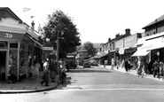
This is the main cross roads in central Epsom, High Street and Waterloo Street, and is gloriously uncluttered in this period view.

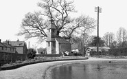
Given the state of the roads in 1889, it is interesting to ponder whether the photographer was using the little boat in the foreground as his means of transport.

Here we see the main road leading north from Preston and the Methodist Church.

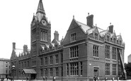
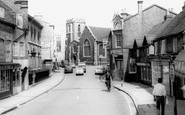
Only three years earlier, the 15th- century half-timbered 'island' in the middle of the street had been removed in a road-widening measure.

The Heath was an area of common land criss-crossed by roads. It became an ecclesiastical parish in 1860.

The road here has since been widened with the demolition of the butcher's shop - can you see the legs of meat hanging outside the window of Mason's?

to be succeeded by other media, and although most of the houses in this view remain, the place is virtually unrecognisable and the traffic scanty: this is the main A40 London to Oxford road

The road has not changed, but the chalet-style house has gone, replaced by luxury flats, and there are now houses to the right.

Liphook expanded as a village thanks to the London-Portsmouth road and the arrival of the railway in 1859.

The main road towards South Molton is plain to see.

A wonderfully evocative view showing the joys of the motorcar and the open road. A
Places (26)
Photos (14329)
Memories (11058)
Books (5)
Maps (476)

