Places
26 places found.
Those places high-lighted have photos. All locations may have maps, books and memories.
- Town End, Derbyshire
- Town End, Buckinghamshire
- Town's End, Somerset
- Towns End, Dorset
- Town End, Merseyside
- Town End, Cambridgeshire
- Town's End, Buckinghamshire
- West End Town, Northumberland
- Bolton Town End, Lancashire
- Kearby Town End, Yorkshire
- Town End, Cumbria (near Grange-Over-Sands)
- Town End, Cumbria (near Bowness-On-Windermere)
- Town End, Yorkshire (near Huddersfield)
- Town End, Yorkshire (near Wilberfoss)
- Town End, Cumbria (near Appleby-in-Westmorland)
- Town's End, Dorset (near Melbury Osmond)
- Town's End, Dorset (near Swanage)
- Town End, Cumbria (near Ambleside)
- Town's End, Dorset (near Bere Regis)
- Town End, Cumbria (near Ambleside)
- Town End, Cumbria (near Lakeside)
- Town End, Cumbria (near Kirkby Lonsdale)
- West-end Town, South Glamorgan
- Townend, Derbyshire
- Townend, Strathclyde (near Dumbarton)
- Townend, Staffordshire (near Stone)
Photos
26 photos found. Showing results 3,001 to 26.
Maps
195 maps found.
Books
160 books found. Showing results 3,601 to 3,624.
Memories
3,720 memories found. Showing results 1,501 to 1,510.
The Old Parsonage
Throughout my childhood, my parents would take my brother and I on holiday to stay at The Old Parsonage in East Dean, and we visited so often that it became a second home to us. It was owned at that time, by an elderly and ...Read more
A memory of East Dean in 1950 by
Beaconsfield St.
Although I was born at 96 Manchester Road, I too remember Beaconsfield Street very well as my aunt and uncle lived there. Doe's anyone remember The Brownbills? I went to the Church School in the next street, before moving on to ...Read more
A memory of Prescot in 1930 by
Even More Fond Memories
Around this time I was attending the senior school (and I do believe this newsagents was owned and run by the Burrell family) and often used to pass under the clock tower as I walked to and from the school via the lane ...Read more
A memory of Buntingford by
Is This My Mum
I was born in East Harlsey in 1958 and spent 19 years living there. The photo on this site I believe is my mum, Mrs Lorna Whittaker, stood outside our family home next to the Methodist Chapel. I loved going to the village ...Read more
A memory of East Harlsey by
Growing Up In Fareham
I was born in Brighton Sussex. After travelling from station to station, as my father was in the RAF (I'll miss out that part of the story), My mother Eileen,sister Shirley & I moved to Fareham after the 2nd WW, I was 9 ...Read more
A memory of Fareham by
Memories Of Elizabeth Gallimore
I was born in 19 Windsor Terrace in 1949. I remember growing up in Haswell and going to the school at the top of the road opposite Church Street where I went to both the infants and the juniors. We used to go up the ...Read more
A memory of Haswell in 1959 by
Mmemories Of A Better Cannock
The pictures in Francis Frith nostalgic photos, bring to mind the Cannock I remember. Even the pictures from 1955, the year of my birth, show places I recall. I would go with my grandad and John Brogan, in the old ...Read more
A memory of Cannock in 1960 by
Birthplace
I was born in a house in Oaks Way, which joined Oaks Road. We used to play on the green, but it was too slow and slopey for ball games. Every Saturday we were sent down to cross the railway and get fresh rolls from the bakers, on the other side of the railway line.
A memory of Kenley in 1964
Stables On The Avenue
I was lucky enough to ride some some lovely ponies and horses stabled on The Avenue. My mum and l would ride out over Epsom Downs, Walton Heath, Headley Heath and Mickleham Downs. It was a wonderful way to ...Read more
A memory of Walton on the Hill in 1969 by
Pontlottyn In The 1960's
I lived on Farm Road behind the police station facing the court house. There were so many lovely old buildings on the Square that I remember. The most prominent one for me was the sweet shop, it had such beautiful ...Read more
A memory of Pontlottyn in 1960
Captions
5,111 captions found. Showing results 3,601 to 3,624.
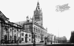
The Town Hall is to the west of the cathedral. It was designed in the Gothic style of the late 13th century by William Henry Lynn of Belfast, and completed in 1869; the tower is 160ft high.
Speculators built many homes, and this substantial little town is now a favourite place for retirement.
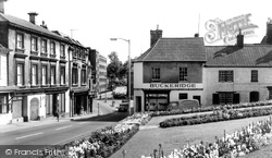
This was the site of the Old Town Hall. Thomas Harris paid for the enclosure and planting of the Central Gardens in 1896.
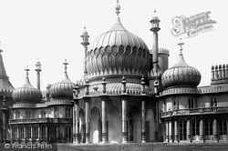
Brighton Pavilion is a fitting reminder of this town's emergence as a seaside resort.
This attractive town was the site of a timber castle belonging to the Montfitchet family, from whom it takes its name.
Now the suburbs of Poole have crept nearer, and the old village has become a small dormitory town. Corfe Mullen's mill received a mention in the Domesday Book.
Situated to the south-east of the town on the left bank of the river Teith at its junction with the Ardoch, Doune Castle derives its name from the Gaelic word 'dun', meaning a fortified place.
Once upon a time there was a house on the site of the Town Hall called Rosehill.
About 1785, Sir Richard Hotham, a wealthy Southwark hatter, who determined upon acquiring the glory of a seaside Romulus, set to work to erect a town of first-class villas in this pleasant spot, with a
For its size, St Mary's had more chantries than most parish churches, an indication of just how prosperous the town was between the 13th and 16th centuries.
Situated to the south-east of the town on the left bank of the river Teith at its junction with the Ardoch, Doune Castle derives its name from the Gaelic word 'dun', meaning a fortified place.
Tor Bay is bounded on the north by Hope's Nose (round the corner to the left) and Berry Head, seen here across the bay.
The small village of Lilbourne had a market charter granted in 1219 by Henry III, but it clearly never developed into a fully fledged town.
It was designed by William Butterfield in the prevailing neo-Gothic style, and much of its cost was met by the wealthy Windsor family.
This gorgeously ornate building is early 18th-century, and has been refurbished every century since. Before the railway - the Quay station can be seen on the left - this area was quayside.
This view shows Peveril Point, eastwards to its lookout and fort (far left), which with a semaphore mounted on Round Down, operated as a Royal Navy signal station during the Napoleonic Wars
The Reach dates from the 13th century and used to extend further into the town.
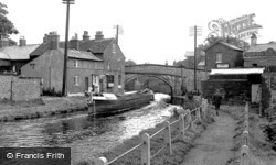
The Bridgewater Canal flows through the pretty town of Lymm in Cheshire. An empty pair of boats head towards Manchester, probably to collect coal.
The River 1903 Amid a grove of tall poplars on the banks of the River Stort are the weather- boarded malting mills, which helped to lay the foundation of the town's prosperity following the passing
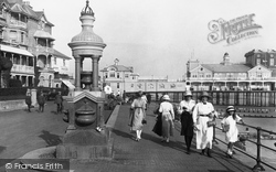
Unfortunately, the town had much of its heart punched out by 1960s development. The 1897 Diamond Jubilee drinking fountain was reerected in The Steyne gardens in 1969.
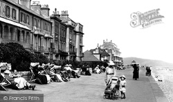
I am old enough to walk on my own now!' says the child standing by her pushchair.
This coastal town, famed for its oysters, was one of many to suffer in the great tides of 1953, which damaged many homes and businesses.
Quay Town, along the old harbour quays, has been much changed since 1890. To make a promenade, all the cottages on the sea side of the lane have been demolished: a great loss of character.
Frith's photographer was looking east, past the Town Hall on the right, towards St Nicholas's Church and the abbey gateway.
Places (26)
Photos (26)
Memories (3720)
Books (160)
Maps (195)

