Places
26 places found.
Those places high-lighted have photos. All locations may have maps, books and memories.
- Cemmaes Road, Powys
- Six Road Ends, County Down
- Road Weedon, Northamptonshire
- Severn Road Bridge, Gloucestershire
- Roade, Northamptonshire
- Berkeley Road, Gloucestershire
- Harling Road, Norfolk
- Road Green, Devon
- Builth Road, Powys
- Cross Roads, Yorkshire
- Steele Road, Borders
- Cross Roads, Devon
- Four Roads, Dyfed
- Road Green, Norfolk
- Biggar Road, Strathclyde
- Clarbeston Road, Dyfed
- Five Roads, Dyfed
- Eccles Road, Norfolk
- Grampound Road, Cornwall
- Morchard Road, Devon
- Wood Road, Greater Manchester
- Four Roads, Isle of Man
- St Columb Road, Cornwall
- Clipiau, Gwynedd (near Cemmaes Road)
- New Road Side, Yorkshire (near Silsden)
- New Road Side, Yorkshire (near Cleckheaton)
Photos
14,329 photos found. Showing results 3,321 to 3,340.
Maps
476 maps found.
Books
5 books found. Showing results 3,985 to 5.
Memories
11,058 memories found. Showing results 1,661 to 1,670.
The Good Old Days
I was born in Luton in the 1940s and remember well the shops in Manchester Street with WG Durrants butchers on the corner of Manchester Street and Bridge Street. Next door in Bridge Street was a garage and further along Manchester ...Read more
A memory of Luton by
Plumpton Close
My grandparents Jack and Beral Storey lived at 8 Plumpton Close with their kids Ricky, Stevie, Sharon and Darrell. My dad was Stevie who sadly passed away in 1980. I spent every weekend at my nan's and have great memories like ...Read more
A memory of Northolt in 1977 by
Willenhall Revisited 2012
At the request of my 42-year-old daughter "to see where Mom was born and her childhood up to age 15 years" we made a nostalgic visit from Herefordshire back to HUMP-SHIRE as Willenhall was known, on New Year's Day ...Read more
A memory of Willenhall by
Old House On Harbour Road
The house on Harbour Road was where I lived with my parents and sister for approx two years. We lived in one room in the gable end, then we were moved to the other end which was three rooms in a row. We lived there till ...Read more
A memory of Kinghorn in 1941 by
Great Torrington
My mother in law Gladys Bidgway was born in New Street, but they all lived at what is now Londis in Mill Street, all 18 of them! Most of the girls went to work in the Glove Factory in Whites Lane. Gladys worked there with her ...Read more
A memory of Taddiport in 1910 by
Choir Boy
I became a choirboy at the Ascension church when I was eight. I also joined the 2nd Collier Row cubs attached to the church in 1948. The vicar was Father Reynolds and the cub leader was Olive Smith. I attended Clockhouse Lane school ...Read more
A memory of Collier Row in 1948 by
Odeon Pictures
After the war I used to go to the Salvation Army flicks, almost next to the Odeon. They were free on sat ams I believe. I lived at 191 Gillingham Road till 1955,then went to Canada. Memories of Kerridges, Livingstone Circus, ...Read more
A memory of Gillingham in 1950 by
Biking To School
I attended Clarendon Road from 1950-52 and then moved to Eckelford. Initially my father took me by bike and then went on my own. I am the youngest of nine children, several of whom also went to Clarendon Road.
A memory of Ashford by
Shops
Penny son amd parker, coop butchers and grocery, barbers, horlocks funeral, Wardona picture house, news agents, st botolphs school, and church. Springhead Road where my mother worked for Mrs Keen who had a drapers shop in Northfleet.The ...Read more
A memory of Northfleet in 1942
Then & Now
I remember during my teens to early twenties there always seemed to be gigs on. From The Green Man (where it must be said, I really shouldn't have been, not then being 18), where it was very bluesy music, plus of course the mighty ...Read more
A memory of Kidderminster in 1973 by
Your search returned a large number of results. Please try to refine your search further.
Captions
5,036 captions found. Showing results 3,985 to 4,008.
This is the main road through what was once the home of the Welsh iron industry. The first forge is reputed to have been working in 1425, with the first ironworks following in 1577.
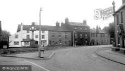
The square, originally Cross Bank, was bypassed in 1810 on its eastern side by the A6 Market Harborough to Leicester road. A
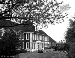
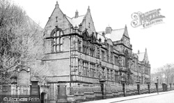
The original entrance to the college was intended to be from Ormerod Road, as the impressive doorway indicates.
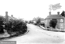
A couple of miles north-east of Ticehurst, Flimwell is a small village bisected by the London to Hastings road, now the A21, which crosses the foreground of this view.
This photograph was taken from outside the Market Hall looking down Blackburn Road towards its junction with Abbey Street.
A loop from the Coltishall to Wroxham road can take you down to the delightful small village of Belaugh.
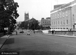
The newspaper office on the left and the road running to the right of it have gone; in their place is a modern shopping complex.
This old coaching town on the London to Brighton road had the misfortune to be designated a New Town in 1947. Now swamped by housing estates, the High Street was mainly pedestrianised.
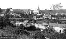
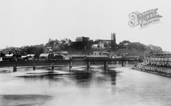
This picture shows the old road bridge, which was washed away in disastrous floods in the 1920s; the railway bridge is to its left.
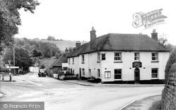
Hill, which is 534 feet high.The Norman church of St Mary was rebuilt in 1849, with a timber bell turret and a shingled spire.THis photograph shows the old coaching inn on the Emsworth to Harting road
The bridge in our photograph is the Greyhound Road Bridge; it replaced the very first bridge, the medieval Old Bridge, which led directly to Bridge Hill and China Lane, which was only 8ft wide.
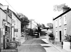
Car drivers using the shop, post box or phone (on the left) must have caused an obstruction on this narrow part of the main road, and since this photograph was taken, the house on the right was demolished
On the stony Stanton Road, Domesday Scepecote (meaning 'shelter for sheep') was home to the powerful Bassett family.
The road has not changed, and the route into the Market Place is still the same; however, as in most of these photographs, the telegraph poles have long since gone.
This is still Main Road.
Revesby is an estate village, and the Estate Office on is the nearby A153 main road. The village was laid out in the 1850s around a huge green.
There has been change here, with development on both sides of the road, though the white building in the centre and the terrace of houses remain.
Best Outfitters are in the three-storey building, beyond which the Lily Hotel projects towards the road, with Colmer's Hill being the distinctive hilltop (centre).
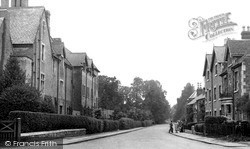
This view looks north along Woodcote Road towards the railway bridge. The station is on the left, but is concealed by the distant shops.
Parked on the road further up the street is a Mini estate, which was first sold in 1960.
Whitehall is on the extreme left of this photograph, taken at this junction of Park Lane and The Broadway; the widening of the Malden Road has yet to take place.
Boys used to arrive on the railway located down Old Station Road behind the photographer. The village shop seen here dates from 1856.
This long and irregular village stands on either side of a switchback rise in the otherwise dead-straight Roman road that comprises this section of the A229.
The track on the right descends from the Dorchester Road, near the junction with Lee Lane, and that to the left heads for St Andrew's Well.
Places (26)
Photos (14329)
Memories (11058)
Books (5)
Maps (476)


