Places
19 places found.
Those places high-lighted have photos. All locations may have maps, books and memories.
- Hill of Mountblairy, Grampian
- Hill of Banchory, Grampian
- Hill of Fearn, Highlands
- Rocky Hill, Isles of Scilly
- Hill of Beath, Fife (near Dunfermline)
- Hill of Drip, Central Scotland
- Hunny Hill, Isle of Wight
- Quarr Hill, Isle of Wight
- Quine's Hill, Isle of Man
- Kite Hill, Isle of Wight
- Broom Hill, Avon
- Merry Hill, West Midlands
- Rose Hill, Derbyshire
- Cinder Hill, West Midlands
- Barton Hill, Avon
- Spring Hill, West Midlands
- Golden Hill, Avon
- West Hill, Yorkshire
- Oak Hill, Staffordshire
Photos
2 photos found. Showing results 1,261 to 2.
Maps
4,410 maps found.


Books
3 books found. Showing results 1,513 to 3.
Memories
3,576 memories found. Showing results 631 to 640.
Edward Road Balsall Heath
my maiden name was Pamela gillett and I lived at 53 Edward Road Balsall Heath during the 40 50s our house was right opposite the Police Station and ARP yard. Have happy memories of Tindall Street school and then ...Read more
A memory of Birmingham in 1950 by
Dogdyke County Primary School
Being born in 1957 I attended Dogdyke County Primary school from 1962 whilst living with parents in Witham Drive, Chapel Hill. We used to walk or cycle to school in those days. Shortly after then we moved to ...Read more
A memory of Dogdyke in 1962
Rememberinggraysandrookhalldellroad
I wasn't born in Grays. In fact had a very disrupted childhood due to my father initially being in the army. However I spent one week at Quarry Hill Primary school at the end of the school year before moving to ...Read more
A memory of Grays in 1953 by
Memories Of Aberkenfig
I think this was in the mid fifties. We lived at 15 Dunraven Street and at the top of the street there was quite a steep hill (it's all closed off now) and at the top of the hill was an entrance to the Forestry Commision ...Read more
A memory of Aberkenfig by
Fort Street (1950s)
Fort Street, in North Motherwell, was a very close-knit community in the 1950's, which is why I still remember the following names: Mr and Mrs Darroch lived at number 21 with their children John, Denise and Keith. Mr Bill Rae, ...Read more
A memory of Motherwell by
We're My Roots Lay
I was born in Kelstern 1954, the house I was born in my gran and grandads was next door to the school, sorry to say neither of these exist today, but times move on as they say. My grandparents were Bert and Margery Vickers. My ...Read more
A memory of Kelstern by
Salford "Its My History"
Salford forms much of my family’s history, although I only spent a little time there, leaving when I was very young, some years ago I started to wonder how? why? what? brought both my families the HARRIS family on my Dad’s side ...Read more
A memory of Salford by
1973 Demolition Year For The Market Buildings
I arrived in Wolverhampton when demolition of the market buildings was under way. The buildings in front of the church (in the photo) must have already been long gone, but the buildings on the side ...Read more
A memory of Wolverhampton
The Awakening
On the right of the photograph the second shop belonged to Arthur Sansom, the Newsagents and Confectioners. It has a sign board above the shop front: PICTURE POST. In the Easter holidays of 1959 at the age of 14½, I took my first ...Read more
A memory of Locksbottom
Wood Green In The War Years
Does anyone remember the fire station on Bounds Green RD ?? well that is where I lived from 1939 to 1948..#8 Firemens Flats. My father was a fireman and drove a huge Leyland Merriweather shining brass engine... There ...Read more
A memory of Wood Green by
Captions
1,749 captions found. Showing results 1,513 to 1,536.

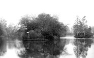
Bodinnick is a tiny village built on a steep hill on one side of Pont Creek, an estuary of the Fowey River. From here the ferryboats would take the passengers across the fast-flowing river to Fowey.

We move to the third of our three rivers, and go high into the hills to find Colne Water. The area used to be known as Marsden.

The parish church of All Saints is unusually wide, with a tiny tower and high arched windows.
Bodinnick is a tiny village built on a steep hill on one side of Pont Creek, an estuary of the Fowey River. From here the ferryboats would take the passengers across the fast-flowing river to Fowey.

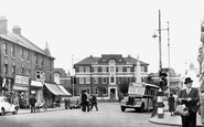
This marvellously detailed view of the High Street before it was transformed into a pedestrian precinct was taken from the first floor of the Cock Hotel.

A mile or so south of Quorn, the camera looks north towards the weir, with Hawcliff Hill and Buddon Wood to the left.

The parish church of St Michael is one of the most interesting in the Lake District.

The pub occupies a picturesque setting on the crown of the hill, and is named after the leader of the Peasants' Revolt of 1381.

Three Bronze Age stone circles on Bodmin Moor are called the Hurlers, set amongst the old tin mines. They stand in line, and are all over 100 feet in diameter.
Three Bronze Age stone circles on Bodmin Moor are called the Hurlers, set amongst the old tin mines. They stand in line, and are all over 100 feet in diameter.

In the middle ground, in front of the church nestling below the humped hills, carriages in the siding await an engine.

Pleasington Priory, a Roman Catholic church dedicated to St Mary and John the Baptist and built in 1819, is set on a hill on Pleasington Lane, close to the River Dunsop and Witton Park, Blackburn.

Beyond the bridge is Back Hill Steps. Behind the cottages near the steps is a large three-storey house with gables.

Epsom is famous for two things: Epsom Salts, and the two great classic flat races run on the Downs south of the town, the Derby and the Oaks, both inaugurated in the late 18th century.

Back in Surrey, the route reaches Haslemere; we look south-west along the High Street into the market place of this small town, with the 1814 Town Hall closing the vista.

Silbury Hill, near Marlborough, is the largest man-made mound in Europe. It was once thought (justifiably at that time) to be a large burial mound for an important Bronze Age chieftain.

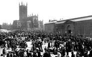
This event, staged on a hot June day, marked the acquisition of the sixty acres of Colley Hill, overlooking the town, by the National Trust after a lengthy fund-raising campaign to gather the £5000 needed

The fact that is was possible to park on the side of the hill without a problem makes this photograph one to be treasured. The building on the left is K Block, with F Block on the right.

The reasoning behind the construction of the Dudley and Stourbridge Canals was for the transportation of coal from pits around Dudley to the glass works at Stourbridge, and for the export of coals

Another of the small iron-working hamlets in the valley of the Tilling Bourne, Friday Street probably derives its name from the Scandinavian goddess Frigga; it still enjoys its peaceful setting above a

Situated six miles south-east of Mold, Caergwrle is a small castle comprising the ruins of three round towers and a polygonal turret; it was captured and destroyed in 1282.

Sudbury, on the River Stour, was once an important cloth town, and has always had a popular market. Market Hill is lined with elegant Georgian buildings, with St Peter's Church at the top.

Freebrough Hill, located on the edge of Moorsholm on the A171 Guisborough- to-Whitby moor road, is steeped in legend.

Most of the region's towns have fine buildings and churches paid for by the wool trade that flourished in these parts.
Places (19)
Photos (2)
Memories (3576)
Books (3)
Maps (4410)

