Places
36 places found.
Those places high-lighted have photos. All locations may have maps, books and memories.
- Shanklin, Isle of Wight
- Ventnor, Isle of Wight
- Ryde, Isle of Wight
- Cowes, Isle of Wight
- Sandown, Isle of Wight
- Port of Ness, Western Isles
- London, Greater London
- Cambridge, Cambridgeshire
- Dublin, Republic of Ireland
- Killarney, Republic of Ireland
- Douglas, Isle of Man
- Plymouth, Devon
- Newport, Isle of Wight
- Southwold, Suffolk
- Bristol, Avon
- Lowestoft, Suffolk
- Cromer, Norfolk
- Edinburgh, Lothian
- Maldon, Essex
- Clacton-On-Sea, Essex
- Norwich, Norfolk
- Felixstowe, Suffolk
- Hitchin, Hertfordshire
- Stevenage, Hertfordshire
- Colchester, Essex
- Nottingham, Nottinghamshire
- Bedford, Bedfordshire
- Bury St Edmunds, Suffolk
- Aldeburgh, Suffolk
- St Albans, Hertfordshire
- Hunstanton, Norfolk
- Chelmsford, Essex
- Bishop's Stortford, Hertfordshire
- Peterborough, Cambridgeshire
- Brentwood, Essex
- Glengarriff, Republic of Ireland
Photos
11,144 photos found. Showing results 14,101 to 11,144.
Maps
181,031 maps found.
Books
442 books found. Showing results 16,921 to 16,944.
Memories
29,040 memories found. Showing results 7,051 to 7,060.
From 1950 To 1955 At Riversleigh Staith St Bubwith
When I was five years old , Mum Dad and me moved to Bubwith in to a house by the Derwent called Riversleigh. My memories are many and varied from the five years I lived there. The house opposite ...Read more
A memory of Bubwith in 1950 by
In The Footsteps Of Dead Poets.
Just out of Trumpington, on the road to Grantchester, was the entrance to an area known as Byron’s Pool, named after Lord Byron who apparently frequented the area whilst at Cambridge University. Probably hoping ...Read more
A memory of Grantchester in 1956 by
The Perfect Holiday
In the late 1950s we had a couple of holidays in Bracklesham bay, which was then a tiny, but growing village. I had never seen shops which were the equivalent of wooden shacks mounted on bricks. There were some modern ...Read more
A memory of Bracklesham Bay in 1959 by
Childhood Years
Many hours were spent playing on the hills around this area. In the centre of the picture is a mound, we called it the Tump, it was the excavation from the cutting and it was made into a feature with three seats or benches for walkers to enjoy a rest and admire the views over Herefordshire.
A memory of Great Malvern in 1960 by
The Dingle
I lived in Colwyn Bay as a child and have fond memories of The Dingle. It seemed like a magical place to a young child. Over the brook, which runs through The Dingle, there was a little bridge which led to a fortune teller's ...Read more
A memory of Colwyn Bay by
Pearks
Pearks was one of the first supermarkets in Wolverthampton to start trading. I worked there in 1962. My name was Marain Beech, I went on to marry a former work colleague, Chris Rutter. Cheese was cut up on the premises, and so wa ...Read more
A memory of Wolverhampton in 1960 by
Urbanites Invade
Hi Guys and Gals, We moved to 19, Long Street in about 1967. Being townies from the new estate I suppose we were resented by the original villagers. Being a kid, I don't remember feeling this. We lived opposite the ...Read more
A memory of Wheaton Aston in 1967 by
Childhood Memories
My father was born in Marlow and mother had already made 2 very good friends before she met and married him. As a result we as children (I was the eldest of 6) found it a wonderful haven to be welcomed at their home on countless ...Read more
A memory of Marlow in 1930 by
Making Our Own Entertainment
Across from The Angler Retreat in Cricket field Lane is the river Coln. Down the lane on your left you pass the West Drayton Cricket Club with the river on your right. Next to the cricket field is The Coln Park ...Read more
A memory of West Drayton in 1952 by
Shopping In Barking
I was born in 1947, so anyone that reads this of that era can relate to the great shopping and Barking people. You could never walk through the shops without seeing a friend or neighbour and through a child's eyes everything ...Read more
A memory of Barking in 1950 by
Your search returned a large number of results. Please try to refine your search further.
Captions
29,395 captions found. Showing results 16,921 to 16,944.
Great Easton stands on a rise above the River Chelmer, which is here little more than a stream.
Hedingham's dominant feature, the enormous castle keep, looms behind these cottages just to the right, out of picture. Bones were recently unearthed in a garden at Pye Corner.
The High Street runs along the east side of the market place.
The fascia of the pub seen in this view has now been altered, and other changes here include the addition of a roundabout.
Bartholomew Street, on the southern side of the town centre, was originally called West Street. This general view shows the street about 40 years ago.
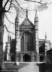
The magnificent west front of Winchester Cathedral is seen here from its former burial ground. The beautifully-decorated Winchester Bible can be seen in the Cathedral Library.
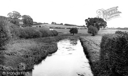
The Bere Stream, seen looking eastwards from Southbrook Bridge, towards Bedford and Jesty's watercress beds with a glimpse of Woodbury Hill (top left).
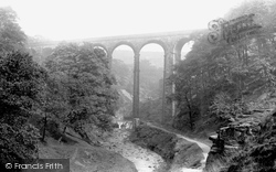
This viaduct was constructed of local stone in 1867 for the Lancashire & Yorkshire Railway Company; the line opened in 1870 and closed in the 1960s.
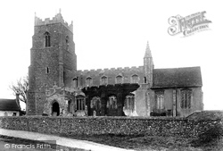
The church of St Lawrence has twin rood-stair turrets – these are usually found in much larger churches, such as St Mary's, Bury St Edmunds. The south porch dates from 1466.
The first part of Newtown was built as workers` cottages for the employees of the ironworks, and the other section was for workers in the brick works.
The view has survived the two world wars that changed our way of life forever. Could it be that the lack of change in this view brings with it all that we desire in village life?
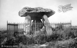
To the west of the A229 is Kent's most famous Neolithic burial chamber. The capstone measures 13 feet by 9 feet, and the earthen mound, which covered the stones, was 170 feet long.
The house on the right with the gate was called Inwood House after the several generations of the Inwood family who came from nearby Neatham.
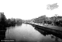
We are looking towards Ouse Bridge with South Esplanade on the right.The view has remained virtually the same, except for the difference in the river traffic and a change of use for some of the
We are looking towards Ouse Bridge with South Esplanade on the right.The view has remained virtually the same, except for the difference in the river traffic and a change of use for some of the
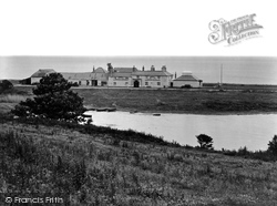
This area has always been of danger to shipping.
Pooley Hall was built by Thomas Cockayne between 1506 and 1509 on the site of a much older house.
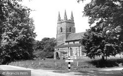
In a picturesque setting of mature trees and a grassy churchyard, the building is in the main of the 14th century, apart from its two-bay 13th- century nave arcade.
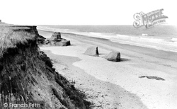
At the end of 1943, the whole area was requisitioned by the military, and US forces practised the D-Day landings.
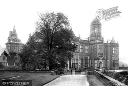
With parts thought to date from 1469, when the original hall was built by Piers Warburton, the present building largely dates from the 1830s and 1840s, and is considered an important example of the Victorian-Jacobean
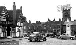
Sandbach's Square is the scene, each May, of an Elizabethan market held to commemorate the original market charter presented to the town in the 1500s.
The mill house survives just out of picture to the right, but of the mill there is virtually no trace.
This photograph shows Pier Gap prior to the building of the 'Venetian Bridge'.
This scene remains virtually unchanged today, but it has been cut off from the High Street by an ugly ring road.
Places (6814)
Photos (11144)
Memories (29040)
Books (442)
Maps (181031)


