

Places
36 places found.
Those places high-lighted have photos. All locations may have maps, books and memories.
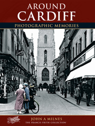
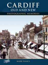
- Cardiff, South Glamorgan
- Barry, South Glamorgan
- Penarth, South Glamorgan
- Rhoose, South Glamorgan
- St Athan, South Glamorgan
- Cowbridge, South Glamorgan
- South Molton, Devon
- Llantwit Major, South Glamorgan
- Chipping Sodbury, Avon
- South Chingford, Greater London
- South Shields, Tyne and Wear
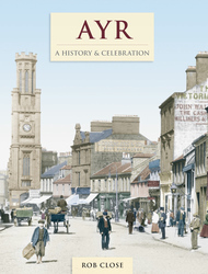
- Ayr, Strathclyde
- St Donat's, South Glamorgan
- Llanblethian, South Glamorgan
- Thornbury, Avon
- Llandough, South Glamorgan
- Fonmon, South Glamorgan
- St Nicholas, South Glamorgan
- Jarrow, Tyne and Wear
- Penmark, South Glamorgan
- Font-y-gary, South Glamorgan
- Maybole, Strathclyde
- Yate, Avon
- Oxford, Oxfordshire
- Torquay, Devon
- Newquay, Cornwall
- Salisbury, Wiltshire
- Bournemouth, Dorset
- St Ives, Cornwall
- Falmouth, Cornwall
- Guildford, Surrey
- Bath, Avon
- Looe, Cornwall
- Reigate, Surrey
- Minehead, Somerset
- Bude, Cornwall
Photos
5,607 photos found. Showing results 1 to 20.


Maps
2,499 maps found.


Books
23 books found. Showing results 1 to 23.

Memories
1,580 memories found. Showing results 1 to 10.
I Lived In Hampstead Norris From 1945 To 1962
I lived in Hampstead Norris as it was known in those days from 1945 to 1962 when I departed for greener pastures(I thought). I have had this longing for a while now to get in touch with people I ...Read more
A memory of Hampstead Norreys in 1960 by
So Many Happy Hours
I spent so many happy summer holidays in Great Barton, and in particular Conyers Green where my Aunt Norah Lovelace lived in a cottage next to the old chapel building. I cycled often to the village store/post office, and to ...Read more
A memory of Conyer's Green by
Wartime Evacuation In 1944
I was placed in an orphanage on 13th October 1943 together with my elder brother Brian. My father had died on the infamous Siam (Thailand) Railway as a forced labour navvy. He was a regular soldier and had already been ...Read more
A memory of Tairgwaith in 1944 by
The Creasey Family At Worth, West Sussex
My great-grandmother's family were farmers in Worth, and nearby Copthorne and Charlwood in the mid-nineteenth century. Great-grandma was Eliza Creasey and she married great-grandad George Allen in the chapel at ...Read more
A memory of Worth in 1860 by
Visiting The Isle Of Man Railway
Two of my friends i(Bob and Tony) n our Manchester University Hall of Residence were both train buffs and motorcyclists so one early summer weekend in 1967 we rode our bikes on a Friday evening down the "East Lancs ...Read more
A memory of Douglas in 1967 by
The Creasey Family Of Felbridge And East Grinstead
In the nineteenth century my Creasey family were tenant farmers at Gibbshaven Farm near Felbridge. Many of the family lived their entire lives in the area and the church was where they were ...Read more
A memory of Felbridge in 1870 by
Lost Times
My memories are of Okenden in the early days, my father was born there and was from a family of 11 children, he was called Arthur Oakley, he lived there when the local bobby walked the streets pushing his pushbike, and if he did any ...Read more
A memory of South Ockendon in 1959 by
Staverton Elizabethan Fayre
The Staverton Playing Fields were the location for the Elizabethan Fayre on August Bank Holiday Monday. Lots of entertainment was arranged including a jazz band, the Babelfish Ceilidh Band, Dog Racing, Punch and Judy, ...Read more
A memory of Staverton in 2008 by
The Waltham Abbey Choir And Other Memories
My family lived in Waltham Abbey from 1955 to 1961 and living there left a lasting impression on me. I attended Waltham Holy Cross County Primary School during this time and at the ripe old age of 8 ...Read more
A memory of Waltham Abbey in 1960 by
The Steel Houses
Having lived in Brymbo in a very damp two up two down house in 'The Green' my parents were 'over the moon' to be given a new three bedroomed house; 23, Bryn Hedd, Southsea, (which means peaceful hill) became their home for ...Read more
A memory of Southsea in 1950 by
Captions
2,476 captions found. Showing results 1 to 24.

Moving south-west, the tour reaches East Harting, a hamlet east of South Harting, the main village with the parish church.

Moving south-west, the tour reaches East Harting, a hamlet east of South Harting, the main village with the parish church.

Already falling into disrepair in Victorian times, thatched cottages on the east side of South Street, beside South Bridge, would soon succumb to the front-line of urbanisation.

Moving south to the Cuckmere River valley, our tour reaches Upper Dicker, about two and a half miles west of Hailsham.

Altrincham is situated only 8 miles south-south-west of Manchester, and its popularity as a residential area for business people grew with the opening of the Manchester South Junction & Altrincham Railway

This view looks south down the hill to the village. The churchyard is on the right, and the wooded ridge of the spur south of Dursley flows across the horizon.

The south transept south window is later Perpendicular, and so is the top of the tower and the two-storey south porch, which has fleurons below the battlements.

The south door of the church is visible and the extent of the cemetery easier to see. There are allotments traversed by a path from South View to the fields and Lyddington in the south.

The south aisle was Abbot Thokey's dream. Imagine a place so beautifully decorated that words cannot describe it.

Coal mining in South Wales has declined still further since this photograph was taken.

Situated to the south east of St Hildas's Church, South Crescent and Albion Terrace were built in the early Victorian period.

William 'Duke' Sutton was landlord of the Black Bull when he opened his bathing hut at South Hawes near what is now the junction of Duke Street and Lord Street.

This view, from the famous High and Over viewpoint on the South Downs, shows the big meanders and flat valley floor of the only undeveloped river-mouth in the south-east.

An angel has appeared from a former house in the south chapel; the pulpit is dated 1628, and has blank arches and arabesque decoration; the back panel upper half has caryatids and the tester has strapwork
A charming view of Glynn, a little Irish village about a mile to the south of Larne, on the western edge of Larne Lough. Just to the south of the village are the ruins of the old church.

The Baptistry extends and projects to the south at the west end like a porch, and has two rounded angle buttresses with solid pinnacles.

A view of the south porch that Morwent lovingly erected. Note the rich lace-like carving, 'saracenic work'. The porch bonds well with Abbot Thokey's decorated south aisle within.

A bustling view along South Street, which was built in 1850 and originally called New Road. It connects the town centre with the railway, and runs south from the Borough towards the River Wey.

Another general view, this time of the tranquil Usk as it wends its way down towards the Severn estuary south of Newport, Gwent. The Usk rises south-west of Trecastle in Powys.

South Road is the main route used for through traffic, which is why we can see a petrol tanker (centre left) going though the shopping area.

This Victorian photograph depicts the view to the south of Storrington, looking towards the downland. The famous South Downs Way long-distance trail runs along the top.
This view looks south down the hill to the village. The churchyard is on the right, and the wooded ridge of the spur south of Dursley flows across the horizon.

Still close to the Yorkshire county boundary and south- west of Harworth, Oldcotes village is situated at the crossroads of the A634 and A60; Main Street runs east from the A60 Doncaster Road

The lozenge-shaped washroom windows can be seen (centre, 72159) on the south side of Old Quad.
Places (15471)
Photos (5607)
Memories (1580)
Books (23)
Maps (2499)

