Places
36 places found.
Those places high-lighted have photos. All locations may have maps, books and memories.
- Bangor, County Down
- Newcastle, County Down
- Greyabbey, County Down
- Donaghadee, County Down
- Downpatrick, County Down
- Portaferry, County Down
- Dromore, County Down
- Downings, Republic of Ireland
- Hillsborough, County Down
- Killyleagh, County Down
- Ardglass, County Down
- Rostrevor, County Down
- Dundrum, County Down
- Newtownards, County Down
- Warrenpoint, County Down
- Ballygowan, County Down
- Ballywalter, County Down
- Ballyward, County Down
- Bishops Court, County Down
- Boardmills, County Down
- Culcavy, County Down
- Katesbridge, County Down
- Killough, County Down
- Millisle, County Down
- Portavogie, County Down
- Saul, County Down
- Seaforde, County Down
- The Diamond, County Down
- Audleystown, County Down
- Kearney, County Down
- Annaclone, County Down
- Ballyhalbert, County Down
- Ballymartin, County Down
- Clare, County Down
- Conlig, County Down
- Dollingstown, County Down
Photos
1,089 photos found. Showing results 561 to 580.
Maps
459 maps found.
Books
47 books found. Showing results 673 to 696.
Memories
8,147 memories found. Showing results 281 to 290.
Edgecoombe, Selsdon 1957 61
I remember Selsdon well as my family lived at 68 Edgecoombe, the long road on the opposite side of the wood at Selsdon not to be confused with Selsdon Woods. We had two ways to get to Selsdon shops. Through the woods ...Read more
A memory of Selsdon by
Stubbington 1955 1960
I arrived accompanied by my father in 1955 not really knowing what to expect as I had been born and brought up in Jersey, which in those days was rather different to the mainland. My father, uncle and grandfather had all ...Read more
A memory of Stubbington by
The Blue Cap Hotel
My Grandparents Jack and Edna Williams ran The Blue Cap Hotel in Sandiway during my youth and my fondest memories are there, of Rooms 6 and 7, which would be allocated to my sister and I during our stays. There were garages out ...Read more
A memory of Sandiway in 1964 by
A Search For Ancestors
I’ve just visited Buttermere to look at the little church where my ancestors (Annetts and Cummins families) would have attended during the Victorian era. A quaint little church set in the valley down a bridle way. ...Read more
A memory of Buttermere by
Sarc Florence Road And More
Woolston seems to have played quite a big part in the history of our family, so it's appropriate I guess that as an adult I have ended up living here with my Husband!! It started as far back as my great great great ...Read more
A memory of Woolston by
First Love
I met my husband, who was my first boyfriend, at Walsall and Staffs Technical College in 1970, we would often go into the George for a drink at lunchtimes. It holds special memories for us both, still together after 33 years of marriage, and we were horrified when they pulled it down.
A memory of Walsall in 1970 by
Stranger In A Foreign Land
Hello, I am just a a visitor to Coseley I came in the late 1980’s and stayed here ever since. I went to the Coseley Secondary School during that time and loved every moment. Yeah, as always there were some disputes along the ...Read more
A memory of Coseley by
Plymstock Memories Late 1950s
Having moved out of Plymouth, and awaiting a new build house off Dunstone Road, I lived for a while at my grandparent's house on Dean Hill whilst attending Goosewell Infants. At that time Dean Hill was a tranquil leafy ...Read more
A memory of Plymstock
High Wycombe 1956 On
I was born in the Shrubbery Nursing home in 1956. I grew up in Lane End, about 5 miles away. I have photos of me looking awful in baggy knickers on the Rye (the park in Wycombe town) as a toddler. There was a play area on ...Read more
A memory of High Wycombe by
Hatch End Shops In The 1960''s
I lived in Hatch End from 1956 until I went up to Manchester in 1966, so I got to know my local shops both as a helpful schoolboy running errands for my mum to MacPhails the greengrocer and later as a teenager buying ...Read more
A memory of Hatch End in 1960 by
Captions
2,258 captions found. Showing results 673 to 696.
Milborne Port lies east of the Dorset town of Sherborne.
Looking down the lane, towards Cannock Chase, note the railway bridge which carried the line between Colwich junction and Macclesfield.
is standing in Church Street.The early markets were held in this area of the town.The White Lion Hotel on the right is still there today, and so is W D Cunliffe the grocers and bakers.Three doors down
People first settled here at the foot of the North Downs because of the fresh water springs emerging from where the chalk meets a band of clay.
In this relatively unspoilt village the buildings are of various materials, including brick, flint, clunch (chalk) and sandstone, which reflects its location on the border between the South Downs and the
The inscription described her as a 'rat catcher who has lodged in many a town and travelled far and near. By age and death she is struck down to her last lodging here.'
This road makes its way down to a bridge over the River Colne, from which this village also takes its name.
The timbers in the Abbot's House, as this building is known, have recently been dated - the trees were cut down in 1457.
We are looking down the Main Street of the charmingly-named hamlet of Appletreewick in Wharfedale, with the prominent 1,550ft fell of Simon's Seat in the background.
This smart terrace of houses stands just down the hill from picture No 32349, on the western approach to the town.
We are looking down this attractive street to the St Thomas and Newport part of Launceston, where the old church tower is just visible.
Chalton Down Mill was a brick tower windmill located on a remote hill top overlooking the main London to Portsmouth road. It was powered by four patent shuttered sails and winded by a fantail.
Their great house was pulled down in the 1930s, and only a few tombs in the parish church are there to remind us of how powerful this local family once were.
With numbers of worshippers falling dramatically, and the prospect of the inner relief road being built, it was knocked down in 1980: a sadly short life for such a wonderful building, as this interior
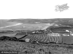
This view is taken from Saunton Down over the popular holiday beach at Croyde. In the field below, the wheat is harvested and placed in stooks to dry. This was before combine harvesters were used.
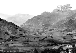
This expansive view down the valley of Great Langdale shows Harrison Stickle (2,403ft) and Gimmer Crag prominent on the skyline.
Since the 18th century, substantial houses have been built with gardens leading down to the river, alongside the main road which runs parallel to but out of sight of the river.
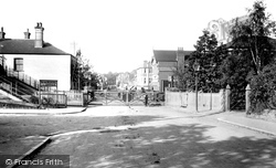
We are in Heathcote Road, looking down the High Street, with the grounds of the Staff College visible in the background.
The Wye frames the town centre, running in a loop around the western and southern sides.
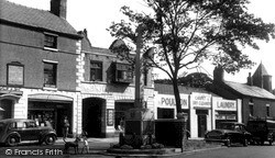
Poulton Laundry has gone, and the Methodist church (far right) has been pulled down—the new church is on Queensway.
The Old Etchingham Arms in the centre of the photograph had to be rebuilt in the 1900s after its predecessor burnt down.
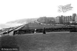
The town climbs increasingly steeply away from the sea to the west of the Wish Tower, with an expansive green- sward, known as the Western Lawns, between the much lower promenade and the buildings fronting
The Co-op (left) now houses a fish and chip shop, and the small garage (right) just down from the Fox pub has gone, to be replaced by modern shops.
A little further down is F Ward the boot maker's shop.
Places (198)
Photos (1089)
Memories (8147)
Books (47)
Maps (459)


