Places
36 places found.
Those places high-lighted have photos. All locations may have maps, books and memories.
- Bangor, County Down
- Newcastle, County Down
- Greyabbey, County Down
- Donaghadee, County Down
- Downpatrick, County Down
- Portaferry, County Down
- Dromore, County Down
- Hillsborough, County Down
- Downings, Republic of Ireland
- Killyleagh, County Down
- Ardglass, County Down
- Rostrevor, County Down
- Dundrum, County Down
- Newtownards, County Down
- Warrenpoint, County Down
- Ballygowan, County Down
- Ballywalter, County Down
- Ballyward, County Down
- Bishops Court, County Down
- Boardmills, County Down
- Culcavy, County Down
- Katesbridge, County Down
- Killough, County Down
- Millisle, County Down
- Portavogie, County Down
- Saul, County Down
- Seaforde, County Down
- The Diamond, County Down
- Audleystown, County Down
- Kearney, County Down
- Annaclone, County Down
- Ballyhalbert, County Down
- Ballymartin, County Down
- Clare, County Down
- Conlig, County Down
- Dollingstown, County Down
Photos
945 photos found. Showing results 1,201 to 945.
Maps
459 maps found.
Books
49 books found. Showing results 1,441 to 1,464.
Memories
8,169 memories found. Showing results 601 to 610.
Year Of The Appendix
During that summer my family made a trip to stay at Mount Edgcumbe for a fortnight or so, my mum being a distant relative of the occupying family, so to speak. On the journey down the A.38, (no M5 then), I ...Read more
A memory of Mount Edgcumbe Country Park in 1961 by
Happy Days
My sister and I used to visit our grandparents, Harry and Lily Bliss, who lived on Sandringham Drive, West Monkseaton. We would come down from Scotland in late June and stay for two weeks. Favourite memories include the Spanish ...Read more
A memory of North Shields in 1958 by
School And Before
I lived in Holly Street, North Kilbowie, I was born there 1949. My gran and grampa moved into 1 Holly Street in 1939 before the Second World War. The stories they knew about the blitz were funny as well as tragic. I lost my ...Read more
A memory of Clydebank in 1954 by
Growing Ou In Galley Common
Growing up in Galley Common was the best part of my life. Dad was the manager of the bus depot, Bunty Motors I think it was called, at the bottom of Hickman Road, I lived at 66 Hickman Road. In the summer a lot of ...Read more
A memory of Galley Common in 1959 by
Holmcroft Street
My father was born and raised on Holmscroft Street. He left in 1950. I have been and know that his segment of Holmscroft Street has been torn down. Does anyone know if this school was anywhere near Holmscroft Street? Does it still exist?
A memory of Greenock in 1940
First School
I was six when this photo was taken. We lived in a tiny flat in Curzon Street, basically one room, and I went to school at Fintragh, a tiny private school in two rooms part way down the high street, opposite the Post Office. This ...Read more
A memory of Calne in 1950 by
Welsh Girl From Six Bells
Born in Abergavenny in Dec/ 1951. Brought home to my Nanna's house who we lived with in 1 Lancaster Street where my family lived. Dad worked down the six bells pit at the time, and I have fond memories while I was ...Read more
A memory of Six Bells in 1958 by
Carrog Memory, As A Ww2 Evacuee.
I first visited Carrog in 1939 as an evacuee, at the start of World War 2. I was accompanied by my two sisters, having travelled by train from Birkenhead on the Wirral. All the evacuees were escorted to the Church ...Read more
A memory of Carrog in 1940 by
My Youth
I was born at Springend near Horbury in 1948, lived at 40 Northfield Lane, Horbury emigrated to Australia in 1961. I remember the Library, spent hours there reading the famous five books and secret seven, still do. Whites fish and chip ...Read more
A memory of Horbury in 1950 by
County Oak And Tushmore Sports And Social Club
Tushmore Lane and either side of the main A23 had properties forming the catchment area for club members, also another general store and petrol station. County Oak boasted a recreation ground ...Read more
A memory of Crawley in 1953 by
Captions
2,258 captions found. Showing results 1,441 to 1,464.
Down the street lies the aptly-named Locomotive pub.
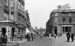
As we move further down the main street, no less than three hotels are now in view: the Queen's peering round the corner (centre left), the impressive White Lion and the more humble Royal
Bridge Street curves down to the river. A variety of architecture is to be enjoyed here, from red brick houses to timber-framed cottages.
The van (right) is driving down Fanhams' Hall Lane from Ware, and may be about to turn left past Appleton Farm and Baker's End.
Although old coaching inns like the Fountain would have lost a certain amount of long-distance business with the development of the railways, they were still used as the pick-up and set-down points for
There was direct access between the hall and the Chamberlain Tower, as well as steps leading down to a postern opening towards the Seiont.
In fact these huge blocks slithered down the sides of the hills after the last ice age, and have sometimes been mis- taken for resting sheep.
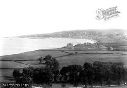
The view is southwards across Swanage Bay to Peveril Point (centre left) and Peveril Downs (central skyline) on the other side of the town.
It was designed by James Wilding, a Liverpool man who was associated with a number of buildings in the town and who also played an important part in the development of Runcorn Hill as a park once the
It may have been created in 1740, when two overhanging stones fell down the hill, making the houses in the Hough shake, and, according to legend, squashing an old woman and her cow.
A splendid panoramic view, taken early in the year, of the Stour Valley looking across to the Julliberrie Downs, with the 14th-century tower of Chartham church rising above the trees.
This is the view south down the High Street from outside Beech Hurst, which is off to the left.
The growth of Cardiff's docks was to some extent a symptom of their own success. There was simply too much coal coming down the valleys from Merthyr for the wharves to cope with.
There was at one time another line down to Rawtenstall, joining what is now the East Lancashire Preserved Railway. As well as having three railway lines, the town also had three turnpike roads.
A butcher's delivery boy can be seen cycling down the road, more of the shop fronts are covered by awnings, and a uniformed policeman can be seen on the right.
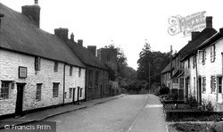
Down the street stands Welton's church, dedicated to St Martin and distinguished by its square 14th-century tower. Inside is an ancient tub-shaped font, said to be Saxon.
From there, the Kennet & Avon Canal plunges down the extraordinary flight of 29 locks at Caen Hill to the valley below.
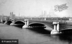
The halfpenny toll on the original Blackfriars Bridge caused riots, and in 1780 angry protesters burned down the toll-house.After a succession of expensive repairs a replacement was suggested, and
With no smoky tunnels, Queen Victoria's favourite railway line was just like 'going down the Nile'.
We are looking down the street in the opposite direction to photograph B672001, with the Forge Hammer now on the right.
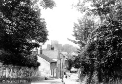
Race Hill was once the main road into Launceston from the south; it leads down to the South Gate, which is the last remnant of the old town walls.
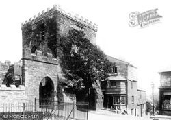
Southgate is the only surviving gate of the three that used to give access to the old walled town.
Down the lane to the left, on the other side of the castle green, is Northgate and Doomsdale, the prison which included among its inmates the Catholic martyr St Cuthbert Mayne, the Quaker George Fox, and
Southgate is the only surviving gate of the three that used to give access to the old walled town.
Places (198)
Photos (945)
Memories (8169)
Books (49)
Maps (459)

