Search the Archive
Explore all the places you remember!
Subscribe
Join the thousands who receive our regular doses of warming nostalgia! Have our latest blog posts and archive news delivered directly to your inbox. Absolutely free. Unsubscribe anytime.
Recent Blog Features

Country Life
A fascinating selection of images documenting the record of rural life and social and economic change in Britain’s countryside over the last 150 years. (read)


Say Hello!
How to keep in touch with us.Maps In Focus - Part 1
Published on May 17th, 2016
The Francis Frith Collection website isn't just about photographs! For many years we have also been home to historic maps, both Ordnance Survey maps drawn between 1840 and 1930, and illustrated Victorian maps of traditional counties of England and Wales.
In a series of upcoming Blog Posts we will be taking a closer look at Frith historical Ordnance Survey maps; explaining why and how they were drawn and published, features you will see that may seem unfamiliar and how to interpret them.
We hope you enjoy taking a journey back in time and tracing the richly-textured history and heritage of your locality.
It all began in 1791
In 1791 the Board of Ordnance established a body to survey Britain; the first 1-inch map, which showed Kent, was produced in 1801. The other counties of the United Kingdom followed. These first-edition maps were updated as the Victorian age progressed; new roads and railways were added, and major new buildings such as factories, gas and water works marked. It is from these enhanced 6-inch maps that the Frith Ordnance Survey maps have been created.
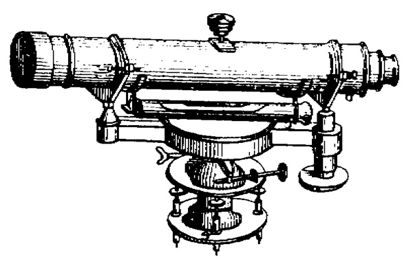
In the days when these maps were drawn the process was very time consuming and expensive so new mapping was only completed every 20 or 30 years. This means maps are unfortunately not available for specific years.
Digitally "stitched together"
The original maps were published in numbered sheets and of course some locations happen to be in the middle of a sheet whilst others could be right on the edge of a sheet. Now, by digitally “stitching” together all the sheets that comprise England & Wales, we can offer you a map with any location at the centre, regardless of where it appeared on the original sheets.
The original Victorian Ordnance Survey Maps from which these reproductions have been created are mapped at 1:10,560 scale, equivalent to 6 inches to one mile. however, the Frith reproductions have been printed at a slightly enlarged 1:9,000-size, to maximise the amount of visual detail. in general they are the first edition maps; however, where the quality or availability is poor, a later edition may be substituted.
Maps drawn "for the public good"
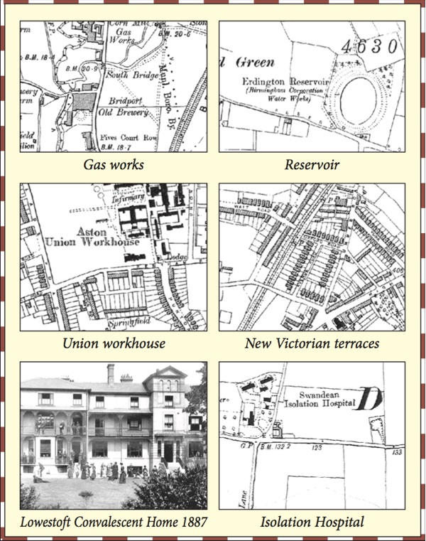
Your own house, if it was built at the time, will probably be marked by cross hatching, with your garden enclosed by a line. in the towns the relentless march of Victorian development into the countryside can be traced by the straight grids of new streets piercing the surrounding fields. On the map these new communities may appear to us congested and claustrophobic, but these neat little terraces, each house with its own yard or garden, must have seemed like paradise to poor Victorian families, accustomed to the smoke and filth of inner city congestion.
There are other signs of community growth and the harkening back to country life: allotments are sometimes marked on the maps. Here the men would gather to dig their strips and cultivate prize vegetables and flowers, and mull over the issues of the day.
Help and aid for the poor grew slowly during Victorian times. Up until the 1860s families had to rely on their own guile and resources to get them through poverty and ill health. But the Victorians finally realised that a decent water supply and efficient sewage services were of primary importance to public health, and you will find that waterworks, sewage pits and gasworks are proudly marked on many maps. Hospitals and infirmaries for the sick and infirm, fever and isolation hospitals, and sanatoria for those who were suffering from consumption (tuberculosis – a common complaint until the early 20th century) sprang up, together with orphanages and almshouses; most of these latter were founded by charitable trusts or benevolent local worthies. If all else failed, there was always the universally hated union Workhouse - these are almost always marked on the Ordnance maps.
Interested in seeing an historic Ordnance Survey map of your area? Simply search for a town to begin. We hope these short notes will help you to get the most out of your own historical Ordnance Survey Map, and that you will enjoy investigating and examining the changes that have taken place to street layouts, housing, fields, town and village boundaries around your house!
Next time: Why the Ordnance Survey maps were so important to Victorian travellers.
Subscribe
Join the thousands who receive our regular doses of warming nostalgia! Have our latest blog posts and archive news delivered directly to your inbox. Absolutely free. Unsubscribe anytime.