Places
36 places found.
Those places high-lighted have photos. All locations may have maps, books and memories.
- Pentre-cwrt, Dyfed
- Pentre Halkyn, Clwyd
- Pentre, Mid Glamorgan
- Ton Pentre, Mid Glamorgan
- Pentre, Powys (near Llangynog)
- Pentre, Powys (near Guilsfield)
- Pentre, Powys (near Bishop's Castle)
- Pentre, Dyfed (near Pontyates)
- Pentre, Powys (near Newtown)
- Pentre, Clwyd (near Mold)
- Pentre, Clwyd (near Ruabon)
- Pentre, Shropshire (near Chirk)
- Pentre, Clwyd (near Hawarden)
- Pentre, Clwyd (near Chirk)
- Pentre, Clwyd (near Ruthin)
- Pentre, Clwyd (near Mold)
- Pentre, Shropshire (near Oswestry)
- Pentre, Powys (near Welshpool)
- Pentre, Clwyd (near Mold)
- Pentre, Shropshire (near Forton)
- Pentre Broughton, Clwyd
- Pentre Gwynfryn, Gwynedd
- Pentre Maelor, Clwyd
- Pentre-clawdd, Shropshire
- Pentre Galar, Dyfed
- Pentre Llifior, Powys
- Pentre-cefn, Shropshire
- Pentre-Gwenlais, Dyfed
- Pentre-Poeth, Dyfed
- Burntwood Pentre, Clwyd
- Pentre Berw, Gwynedd
- Pentre Hodre, Shropshire
- Pentre Llanrhaeadr, Clwyd
- Pentre-celyn, Clwyd
- Pentre Cilgwyn, Clwyd
- Pentre Morgan, Dyfed
Photos
98 photos found. Showing results 2,041 to 98.
Maps
316 maps found.
Books
2 books found. Showing results 2,449 to 2.
Memories
1,253 memories found. Showing results 1,021 to 1,030.
Bryn Dinarth
I used to come for days out as a child to Lloc with my dear late grandmother. We used to visit an old friend who lived at a house called Bryn Dinarth. Her name was Ada Christie. Her house was situated next door to Little Timbers Garden ...Read more
A memory of Lloc
William Bernard Taylor Family Farm Before They Emigrated To Australia In 1853
SUDBURY 591/0/10020 GREAT WALDINGFIELD 21-NOV-05 HOLE FARM II House. Formerly a mid-C15 service building remodelled as a house in c.1600; later C17 extension to ...Read more
A memory of Sudbury in 1860 by
Memories Never Fade Only Names To People's Faces
I have many memories of Kingsbury. I was born in Kingsbury in 1955 and lived in Dorchester Way which backed onto the side of the then fire station. I attended St Bernadette's school off the Kenton ...Read more
A memory of Kingsbury in 1960 by
The Governor's House
I lived in part of the Governor's house in 1973. The back of the house extended to where the car park access ramp is now, before the shopping centre was built. In the cellar were bread ovens and a bricked up tunnel ...Read more
A memory of Newark-on-Trent in 1973 by
A House In Gidea Park.
I was born in Carlton Road in 1937. Got bombed out when a landmine dropped down the road and we were evacuated to Clacton while my Dad worked down the Underground tunnel when his factory and the machines were moved away ...Read more
A memory of Gidea Park by
Place Of Birth
I was born at 5 Bowen Terrace, Sept 42. My best friend's dad Mr Lewis was an engine driver on the trains at Brecon Station which was opposite our house. I used to ride on the footplate while he was shunting around the goods yard. I ...Read more
A memory of Brecon in 1942 by

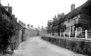
This Is Now Lower Street, Haslemere
This picture shows Lower Street, looking towards Haslemere town centre. The building on the right (covered in ivy) in the foreground is The Good Intent pub.
A memory of Haslemere by
Schools In Bulwell 1964 To 1974
Born in Bulwell in 1959. I remember initially going to Cantrall Road school which was really nice. I remember Mrs Hare the headmistress, Mr Anderson and Mr Richy. I liked the latter but not Mr Anderson as he wiped ...Read more
A memory of Bulwell in 1964 by
Odeon Cinema, Hornchurch Road
This is the Odeon cinema on the way to the swimming pool (now the sports centre). Used to go there and watch one film through twice just for fun.
A memory of Hornchurch in 1965 by
Captions
3,593 captions found. Showing results 2,449 to 2,472.

At the junction of the A12 and B1177 (centre right) is an advertisement for the Spread Eagle Hotel, kept by George Zessel, whose father had the White Hart at Wickham Market.

The quaint old clock tower with the fire station in its base, which stood at the foot of Gravel Hill, was an early casualty of the town planners' ruthless remodelling of the town centre.

St Michael's stands on the east side of Melton Road in the centre of the village.

To the centre left is Squirrell's seed and corn merchants, now a housing development.

Delamere, originally called 'foresta de la mare', is a very scattered community with no real village centre.

The tower of St Luke's Church rises just beyond (centre) – local legend states that a yew tree in the churchyard was used to make archers' bows in the Hundred Years War.

The tower of Holy Trinity church is just visible above two fields in the centre of town, and terraced houses along Bodmin Road and the Workhouse can be seen towards the left of the picture

Now it has been adapted by Oakham School as the Art and Design Centre.

There is a glimpse of the Great House - visited by the earl of Chatham with 15-year-old William Pitt the Younger - before Star Supply Stores and the Royal Lion Hotel (centre).

The Nottingham Co-operative Society (centre) is no longer on the left of the High Street - the building is now a pet shop, and the Co-op has moved to a more modern building across the street.

The higher part of Kilburn village, including the parish church of St Mary (which we can see in the background, centre) clusters around its large village green.

We are looking north, with the White Swan on the left and tall trees near the church in the centre. The grass in the foreground would soon bear a 1914-18 war memorial.

Local businesses have now been joined by Fine Fare (centre) and, extreme right, Walter Willson's.

Among the many old buildings in this stretch of the High Street is the Tudor brick Eastgate House, seen on the right, and now the Charles Dickens Centre.

Stanwoods (centre right) is the former Chantry House of the Gurteen family, great employers and benefactors in the town. The 1950s Boots (left) is on the site of the Anchor Temperance Coffee Tavern.

The market is dominated by the castle (centre right), which was built by Henry II between 1165 and 1173. The scaffolding shows that it is under repair by the Ministry of Works.

To the right is a destroyer of the Reserve Fleet; in the centre is the Naval Dry Dock; and to the left is the Harwich to Hook of Holland ferry.

The 35ft statue of Queen Victoria, designed by the architect J S Gibson and the sculptor H C Fehr, dominated the centre of the new city square following its unveiling by the Prince of Wales on 12 May
St Michael's stands on the east side of Melton Road in the centre of the village.

proportion of medieval and Tudor timber-framed houses; it is even more astonishing that the market infill between Middle Row and the High Street survived traffic imperatives.This view looks west to the town centre

The memorial, with its scrolls commemorating the dead of two world wars, has now been cleaned and moved to a site of even greater prominence in the newly refurbished town centre.

A commemorative plaque, visible on the ivy-clad gable end (centre left), has survived.

Centre left stands the Bear Hotel, a lovely old coaching inn dating back to 1432. The shop next door to it sold fishing tackle - fishing is one of the area's most popular pastimes.

In the distance is a corn-grinding post mill (centre left), possibly owned at this time by a Mr Mallett, whose worry was that the building of houses nearby would keep the wind from the mill's sails
Places (57)
Photos (98)
Memories (1253)
Books (2)
Maps (316)

