Places
18 places found.
Those places high-lighted have photos. All locations may have maps, books and memories.
- Hythe, Kent
- Hythe, Hampshire
- Small Hythe, Kent
- Bablock Hythe, Oxfordshire
- Methwold Hythe, Norfolk
- Hythe, Somerset
- Hythe, Surrey
- Hythe End, Berkshire
- The Hythe, Essex
- Egham Hythe, Surrey
- West Hythe, Kent
- New Hythe, Kent
- Broad Street, Kent (near Hythe)
- Horn Street, Kent (near Hythe)
- Newbarn, Kent (near Hythe)
- Newington, Kent (near Hythe)
- Broad Street, Kent (near Hythe)
- Stone Hill, Kent (near Hythe)
Photos
360 photos found. Showing results 2,481 to 360.
Maps
101 maps found.
Books
10 books found. Showing results 2,977 to 10.
Memories
4,406 memories found. Showing results 1,241 to 1,250.
Paper Trail
Lundhill is a steep hill that leads into Royston, where the Monkton coking plant lies. Just at the side of Lundhill was Monkton Row, it was to be demolished in the 1980s. But before then a big flat bed lorry failed to take the corner ...Read more
A memory of Barnsley by
Carter''s Cafe
I am glad Mr Johnson has happy memories of Carter's Cafe. My father and mother, ran this for many years and I remember Mrs Johnson well. My father, and three more Carter generations were all Bradford market people. The other three ...Read more
A memory of Bradford by
Growing Up In The 70s
I was born and brought up in Thingwall Drive, right on the boundary of Irby and opposite the entrance to the golf course. I went to Irby CP School, Coombe Road, and then onto Calday Grange Grammar School. My Granny lived just ...Read more
A memory of Irby in 1976 by
50s 60s Memories
I was born at 13 Alma Place (up the small alley from Argent Street) in 1952, moving to number 6 when I was 5. When I was 9 we moved to Sherfield Road, where I lived until 1970 when we finally moved to Shipston-on-Stour, ...Read more
A memory of Grays by
Growing Up In Pudsey
Dont live in Pudsey any more but was born and brought up there. I lived on Laurel Mount off Richardshaw Lane. across from Farsley omnibus depot. I think there is an office block there now. There used to be Harold's ...Read more
A memory of Pudsey in 1959 by
High Street At Redhill
As a 16 year old, I was a boarder from Cartagena de Indias, Colombia at Saint Joseph's Convent, 122 Ladbroke Road. With me there were around 25 girls ranging from the ages of 4 to 17 years old and at least from 10 different ...Read more
A memory of Redhill in 1966 by
Wonderful Childhood
I lived in Crib-y-mor with my grandmother, Emily Roberts, and my mother Patricia Jones (both originally Williamson). I lived opposite Tom Roberts and at an early age developed my own system of visiting everyone. First I ...Read more
A memory of Llanbedrog in 1959 by
The Bentons Of Springfield
By the 1900's the Benton family owned the Post Office, a cycle shop and were the local Blacksmiths. Would like some information on whether the Plough and the surrounding area is still there.
A memory of Springfield by
Two Dales
Lived further down the road in the village, the semi-detached house on the left. The first was occupied by the Bowlers, newsagents, next door the Waterfall Bros. I helped at the farm to the right for a bit of pocket money. The ...Read more
A memory of Two Dales in 1960 by
Reading In The 60's
I was born in Caversham, Reading. I used to go to a riding school at Sonning Common, owned by Rosemary Drayton and remember the riding school and farm at Bugs Bottom owned by Frank Stokes. I loved the ice cream sold at The ...Read more
A memory of Reading in 1968 by
Captions
4,899 captions found. Showing results 2,977 to 3,000.
They were, of course, designed to make life easier when using transport of the four-legged variety; although by the time this photograph was taken, the motor car was beginning to make its presence
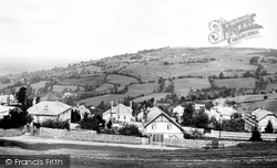
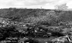
The deep troughs around the summit are caused by slippage of the scarp face, caused by the undermining of the oolitic limestone structure by water pressure.
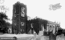
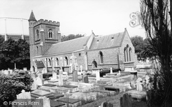
These three similar shots of St Michael's span half a century, but only in 1955 do we notice the restricted area of the burial ground around the church by the appearance of a substantial brick wall.
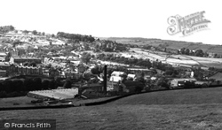
This view of the village on the hill from Hebden Road is dominated by the two big mills, the Ivy Bank Mills on the left and Bridgehouse Mill in the foreground.
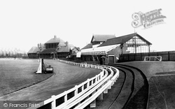
Originally a part of the Cardigan Fields estate, Headingley was put on the market in 1888 and purchased by the Leeds cricket and football clubs in January 1889.
In May 1900, during the Boer War, Mafeking in South Africa was relieved after being defended by the future Boy Scout founder Robert Baden-Powell for 215 days.
Today sunny weather still brings people flocking to this area of the city by the riverside, although the people pictured here would probably be shocked to see the state of undress that is now considered
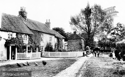
In this picturesque of a long-vanished world, chickens are foraging for food and children playing by the pond.
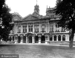
The 'new' University College building which opened in October 1909 was the fruition of ten years' concerted fundraising aided by the Corporation's gift of five acres of building land.
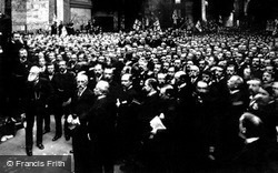
The original Book Of Remembrance containing the names of 35,000 fallen is now overshadowed by the death tolls of conflicts unimaginable to those at its original presentation.
The Church of the Holy Saviour was built between 1876 and 1880 with money raised by the Phipps family, who had been connected to the woollen industry since the 17th century.
By the church stands a statue of Robert Peel, notable because his waistcoat is buttoned the wrong way.
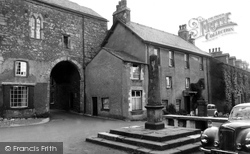
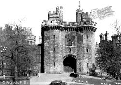
At the centre of the village is the ancient market cross and priory gatehouse, now owned by the National Trust.
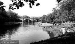
Well before it became a favourite bathing and picnic spot, the Lune's beauties at Caton were extolled by the poets Wordsworth and Gray, and Turner came to paint the scene.
Thought to have been built as a garden summerhouse and now restored by the Landmark Trust, its plaster decoration depicts the Muses.
Bell, Old Church Street has survived for three hundred years; its bar is in the passageway.The Junction, High Street has one very big room, an island bar, and some fixtures and fittings supplied by the
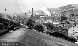
The view shows a typical West Yorkshire industrial landscape of mills; these ones were originally powered by the fast-flowing streams of Colden Clough.
Now bypassed by the A616, Stocksbridge has been 'cleaned up'; it no longer has the constant pall of smoke hanging over it, as it did when this photograph was taken.
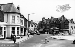
This well-ordered scene is typical of the high quality ambience of the suburb as a whole, and well anticipated by the Midland Bank with its impressive, yet restrained, neo-classical frontage, exactly as
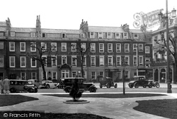
In the foreground is the then newly-laid-out area replacing the Royal Literary and Scientific Institution, now all paved and occupied by the water fountain of 1839 relocated from Bath Street.
To his right is the Free Church, built in 1863 by the owner of a nearby flour mill.
The ornate clock tower and gateway were added in 1874 to designs by the famous pier designer Eugenius Birch. Both the entrance and the tower were demolished in 1928.
The spire of St Mary's church soars above the town, and to the right is the boundary wall of Petworth Park, the great mansion built by the Duke of Somerset towards the end of the 17th century.
Such prosperity did not last, and Colyford had declined by the 18th century. It remains a village of beautiful cottages on the high road between Exeter and Dorchester.
Places (18)
Photos (360)
Memories (4406)
Books (10)
Maps (101)

