Places
26 places found.
Those places high-lighted have photos. All locations may have maps, books and memories.
- Cemmaes Road, Powys
- Six Road Ends, County Down
- Road Weedon, Northamptonshire
- Severn Road Bridge, Gloucestershire
- Roade, Northamptonshire
- Berkeley Road, Gloucestershire
- Harling Road, Norfolk
- Road Green, Devon
- Builth Road, Powys
- Cross Roads, Yorkshire
- Steele Road, Borders
- Cross Roads, Devon
- Four Roads, Dyfed
- Road Green, Norfolk
- Biggar Road, Strathclyde
- Clarbeston Road, Dyfed
- Five Roads, Dyfed
- Eccles Road, Norfolk
- Grampound Road, Cornwall
- Morchard Road, Devon
- Wood Road, Greater Manchester
- Four Roads, Isle of Man
- St Columb Road, Cornwall
- Clipiau, Gwynedd (near Cemmaes Road)
- New Road Side, Yorkshire (near Silsden)
- New Road Side, Yorkshire (near Cleckheaton)
Photos
14,329 photos found. Showing results 3,401 to 3,420.
Maps
476 maps found.
Books
5 books found. Showing results 4,081 to 5.
Memories
11,058 memories found. Showing results 1,701 to 1,710.
The Berth
Hi, I was born in 10 Horner Street, in 1941, parents were Idris and Olive, one sister Pat, lived in England for a while. Came back to Wales in 1953, worked in Hestons rubber factory for about a year then the nylon spinners at ...Read more
A memory of Tir-y-berth in 1941 by
Pontypool
My family lived in The Globe in Crane Street from 1973 until I guess 1980, although I had left in 1979, John and Kitty, ran a fab pub which was always very busy with many customers working in the council and police station. The pub was ...Read more
A memory of Talywain in 1978 by
Barkingside In The 1960s
I remember growing up in Barkingside in the 1960s, going to the State cinema on Saturday mornings, the trolly buses that ran along the high road, Green & Dyson groceries where my mum worked, Fairlop School 1961-66. ...Read more
A memory of Barkingside in 1860 by
St Marys
Just an up-date to my previous memory. I wonder if anybody remembers St Mary's Church just down the road from Valence Wood Road. I was a choirboy there for a numbers of years in the late forties - early fifties. I was married there on Oct 1st. 1955. Alan Gammans
A memory of Dagenham in 1955 by
R & H Law
My Grandfather, Harry Dewhurst, was a partner/owner (I am not sure of the exact commercial position) of R & H Law (Main Street, Grange-over-Sands) in the 1950s. I remember R & H Law having all all four shop fronts as per ...Read more
A memory of Grange-Over-Sands in 1960 by
Living Opposite The Catholic Church In Somerton
I lived opposite the Catholic church from 1949 untill 1970 when I joined the army. I was friends then with Bridget Cox and Eileen White. We went to Sunday school at the Congregational church for ...Read more
A memory of Somerton in 1960 by
Station Road, Nantymoel
My husband and I decided to visit Nantymoel after trying to do some family tree research. We knew my husband's grandfather Dr Melbourne Thomas was born there and we knew where on Station Road he'd lived with his dad ...Read more
A memory of Nant-y-moel
Childhood Memories
As a family we would holiday in Weymourth every year from about 1958-1963. We used to stay in a bed and breakfast owned by a Mrs Walkadine. As I was so young my memories revolve around the wonderful beach, the donkeys and egg ...Read more
A memory of Weymouth
Webbs Brewery Six Bells Colliery
I grew up in Aberbeeg as Pat Howells. Everyone knew the Howells as my dad, Doug, was one of 8 children. My uncle worked in the brewery for many years and I grew up in Woodland Terrace and had to pass the brewery ...Read more
A memory of Aberbeeg by
St Lo
A place on Westcliff Road, Broadstairs, during the early sixties, named St Lo. Used as a skating rink, and as a dance rock n roll club, on Tuesdays and Saturdays. Anyone having any descriptive memories, of this St Lo, social hall - rock ...Read more
A memory of Broadstairs in 1960
Your search returned a large number of results. Please try to refine your search further.
Captions
5,036 captions found. Showing results 4,081 to 4,104.
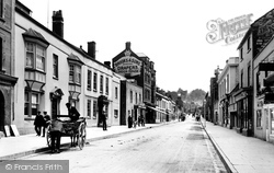
On the near side of the road, a farm cart carries a churn of milk.
We are now further along Leigh Road and looking back towards the station. Trees planted c1900 are now mature, and more modern lighting has been installed.
Leading north off Warwick Road, Frog Lane is one of most attractive lanes in the village, albeit now interspersed with modern houses of the 1960s onwards.
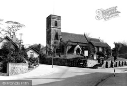
Seen here from the Swithland Road, the church, which is faced in slate from the local quarries, was designed in 1836 by William Railton (1801- 77), a Gothic Revivalist and architect to the Ecclesiastical
Seen here from the Swithland Road, the church, which is faced in slate from the local quarries, was designed in 1836 by William Railton (1801- 77), a Gothic Revivalist and architect to the Ecclesiastical
Later the growth of the commercial road vehicle industry was to deal a killer blow to them both.
A branch line soon followed, and Eastbourne station opened in 1849, but Polegate grew, and until it was by-passed recently it was something of a bottleneck on the Bexhill Road, the A27.
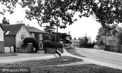
The road widens to form Posey Green, with the 1930s Horseshoe Inn on the right out of camera shot; it is a rambling mix of local sandstone and timber-framing with a huge horseshoe-
Wakefield Road, centre, leads down to Kinsley and Fitzwilliam, two former mining communities. Kinsley was the centre of conflict in 1905 when a strike led to the eviction of 100 pit families.
A straight and wide road leading to the quay creates an impression of past importance.The Romans, the Saxons and the Vikings used the area for invasion.
Towards the southern end of London Road, the 'tip-up' cart is parked waiting for its horse to be harnessed, whilst a milk cart (left) winds slowly up the hill towards the Congregational church close to
Up the hill towards one of Chalfont St Peter's commons, Gold Hill, Tudor-style shops and flats were built on the north side of the road in 1922, called Market Place and decked out with fake
In 1899 a fund was launched for the building of a permanent building on the site, and within six years, the iron church was moved on rollers to the opposite side of the road and the construction of this
The road is still rather narrow and congested, but the scene has changed quite considerably in the intervening years, with many of the buildings being demolished, replaced or altered.
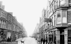
B G Davies, 'Solicitor and Notary', have their offices on the corner, with the Cash Clothing Co and Newman's the chemist further down the road.
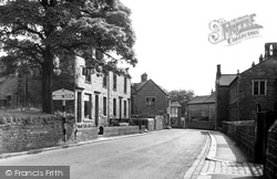
The sign tells us that Gisburn Road leads to Clitheroe, hub of the Pendle Forest area. Stone walls, finials, setts, dripstones and lintels characterise Chatburn and the neighbouring villages.
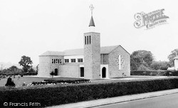
In 1922 the Vincentian Spanish fathers acquired a plot of land at Hillside in Barnet Road to provide a training facility for young priests to foreign missions.
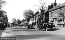
This view gives a clear example of the impact commercial motor traffic had on the Great North Road, prior to the building of the M1 motorway.
Since 1909, Brooks and Sons and the house to its left have been demolished, and the Arches Way road formed. To the right, the finial belongs to The Avalon Club of 1897.
Still on the green, the camera points south to Steventon Road, the south lane from the High Street, already in 1955 closed to traffic.
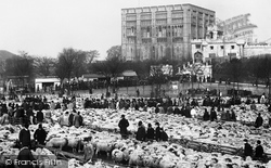
Huge sheep markets were held in the market place, and the farmers and buyers refreshed themselves in the Woolpack, a convenient public house across the road from the castle.
The local council has already made a start on digging up the road and footpaths.
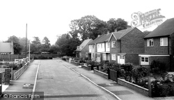
Looking south past the junction with Queens Road, the houses are little changed, apart from being fitted with ubiquitous plastic windows (apart from No 10 on the corner).
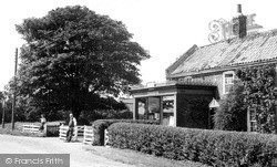
Trusthorpe Post Office is on the road to Thorpe, and is in a late Victorian projection from the left bay of a late 18th-century small farmhouse.
Places (26)
Photos (14329)
Memories (11058)
Books (5)
Maps (476)


