Places
7 places found.
Those places high-lighted have photos. All locations may have maps, books and memories.
Photos
297 photos found. Showing results 341 to 297.
Maps
28 maps found.
Books
Sorry, no books were found that related to your search.
Memories
357 memories found. Showing results 171 to 180.
Lower Street And Up To The Village From Dover
I believe this is called Lower Street and behind us is Dover Road, and a turn to the east to Northbourne and Deal or a walk to the cricket ground at Updown. Behind, to the left, is Buttsole Pond where ...Read more
A memory of Eastry by
Sense Of History
There is a sense of history by walking along Church Street with its deep guttering, for the times when and where horses were the transport and along to the Church, the Palace Of Eastry, Eastry Court and then Eastry farm and the C. ...Read more
A memory of Eastry by
Leaving School
So! Back to 11 Woburn Place, back to school on Hope Chapel Hill back to Hotwells golden mile with its 15 pubs. The War was still going on but there was only limited bombing and some daylight raids, the city was in a dreadful ...Read more
A memory of Bristol in 1945 by
Part 20
Granddad, Mathew Wilson (known to everyone as Matty,) was one of the older brothers, but just too young for the Great War. He sold wet fish from a cart, everyone there gave their takings to Margaret, and until they left home she ...Read more
A memory of Middle Rainton in 1945 by
Fond Childhood Memories
I remember back in the late 50's, as kids, we used to swim at the Woodlands camp swimming pool. We lived at East Hill and used to either walk or cycle to the pool. I remember we then used to play in the club house. We ...Read more
A memory of Knatts Valley in 1958 by
Barking And St Margaret's Church From 1970's
My husband and I were married at St Margaret's Church in January 1970, we were married by the REV ROXBOUGH, he was a very gentle man and he and his wife moved to Devon in the 80s or there abouts. We ...Read more
A memory of Barking in 1970
On The Corner Of August Lane And Ride Lane
When I was a child, my family stayed in the house then called "Fresh Field" on the corner of August Lane and Ride Lane (we were in the UK on 6 months home leave from the Far East where I grew up). ...Read more
A memory of Farley Green in 1967
Is This My Mum
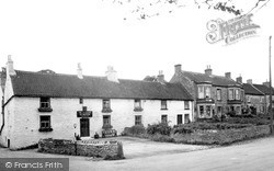
I was born in East Harlsey in 1958 and spent 19 years living there. The photo on this site I believe is my mum, Mrs Lorna Whittaker, stood outside our family home next to the Methodist Chapel. I loved going to the village ...Read more
A memory of East Harlsey by
The Friend I Never Knew
I hope this doesn´t distress anyone - that is not my intention, but does anyone recall the name of the young boy from east view who shot himself ? The reason I ask is, that for many years I lived and played there and hung ...Read more
A memory of Bargoed in 1976 by
1955 1959
During those years, my father was in the US Air Force stationed at Wethersfield. We lived in Coggeshall on East Street. With the advent of Google Earth I can still walk down familiar streets in Coggeshall from Texas. I see some ...Read more
A memory of Coggeshall by
Captions
445 captions found. Showing results 409 to 432.
Parallel to Stratford Road and to the south of it is one of the grid of streets that were laid out for the town from the 1840s, starting at the east and then expanding westward as land was released
The camera looks east down the High Street, which opens onto Church Gate and Derby Road. Kegworth's origins lay in its medieval weekly market and annual fair.
Byworth is a very pretty village with a single winding street a mile east of Petworth; it is set on hilly ground above a small stream flowing in a steep valley towards the Rother.
By now, the High Street was crammed with houses: all the plots had been filled.
Classes (confined to the arts faculty) were originally conducted in the cathedral crypt, but within two years had moved to a separate building on the east side of the High Street.
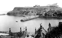
The donkeys have a long walk every day from their field just below the Abbey House, down the donkey path, along Church Street, over the bridge and down Pier Road to the sands.
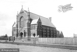
The three earlier chapels were all in the High Street, the first opening in 1837. As the picture shows, there were few other buildings near this chapel in 1891.
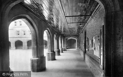
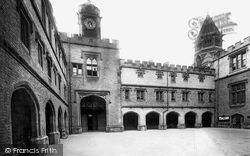
Cloisters with studies above run to the south and east of Old Quad, with a tall arch forming the entrance to the School House dining hall at the south-eastern corner.
Cloisters with studies above run to the south and east of Old Quad, with a tall arch forming the entrance to the School House dining hall at the south-eastern corner.
The project grew through the enthusiasm of Graham Stansfield, the Borough's arts & entertainments officer, who brought in funding from South East Arts as well as commercial sponsorship.
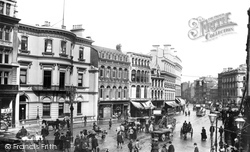
The 114 cars and 1,000 horses were the property of the Belfast Street Tramway Company. The company was now ready to bring in electric trams, and had an act of parliament approving the work.
Copper mining in the 18th century brought an influx of workers into this quiet spot just to the east of Scotch Corner on the Roman Watling Street.
Boudicca, or, as she used to be known, 'Boadicea', queen of the Iceni and daughter of King Prasutagus, ruled much of what is now East Anglia and rose in revolt after being flogged and her daughters
This is the east end of the chancel and side chapels of the parish church of St Michael the Archangel. These walls date from 1505, but the building becomes older as it rises to the west.
This is where the old pack horse trail to Accrington and the east crossed the River Blakewater in a shallow ford.
accents become more East Anglian than Estuarine. Much of the county is still largely agricultural. Along the rivers and the shoreline, there are still miles of sparsely-inhabited wilderness.
Then at the end of the 19th century there came a period of great change for south-east Essex.
ST ANDREW'S Parish Church is situated in Church Street, opposite the site of the original School House.
To reach our final village, Pilton, we must leave our straight route at East Pennard and travel almost due north for a couple of miles or so.
Beyond New Street, Hobbs and Sons built their range of five-gabled boathouses with upper floor balconies, which became prime sites for viewing the Regatta.
The Coming of the Railway The railway line from Fenchurch Street opened in the 1850s.
The Dock Link Road is planned to go from Spalding Road to Skirbeck Road via the dock, with a bridge over the Haven at the south end of High Street.
They formed a hotel company which, for £900, bought from Peter Bruff the street block to the east of the pier.
The Westgate Centre, the Eastgate Shopping Centre, and the high street shops in East Walk, Southernhay, and the Town Square give a comprehensive shopping experience, and of course there is the
Places (7)
Photos (297)
Memories (357)
Books (0)
Maps (28)

