Merry Christmas & Happy New Year!
Christmas Deliveries: If you placed an order on or before midday on Friday 19th December for Christmas delivery it was despatched before the Royal Mail or Parcel Force deadline and therefore should be received in time for Christmas. Orders placed after midday on Friday 19th December will be delivered in the New Year.
Please Note: Our offices and factory are now closed until Monday 5th January when we will be pleased to deal with any queries that have arisen during the holiday period.
During the holiday our Gift Cards may still be ordered for any last minute orders and will be sent automatically by email direct to your recipient - see here: Gift Cards
Places
Sorry, no places were found that related to your search.
Photos
Sorry, no photos were found that related to your search.
Maps
7,034 maps found.
Books
163 books found. Showing results 8,473 to 8,496.
Memories
22,913 memories found. Showing results 3,531 to 3,540.
10 Dalton Square Now Where The Town Hall Is Located
My Great Great Grandmother Jane Oversby worked for a widow, Mrs Margaret Rossall, who lived at 10 Dalton Square, Lancaster. I visited Dalton Square and counted the houses from 2 - 9; then sent down ...Read more
A memory of Lancaster by
1973 Demolition Year For The Market Buildings
I arrived in Wolverhampton when demolition of the market buildings was under way. The buildings in front of the church (in the photo) must have already been long gone, but the buildings on the side ...Read more
A memory of Wolverhampton
The School Of The Holy Child, Laleham Abbey
heads the label in a dictionary of music that I received as a prize in Upper IA. No date. It must have been 1955. My name was/is Margaret Morley. I joined the school on my return from Malaya in 1951, followed ...Read more
A memory of Laleham
A Beautiful Early Childhood In The 50's.
My Dad and Mum moved to what was then 'The old Cottage', Water Lane in 1954-5 from Cornwall. Mum was pregnant and they couldn't get a cottage, so Dad, Ken Johnson, applied to Corfe's Farm to get a tied ...Read more
A memory of West Peckham by
Belgians In Birtley.
Few people are aware of the part Birtley, Tyne Wear, (part of County Durham in those days ) played in the Great War of 1914 - 1918. Belgium in 1914 was occupied by the German Army, and thousands of refugees fled to Britain where ...Read more
A memory of Birtley by
Eastleigh Recreation Ground – Pregnancy Test 1959
I loved to play on the swings, roundabouts and giant slide at Eastleigh recreation ground. The long polished brass slide was fun to try to walk up, slide down roll things down or pee down. I ...Read more
A memory of Eastleigh by
Shops In Upminster
Great site, so,pleased to find it. Lived in Cranham for 15 years and just loved Upminster for shopping, a particular favorite being Roomes. I left the area about 15 years ago and went back to visit a short while ago. Still in ...Read more
A memory of Upminster
Bexley County Technical School For Girls
I attended this school from 1952 -1954 when Miss Collins OBE was Head Mistress. she was very strict but very fair and kind to me having just lost my mother. I seem to remember Miss Odel as the Geography ...Read more
A memory of Bexleyheath by
Parkside. Memories Of The 50's And 60's
My name is Dennis Walsh, I was born in 1953 at 62, Park Side. I lived there until Dec 1965 when we moved to Sydney Australia. My earliest memories are of our house, which backed onto the park. It seemed like a ...Read more
A memory of New Haw by
Eynsford Mill
Further to my other posting, (Swanley, Born and Bred), as a young man I used to work at Eynsford Mill, it was owned by A. Filmer Jacobs, who also owned Shalford Mill, near Guildford, the company was known as Vulcanised Fibre, and they ...Read more
A memory of Eynsford by
Your search returned a large number of results. Please try to refine your search further.
Captions
9,654 captions found. Showing results 8,473 to 8,496.
If we look closely, we will see ladders reaching up to the eaves of The George Hotel, the white building behind the clock tower.
The not unlovely village of Saxelby is situated about a mile north of industrial Asfordby, and on a stream which empties into the River Wreake.
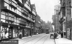
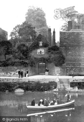
Not a hatless head to be seen as the open-top tram, en route to Frindsbury across the river, passes the lantern and railings of Eastgate House, threatening conflict with horse-drawn traffic.
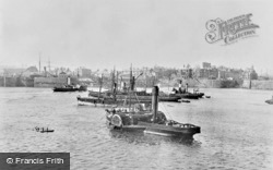
Cardiff Docks were developed during the late 1830s by the 2nd Marquess of Bute, and were enlarged in the 1880s and again in the early 1900s.
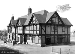
Downhill to the south and across the River Maun, the High Street continues uphill to pass The Dukeries Hotel, now for some reason called Ma Hubbard's Eating House and Hotel.
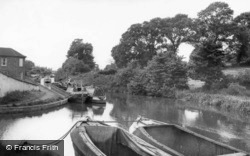
We are looking westwards along the Grand Union Canal on its way to Birmingham, at point where it originally joined the Oxford Canal.
Lickey village is an unremarkable sort of place, but the name is famous among railway buffs because the two-mile Lickey Incline (between Bromsgrove and Barnt Green) is, almost incredibly, the steepest
Market Hill was the hub of the town; here the stocks held felons two at a time until their crimes had been expiated.
In 1700s and 1800s, Barkway lay on the main coach route from London to Cambridge. The Angel Inn (later the Wheatsheaf) served as the main staging post for travellers.
It is time to relax in Marshall Gardens and look over Bridge Foot. To the left, Garlands Garage still has Austin and Wolseley cars for sale, whilst a steamroller rumbles past the Crosville bus stand.
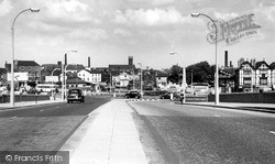
Opened in May 1957 by Alderman Marshall, the flyover bridge replaced the Wilderspool railway crossing, a bottleneck on the main A49 highway.
Until perhaps halfway through the last century the majority of people living in the town (Nick Thomas) A view of St Mary's Grove, opposite the Church.
During the inter-war years the council tried to alleviate the high rate of unemployment and set up a number of public works schemes.
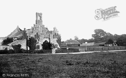
The abbey was founded in 1132 by Baldwin de Redvers, afterwards Lord of the Island and Earl of Devon.
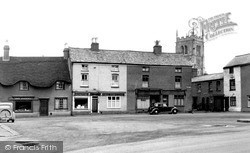
The 15th-century local granite and limestone church tower of St Peter and St Paul, heavily restored in 1872 by P W Ordish, shows above the houses of quality which bound The Green.
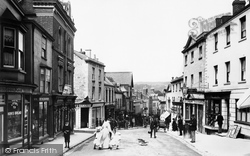
The steep, winding and narrow High Street (down which flaming tar barrels were rolled to the terror of the populace until the practice was banned in 1824) gives an excellent impression of
The ferry originated for the use of monks from the priory, to cross to their farmland on the west bank.
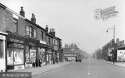
This is a wonderful piece of social history from the 1950s caught on film. Liverpool Road was a long road running from Church Street, Eccles to the airport out at Barton.
Helston Penrose Walk 1913 Penrose Walk runs from the bottom end of Coronation Park down to the Loe and follows its shore to Penrose.
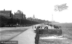
If we look closely at our top photograph, we will see that the turrets and tower of the New Brighton Tower building are missing.
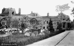
Houses had been built into the central arches of the west front by at least the 1660s. The Norman-style windows to the right date from 1863, when this wing became the Probate Registry Office.
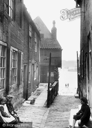
A ghaut (a Viking word) is a narrow passage leading to the river. There used to be an inn at the end of this one, so in the local dialect it became known as T'inn Ghaut.
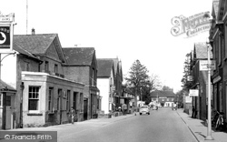
Our last view in this chapter before turning north back to Hailsham shows the Horse and Groom pub at the junction of the High Street and the Eastbourne Road, the A22.
East of Camberley, the route moves on to the villages between Bagshot and Guildford along the A322 on the east side of the sandy heathland of the Bagshot Sands; on the map we see army firing
Places (0)
Photos (0)
Memories (22913)
Books (163)
Maps (7034)

