Merry Christmas & Happy New Year!
Christmas Deliveries: If you placed an order on or before midday on Friday 19th December for Christmas delivery it was despatched before the Royal Mail or Parcel Force deadline and therefore should be received in time for Christmas. Orders placed after midday on Friday 19th December will be delivered in the New Year.
Please Note: Our offices and factory are now closed until Monday 5th January when we will be pleased to deal with any queries that have arisen during the holiday period.
During the holiday our Gift Cards may still be ordered for any last minute orders and will be sent automatically by email direct to your recipient - see here: Gift Cards
Places
Sorry, no places were found that related to your search.
Photos
Sorry, no photos were found that related to your search.
Maps
7,034 maps found.
Books
163 books found. Showing results 9,145 to 9,168.
Memories
22,913 memories found. Showing results 3,811 to 3,820.
Memories
I was born in South Ockendon Cliff Place (Julie Harding) I had 3 sisters Vera, Brenda & Margaret. We are all still living but old age is creeping up. I remember some of the names mentioned. My close friends in Ockendon were ...Read more
A memory of South Ockendon by
Sewer Hill At Back Of Allotments And Corner Shop Near Brampton Primary School
I was born in newham hospital in 1981, and have fond vivid memories of helping my mum whilst pregnant with my Sister go canvassing for the borough council. I used to walk ...Read more
A memory of East Ham by
Watching Granddad Play Bowls
I was only a toddler at the time but my Granddad, who I lived with, used to take me to the park when he was going to play bowls with his friends. I used to sit in my pram and take it all in. This was during the war years.
A memory of Normanton
Brierley Hill Girls Memories
I was born in Chapel Street, in 1947. My uncle, Len Gray, had a newsagents in the town, near the bus stop by the Old Post Office, as was. My Grandad used to sell papers on the Five Ways and as a girl I would stand ...Read more
A memory of Brierley Hill
Leigh Road And Living In Eastleigh
My grandmother lived in a flat in the Eagles building behind Collins the butchers. In the 1951 picture, the girl on the bicycle could easily be me! I would have been 10 then and my coat was a light green with black ...Read more
A memory of Eastleigh by
Good Old Battersea
I was born and bred in Battersea, Firstly we lived in Yelverton road with my Grandparents and I attended Falconbrook School. Then my parents got a Maisonette in Culvert road I then attended Chesterton School. in 1969 I attended ...Read more
A memory of Battersea by
War Time At Auldgirth .
I remember Auldgirth fondly,the school the people realy great times.Ilived at hillend farm it was quite a walk to school,The football park was in one of our fields great times.If any one remembers me Iwould likr to hear from them .Jim Johnstone .
A memory of Auldgirth by
Learned To Swim
Just below the bridge on the ovingham side most of the lads learned to swim and through stones at what we thought was rats now I know they were water voles a much endangered species .Waste from Corbridge and other places flowed ...Read more
A memory of Prudhoe by
The Stickler
Back in the late sixties early seventies my pop group Chris and the Deltics used to practice at The Stickler on Sticker Lane. Pat Lee who i believe was the daughter of the landlord / landlady later ran the group's fan club. Dennis Raynor aka Chris. Would be great to get in touch with Pat.
A memory of Bradford by
Happy Days In Tantobie
Hi My name is Mary Hall I remember living in Ann Cottage and 2 Chapel Street my mother and father was John and Sarah Hall he had a horse and trap. There was a family called Vasey Hall and a family called Middleton I remember a ...Read more
A memory of Tantobie by
Your search returned a large number of results. Please try to refine your search further.
Captions
9,654 captions found. Showing results 9,145 to 9,168.
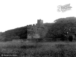
Looking out over Druridge Bay, the rectangular three-storey tower of the late 14th to early 15th centuries takes its name from the Cresswell family.
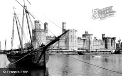
Known today for its massive castle, one of Edward I's chain of fortresses built to subdue the Welsh, this town on the shore of the Menai Strait at the mouth of the River Seiont is now staunchly Welsh-speaking
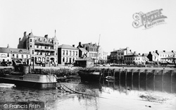
Here we have a range of hotels for those who could afford the comfort. The Grand was almost brand-new, and the Royal was rebuilding.
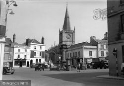
At the corner of the Market Place is the main entrance into St Mary's churchyard, to the left of the church. No 35 Market Place was the King's Head, which is first mentioned in a deed of 1770.
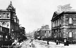
This picture gives us a brief glimpse into the daily life of some of Burnley's people. Notice the woman, right, with the umbrella near the bollard at the top of Saunder Bank.
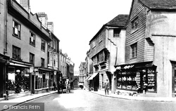
The slate-hung buildings are 11 and 13 High Street, two of the oldest in town.
The vicar of Holy Trinity Church in the mid 19th century was the Rev Edward Lyon Berthon.
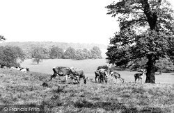
The opening of Woburn Abbey to the general public introduced many to the delights of a rural involvement without the necessity to move home and hearth.
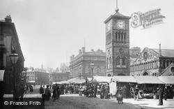
Here we have a busy and bustling view of Northgate. The Town Hall did not need or get a clock, because the Market Hall had the town's clock on a free-standing tower in front of it.
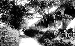
Here we have a grand view of the railway arches heading out of Whalley.
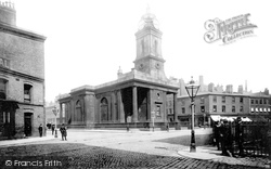
The church's foundation stone was laid on 11 December 1788, and the church was consecrated on 6 September 1795.
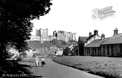
A fortified site since the 6th century, the Norman castle at Bamburgh was besieged in 1095 by William II.
As with so many other towns in the area, it was the Leeds and Liverpool canal which brought about the growth of Burnley, and there is a large piece of that canal history alive and well at the
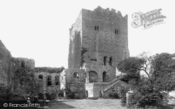
The inner keep is on the right, with holes knocked into its 9ft-thick walls.The smallest Norman keep in England, it last saw action at the end of the Civil War, when Colonel Assheton's forces barricaded
In 1964 this beautiful and historic bridge, built in 1617, finally bent to the increase of traffic and was demolished and replaced with a modern concrete structure.
St Peter's stands in meadows beside the Usk, to the left of the A40 and just beyond the western outskirts of Abergavenny.
Along the banks to the east is the old Spa Baths, now converted to housing. A little to the west of here, near the weir, is the old mill, also now luxury houses.
Parallel to Stratford Road and to the south of it is one of the grid of streets that were laid out for the town from the 1840s, starting at the east and then expanding westward as land was released
Rothley lies some five miles to the north of Leicester, and to the west of the busy A6.
This fine pink granite church, mainly of the 15th century, is well sited at the head of Church Street. Its solid clasping buttressed and battlemented tower rises in four stages.
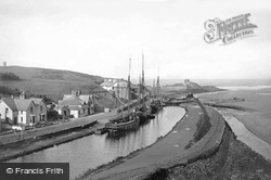
Opened in 1823, the Bude Canal served a large area of north Cornwall. The canal itself extended some 35 miles inland, though by the time this picture was taken much of it had already closed.
Lyme Regis harbour, or the Cobb, was once a seafaring settlement separate from the old town.
The market town of Baldock developed at the junction of a Roman road and the ancient Icknield Way in the mid 1100s.
We now turn left from the High Street into Sheaf Street and look back down the hill to Brook Street. The scene appears very quiet, with only one car and a cyclist to be seen.
Places (0)
Photos (0)
Memories (22913)
Books (163)
Maps (7034)

