Places
20 places found.
Those places high-lighted have photos. All locations may have maps, books and memories.
- Hinkley Point Power Stations, Somerset
- Lyne Station, Borders
- Perranwell Station, Cornwall
- Ferryhill Station, Durham
- Nantyronen Station, Dyfed
- Station Hill, Cumbria
- Station Town, Durham
- Widdrington Station, Northumberland
- Eggesford Station, Devon
- Bedlington Station, Northumberland
- Meopham Station, Kent
- Mintlaw Station, Grampian
- Ratho Station, Lothian
- Uphall Station, Lothian
- Alne Station, Yorkshire
- Hart Station, Cleveland
- Otterham Station, Cornwall
- Udny Station, Grampian
- Balfron Station, Central Scotland
- Ruthwell Station, Dumfries and Galloway
Photos
2,456 photos found. Showing results 1,101 to 1,120.
Maps
73 maps found.
Books
Sorry, no books were found that related to your search.
Memories
3,079 memories found. Showing results 551 to 560.
Plympton Station Holiday Memories
My grandparents, my mother's parents, lived in Vicarage Road, Plympton until 1962 when they moved to Moorland Avenue. As children we always spent our holidays with them and I have early memories of accompanying ...Read more
A memory of Plympton in 1958 by
Station Road
Fond memories of living in Station Road and going to the old Grange Valley Primary School and Haydock Secondary Modern. My grandfather Charlie Blackburn, ran a grocers shop in Station Road and I lived next door. Also remember all the ...Read more
A memory of Haydock by
Childhood Memories We Never Forget
To anyone reading this; I was born Valerie Harding and lived in Wedges Mills and I remember so many things about my childhood in Cannock. The Maypole dancing at John Woods school, attending Church each Thursday ...Read more
A memory of Cannock in 1953 by
School Days
I was a pupil at the Gravesend Technical School for Girls and remember walking along from Pelham Road to have our school lunches at the Boys School, housed in the Technical Institute - sausage and mash and some puddings with custard. ...Read more
A memory of Gravesend in 1948 by
Southdown Bus Station And Clair Meadow
I used to play in the old Clair Meadow and remember the drinks machine which sold pink milk in a wax carton by the tree at the footpath entrance to 'the rec' on Perrymount Road which is still there...I ...Read more
A memory of Haywards Heath in 1969 by
My Young Life Living In Eve Road, West Ham
I can remember my infant years at Napier Road school. I remember when I was in the first year there, we would have a small slice of toasted bread in the afternoons. Then I went to Holbrook School when ...Read more
A memory of West Ham in 1958 by
Living Above The Shops Thornton St North
We moved to Collyhurst (60 Thornton St North) in 1966/67 and I have always considered myself a Collyhurst girl. I absolutely loved it there and used to play on the railway line at the back of the flats. ...Read more
A memory of Collyhurst in 1967 by
Martin Street
I remember S C Cummins quite well, their factory was close to the corner of (I believe) William Street. My grandparents lived at 55 Martin Street for many years and my aunty lived on Earle Street. My uncle lived on William Street and ...Read more
A memory of Crewe in 1970 by
Jellalabad
We lived here for 3 years when my husband was stationed at Tidworth. Nice memories of a very funny old army quarter. I remember locally we army wives called them Coronation Street.
A memory of South Tidworth in 1975
Captions
1,403 captions found. Showing results 1,321 to 1,344.
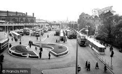
Here we are reminded that before the building of the bus station in Merrywalks, buses waited at several locations in the town.
Its access value lay in the proximity to the main post office and the central police station, both of which were in walking distance via the narrow road on the left.
The centre of Baldock, at the junction of the market place and the Icknield Way, is dominated by the imposing Town Hall and Old Fire Station, opened on 25 November 1897 to commemorate Queen Victoria's
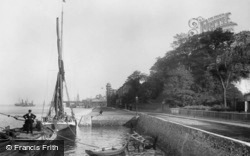
Its situation, opposite the Essex port of Tilbury, led to its becoming the pilot station for the Port of London; at the time of this photograph it was still the world's busiest port.
Its situation, opposite the Essex port of Tilbury, led to its becoming the pilot station for the Port of London; at the time of this photograph it was still the world's busiest port.
Buffer stops were added to the Ilkley station on 3rd January 1966 and the eighty year old bridge over Brook Street was demolished, with work starting at 5am on Sunday 10th July 1966.
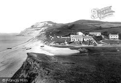
Its buildings range from Bay Cottage (near left), the Royal Standard, Sunnyholme, the Bonded Store, and the Coastguard Station to the old Cobb Arms (right).
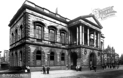
On the left are the police station (1887), the Temperance Institute (1896) and, just out of shot, the Public Library, the first in the country to be financed by the American steel millionaire, Andrew Carnegie
You can see the large ornate wooden Pier Head Station on right of the photograph. The very distinctive square Tower Building was once the town house of the Stanley family and Lord Derby.
Up to the time of Dr Beeching's 'axe', its station at nearby Mardock was served by the single track Buntingford Branch railway line which also ran through the villages of Widford, Hadham, Standon, Braughing
This is a detailed look at the station. To the right, a London & South Western Railway meat van waits to collect meat from the slaughterhouse (centre left).
All the needs of a developing small town are in evidence - the Bedford lorry loaded with builders materials, Charles Love & Son's ironmongery and radio/TV engineer's (right), Lisles petrol station (near
As the railways since Lord Beeching's cuts do not visit Louth, the sign (left) pointing to the station has also gone.
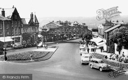
The road heading into the distance is Boltro Road, which leads down to the railway station - the railway line is off to the right of this photograph.
The railway station, which closed in 1963, was situated at the end of Bow Street.
The police station, just visible behind on the left at the top of Union Street, was accessible from the court via an underground passage for the prisoners to pass through on their way from
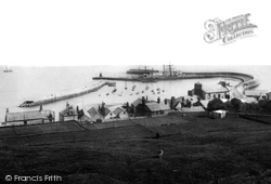
The closest building to the water was the thatched Fishermen's Hut (left of centre) with the tiled Anchor Inn and thatched Anchor Cottages next (centre) and the Coastguard Station behind.
Close to the underground station are two major historic buildings.
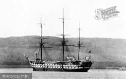
A former warship, the 'Empress', rides at anchor off Gareloch, where she was stationed for many years as an Industrial Training Ship for homeless and destitute boys.
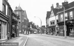
Our view is looking up from the Square towards the railway station. The square tower of St Mary's can be seen peeping out at the centre back of the picture.
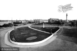
On the right is the Pharos lighthouse, designed by Sir Decimus Burton, and on the left, alongside the river frontage, is the new railway station, one of the finest in the country at that time.
All of this was cleared for the new shopping centre and bus station.
The railway to Preston opened in 1846, but the station we see here did not open until 12 September 1886.
Like Westgate Road, Chaloner Street was opened up in Victorian times, in this case in the 1860s to connect the town centre to the recently opened railway station, which served the town until
Places (20)
Photos (2456)
Memories (3079)
Books (0)
Maps (73)


