Places
Sorry, no places were found that related to your search.
Photos
Sorry, no photos were found that related to your search.
Maps
7,034 maps found.


Books
163 books found. Showing results 1,345 to 1,368.
Memories
22,912 memories found. Showing results 561 to 570.
The Raf Estate
We lived on the RAF estate in Ickenham during the late 1950s, in a semi-detached house at 14 Nettleton Road. Every RAF home mirrored the next; their furnishings were also identical. You could move from Scotland to England (which we ...Read more
A memory of Ickenham in 1957 by
The First
I was the first non-white student at Ealing in 1964 - we were a rare commodity in those days - and apart from the sporadic racist episodes, my period at Ealing till I finished 'O' levels and moved to the US has to this day had a tremendous ...Read more
A memory of Ealing in 1965 by
Summer Holidays
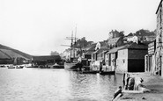
Browsing through the Book "I Remember when..." published by The Francis Frith Collection, I was so delighted to see a picture of The Quayside in 1896 at Salcombe, Devon. There standing proud above the quay was 'Harbour Lights', the ...Read more
A memory of Salcombe in 1890 by
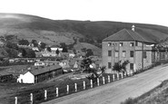
Miner's Hall,Glyncorrwg
My memories are from the 1950s to the 1970s. My grandparents lived opposite the Miner's Hall for many years. (28 Cymmer Road). My grandfather was a bricklayer in the pit and also the Treasurer for the Miner's Hall. I ...Read more
A memory of Glyncorrwg in 1960
Haywards Of Loders Family Tree Search
Hello from Australia to Loders, Researching on-line family Thomas Hayward, m Mary Anne Dodge 1808 November in Sherborne church. Already one gggg cousin Jill Hayward left an entry but has not made contact. ...Read more
A memory of Loders by
Perry Street/Pelham Road South
I live in West Sussex [between Brighton and Worthing] now but lived in Northfleet until 1971. Several photos bought back some vivid memories. In 1955 I would have been attending Cecil Road junior school, just off ...Read more
A memory of Northfleet in 1955 by
Crescent Way 1963 To 1968
My family lived at 3 Downsway just off Southlands Avenue. I had two older brothers when we arrived and by 1966 I had two more and a sister. My older brothers and I attended Warren Road Primary and I remember many of my ...Read more
A memory of Petts Wood in 1963 by
Crescent Way Orpington Kent 1960 1968
My family lived at 3 Downsway just off Southlands Avenue. I had two older brothers when we arrived and by 1966 I had two more and a sister. My older brothers and I attended Warren Road Primary and I remember ...Read more
A memory of Orpington in 1965 by
Harvey's
First time I ever had a milk shake was up here after walking over the stepping stones and looking down at the large carp in the water. What a wonderful place for a child to be brought to visit.
A memory of Guildford in 1960 by
Blackhill And Stephen Yallop!
Hello Stephen mate. My name's Paul Hunter, I was born in 1957, I grew up at 6 Bessemer Street, Blackhill. The Jacksons lived at Number 5, Davie Cudden at number four. My dad worked at 'The Company' CIC. I ...Read more
A memory of Blackhill by
Your search returned a large number of results. Please try to refine your search further.
Captions
9,654 captions found. Showing results 1,345 to 1,368.

To the west of the town centre, and parallel with Chase side, this picturesque street has to be seen by any visitor to Enfield.

A striking building in the High Street is The Queen's Head Pub, mainly of the 17th century, with its welcoming atmospheric bars.

After his trial for treason at Northampton in 1164, Thomas à Beckett escaped from St Andrew's Priory.

Studs on the road surface mark the only traffic crossing in Kettering at this date. On the right, Gordon Thoday, with branches throughout East Anglia, sold dress fabrics.

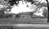
He at once embarked on a programme of rebuilding and extension, doubling the size of the house, and moved the entire village of More Crichel except for St Mary`s Church, a mile away to the south in

The 16th-century house on the left still has its original brackets supporting the exposed joists of the first floor.

The locks and docks at Eastham form the western end of the Manchester Ship Canal.

Centre left at No 33 is the Green Dragon, a cider house, which closed in the late 1960s.

Such was the scale of operations at Vauxhall Motors that the maintenance and building contractors had their own site (foreground) complete with semi-permanent buildings, security and a fully operational

By 1965 the car was increasingly making its impact on Uttoxeter, as we can see from the number of parked cars.

Only one of the boys is wearing shorts; the other three are in jeans, which were becoming readily available at around 7s 6d a pair.

Harrow Park winds away to the east of the High Street, past one or two rather grand houses, to arrive at Deynecourt at the foot of the hill.

The intending attackers spent much of the day in the Duke of York on Nottingham Road, drinking and singing revolutionary songs. Unsurprisingly, they attracted a certain amount of attention.

Not visible in this photograph, but well worth walking to see at the west end of the street, is St Stephen's church, a large and handsome building which was founded before the Norman Conquest.

The top part of the cross was discovered in the 19th century at Tresmarrow Farm, and was put in the town museum.

Some of these features were already in place at the turn of the century and a number of other prestigious regeneration schemes are at an advanced stage in their development while others are on
The Town Hall and the Market Hall stand out at the centre; the large building to the right of the Market Hall is Samuel H Facey & Son's brewery, which opened in 1862.

The White Horse Hotel, right foreground, advertises its select bowling saloon. The horse of the sign seems to be emerging from White Horse Lane just beyond the hotel.

Another of the surrounding parishes into which Bridport borough expanded, Bothenhampton lies to the south-east, with a deep-cut village street which has left a dense cluster of terraces standing on

This private estate was developed in 1833 by the Wakefield solicitor and Clerk of Barnsley Canal Company Thomas Foljambe (1775-1851), part of a larger scheme to build a number of grand
The White Horse Hotel, right foreground, advertises its select bowling saloon. The horse of the sign seems to be emerging from White Horse Lane just beyond the hotel.

Cheesden Brook passes under Ashworth Road, flowing to the right to join Naden Brook as it leaves Carr, Gelder and Bamford Woods.

The Stone and Eccleshall roads used to divide in front of the Waggon and Horses public house, but by this time a roundabout had been built to the rear of it, on the left.

Blundellsands beach forms part of the sixteen miles of sand stretching from Waterloo to Southport.
Places (0)
Photos (0)
Memories (22912)
Books (163)
Maps (7034)

