Places
36 places found.
Those places high-lighted have photos. All locations may have maps, books and memories.
- Pentre-cwrt, Dyfed
- Pentre Halkyn, Clwyd
- Pentre, Mid Glamorgan
- Ton Pentre, Mid Glamorgan
- Pentre, Powys (near Llangynog)
- Pentre, Powys (near Guilsfield)
- Pentre, Powys (near Bishop's Castle)
- Pentre, Dyfed (near Pontyates)
- Pentre, Powys (near Newtown)
- Pentre, Clwyd (near Mold)
- Pentre, Clwyd (near Ruabon)
- Pentre, Shropshire (near Chirk)
- Pentre, Clwyd (near Hawarden)
- Pentre, Clwyd (near Chirk)
- Pentre, Clwyd (near Ruthin)
- Pentre, Clwyd (near Mold)
- Pentre, Shropshire (near Oswestry)
- Pentre, Powys (near Welshpool)
- Pentre, Clwyd (near Mold)
- Pentre, Shropshire (near Forton)
- Pentre Broughton, Clwyd
- Pentre Gwynfryn, Gwynedd
- Pentre Maelor, Clwyd
- Pentre-clawdd, Shropshire
- Pentre Galar, Dyfed
- Pentre Llifior, Powys
- Pentre-cefn, Shropshire
- Pentre-Gwenlais, Dyfed
- Pentre-Poeth, Dyfed
- Burntwood Pentre, Clwyd
- Pentre Berw, Gwynedd
- Pentre Hodre, Shropshire
- Pentre Llanrhaeadr, Clwyd
- Pentre-celyn, Clwyd
- Pentre Cilgwyn, Clwyd
- Pentre Morgan, Dyfed
Photos
98 photos found. Showing results 121 to 98.
Maps
316 maps found.


Books
2 books found. Showing results 145 to 2.
Memories
1,253 memories found. Showing results 61 to 70.
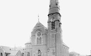
St Johns United Reformed Church
I was married at this church on 25th March 1978. My grandmother, Evelyn Sanderson also played the organ here, and at its sister church St Georges further up Park Rd. My grandfather's funeral service was also ...Read more
A memory of Hartlepool in 1978 by
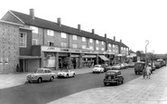
Pontypool Town Centre
I lived in Upper Bridge Street and remember a few of the shops in town, I think! On the corner of Upper Bridge Street and the Bell Pitch was Franketti's fish shop with an awesome Art Nouveau till and free chips if you took ...Read more
A memory of Pontypool in 1960 by
Growing Up In Northwood Hills
I was born in a small maisonette off Alandale Drive and my mum still lived there until she passed away aged 95 in 2014. The border between Hillingdon/Harrow runs across the back garden. I attended Pinner Wood ...Read more
A memory of Northwood Hills in 1960 by
Holes, Hoardings & Hythe Ferry
On returning from the Middle East, my family holed up across the water at Fawley. A big city was very exciting for me and after getting off the Hythe Ferry it was all bomb craters up to about the Dolphin. Above Bar ...Read more
A memory of Southampton in 1954 by
Town Hall Roundabout
Living in Watford from the early 1950's, I well remember the Town Hall roundabout before they moved it. Can't recollect whether it was nearer or further away. I can recollect, not far from a pub called the OBH, or almost ...Read more
A memory of Watford in 1952 by
High Cannons School.
I came from Lowestoft in Suffolk to live with an aunt and uncle in Glenhaven Ave, while my mother was ill. I remember being taken by coach with my sister Jacky to High Cannons. We were not happy at first. It was very ...Read more
A memory of Borehamwood in 1953 by
The Gardens Remembered
I am puzzled as to which year this photo was taken. It must have been very late fifties because my earliest memory of The Rest Garden, as we called it, was when it was still recognizeable as a graveyard. The gravestones ...Read more
A memory of Uxbridge by
Folkstone Court, Newmarket Avenue
My name is Jo Buchanan, I used to live at 2 Folkstone Court and went to Islip Manor Middle School and would love to hear from anyone who remembers me from 1978-1988. I'll always remember going cooler picking, down ...Read more
A memory of Northolt in 1980 by
My Nan Was From Northham
My nan, Florance Annie Hearn or Heard travelled with her dad and 3 older sisters from Northham way before the first world war. His work as a master builder took him to Lidney, Abbertillery, Abbgavenny and most stops ...Read more
A memory of Northam by
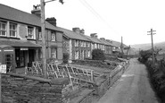
The Old Post Office
My granddad, Charlie Davies, owned the post office and it was where my dad, Arfon Davies, was born. When my grandad died it was taken over by my Auntie Nellie, my dad's sister. My brothers, Gwyn, Iwan and Geraint came to ...Read more
A memory of Cwm Penmachno in 1950 by
Captions
3,593 captions found. Showing results 145 to 168.

Here we see a conversation piece in the town centre, a century and a quarter after the proprietor of the Royal Goat changed the village's name and erected Gelert's Grave nearby.

There were around 160 shops in the town centre by this time, and the Development Corporation had turned their attention to providing Basildon with a health centre, and also police, fire and ambulance stations

Carey & Lambert's Austin garage (centre right) has long since gone, as has the Chandler's Ford School seen in the distant centre of the photograph.

The Circus, in the town centre, is where five roads meet. It has the usual mixture of banks and public houses on its corners.

The imposing Queen Hotel in the centre was built in 1875. The Primitive Methodist church on this side of the hotel was completed in 1910; it became a community centre in the 1970s.

The increasing sizes and numbers of vehicles led to the town centre being by-passed. The building behind the man on the Corgi (centre right) has been demolished to create Angel Link.

Perry Spring was built round a courtyard, and included a community centre. Some sculptures, 'Torsos', by Karel Vogel, were sited outside.

This is the shopping centre of Kippax, much changed on the left, but untouched on the right.

Further west along Main Street, looking towards Lyme Regis, the plateau of Langdon Hill forms the skyline (centre). The cart is beside Rose Cottage and Foss Cottage (left).

At the top of the hill behind the trees stands the Territorial Army building and the town centre.

Continuing south, cross the Eastbourne to Seaford road into the centre of East Dean village with its steep winding lanes.

The building in the centre of the photograph is the Market Hall; today it is really only a façade, as it is now part of the new Crown Centre which adjoins it on the right.

This view looks northwards along Middle Street (otherwise known as Chapel Street) in the centre of the village towards a 17th- century thatched cottage on the corner with Grove Road (centre
It continued in this capacity until 1969, when it became a training centre for British Leyland, and it was later used as a marketing institute and conference centre by the Rover Group.

We are south-west of the village centre, and the photograph exudes a strange feeling of well- cared-for neglect.

The village had once been a centre for lead-mining, but by 1900 it was once again reliant on agriculture.

Bridge Stores (right of centre) advertises Colman`s Mustard in much more basic style than the Victorian sign that used to look down on the central part of the street.

Virginia creeper has now spread to every inch of stonework on the 18th-century house (centre right). On the skyline, in the gap, are the three-storey lines of Grove House in Rax Lane (right).

This view depicts the bustle in West Steet, with children and cycles, and a flock of sheep being driven uphill (left of centre). Market stalls for animals can be seen between the trees.

The freedom of the road, when roadside parking was an inalienable right, can be seen in a view westwards to the Town Hall (centre) from opposite the Golden Road Cafe (far left).

Looking West We are looking across the lake to the houses in Durham Street, with the Presbyterian church roof in the centre of the picture, and the Holy Rood Roman Catholic church on

In the distance in the centre of this photograph is The King's Arms public house; at this time it was one of the houses of the Maidstone brewers Style & Winch Ltd.

St Mary's position in the centre of the town, and the dominating height of its splendid 16th-century tower at 90 feet, make it one of the most prominent buildings in Brecon.
We are south-west of the village centre, and the photograph exudes a strange feeling of well- cared-for neglect.
Places (57)
Photos (98)
Memories (1253)
Books (2)
Maps (316)

