Places
17 places found.
Those places high-lighted have photos. All locations may have maps, books and memories.
- Bridge End, Oxfordshire
- Bridge End, Lincolnshire
- Bridge End, Essex
- Bridge End, Bedfordshire
- Bridge End, Clwyd
- Bridge End, Warwickshire
- Bridge End, Surrey
- Bridge End, Durham (near Frosterley)
- Bridge End, Northumberland (near Hexham)
- Bridge End, Hereford & Worcester (near Tirley)
- Bridge End, Hereford & Worcester (near Bosbury)
- Bridge End, Shetland Islands
- Bridge End, Cumbria (near Carlisle)
- Bridge End, Northumberland (near Hexham)
- Bridge End, Devon (near Kingsbridge)
- Bridge End, Devon (near Sidmouth)
- West End, Yorkshire (near Pateley Bridge)
Photos
40 photos found. Showing results 1,381 to 40.
Maps
520 maps found.
Books
2 books found. Showing results 1,657 to 2.
Memories
1,928 memories found. Showing results 691 to 700.
Childhood Memories
I first visited Weymouth as a small child during the second world war to see my rather strict widowed maternal grandmother who lived at 10 Carlton Road South, within walking distance of the beach. I particularly recall the ...Read more
A memory of Weymouth in 1945 by
My Birthplace
I was born at Coullie Udny on 8th September 1941 in my grandparent's house, their name was Burnett and he was a grieve at Coullie. The Cottar House they stayed in is now called Burnett Cottage. I lived there for 17 years and ...Read more
A memory of Udny Green in 1941
Friends In Swindon West Midlands
I used to ride my horse through Swindon when the steel works RTB was there. The offices looked over the little bridge and my friend Derek Williams used to work there and wave through the window to me and my mates on our ...Read more
A memory of Swindon in 1965 by
Before The Motorway
I was born on Boxing Day 1941 during World War II at an address in Maylands Road. I started school at 5 years of age at Bedhampton Junior School and my teacher was Mrs Davies who also lived in Maylands Road. On Sundays my ...Read more
A memory of Bedhampton by
Sidcup Memories ( 1970's )
Mr Father Charles Edwin Gillmore was born in Sidcup in 1942. He lived at home with his brother David Gillmore and sister Maureen Clarke also their Mother Florence Ada Gillmore ( Nee Eustace ) at 22 Alma road Sidcup, just down ...Read more
A memory of Sidcup in 1972 by
My Teenage Years
My family and I moved to Withybrook in 1960 first of all we lived in 2 all saints close later we moved yo 4 Kirby Lane. 2 All saints Close was the place where I met my future wife she lived at No3 next door. I was ...Read more
A memory of Withybrook in 1960 by
Evacuation
I was evacuated here with my sister during the war and we lived at 19 Canning Street with two elderly ladies. They kept hens on a piece of land opposite. I used to go across the road and across a bridge over a stream to the local shop with ...Read more
A memory of Padiham by
A Very Dangerous Route In The 1950's.
It was the late 1950's and we were travelling in a motorbike and sidecar. Mum and dad were on the bike and the two children (my brother and I) in the sidecar. We started to descend slowly down the hill, all ...Read more
A memory of Countisbury by
Recollections Of Ash Vale By Lt Col Taylor
RECOLLECTIONS OF ASH VALE By Lt Col Taylor Ash Vale, viewed from the main route through it the Frimley and Ash Vale roads would not have appeared to alter a lot during the last 100 years. Houses do now ...Read more
A memory of Ash Vale by
Westwood Secondary
I lived at 111 Danson Crescent right by the gates to Danson Park, I went to Westwood School and played for their football team this would have been in the early sixties. I used to sell the Evening news and Standard papers on the ...Read more
A memory of Welling by
Captions
1,770 captions found. Showing results 1,657 to 1,680.

This delightful bridge spans the Monmouthshire canal. The canal was built between 1797 and 1812 to link Brecon with Newport and the Severn Estaury.

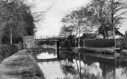
Heating and cooking was performed on a coal-fired range, whose chimney we can see behind the tiller. On the right, in front of the bridge, there is a lifting winch.

We are looking past John Carr's Green Bridge towards the magnificent castle - a true picture of medieval England.

This seems a quiet day, for my childhood memories of passing through Newark are of nose-to-tail crawls and relief on crossing the bridge.

The Macclesfield road rises in the distance to the bridge over the railway line, with the station and livestock market going down on the left.
Further downstream and opposite Hampton Court, Molesey Lock is photographed from Riverbank, the busy A3050 along the Surrey bank of the River Thames.

The course of the canal meant that a section of the L&NWR line to Liverpool via Warrington and Speke would have to be re-routed; this resulted in the building of Latchford Viaduct.

Children pose near the small bridge over Downham Beck, a brook which runs through the heart of the village.

Forming a picturesque scene near Askham, the bridge arches over the River Lowther whose waters have their origin in the north-east Lakeland fells above Shap.

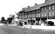
Bridge Street is bustling with Saturday afternoon shoppers. Next to Singleton's the butchers is the Midland Bank's fine facade.

This view was taken fromthe river bridge seen in photograph 27007, and looks towards the parish church of St Michael and All Angels, perched on the cliff edge above the river.

This view looks along Foregate Street; the bridge carrying the Great Western Railway lines to Hereford and South Wales can be seen in the background.

In our view we are looking towards the bridge over the burn. The Brown Cow public house is on the right, and the Black Bull Hotel can just be made out further down the road.

Here, utilising the course of the River Colne, the canal goes left of the island under the bridge.

Nestling on its sandstone ridge in a loop in the Dee, Chester is closely framed on two sides by water.

Looking eastwards along Church Street from Magnolias, across the River Bride, in a sylvan setting beside a clapper bridge next to the village school.

Houghton is a hamlet with a long stone bridge across the tidal River Arun.

This photograph was taken from the old bridge that led onto the island, and now leads to the Upper Reaches Hotel and its car park.

Obviously still viable in these photographs, Southport Pier was closed in the 1990s; it was demolished and rebuilt at a total cost of £7 million, and was reopened in 2002.

This view is looking down from the road bridge; things have changed greatly at Sandy.
Heating and cooking was performed on a coal-fired range, whose chimney we can see behind the tiller. On the right, in front of the bridge, there is a lifting winch.

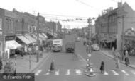
Cars replace horses on the taxi rank, traffic lights control movement over the bridge, Prideaux's have expanded hugely, adding Morris and Austin to their dealerships, and the gazebo has gone, demolished

We are looking upstream, towards the Abberley Hills in the distance, with the tower and spire of the otherwise demolished St Andrew's Church prominent on the right.

The capital of the Broads is Wroxham which is just across the bridge. It is a popular starting point for boating holidays which grew rapidly in the early years of this century.
Places (17)
Photos (40)
Memories (1928)
Books (2)
Maps (520)

