Places
36 places found.
Those places high-lighted have photos. All locations may have maps, books and memories.
- Cardiff, South Glamorgan
- Barry, South Glamorgan
- Penarth, South Glamorgan
- Rhoose, South Glamorgan
- St Athan, South Glamorgan
- Cowbridge, South Glamorgan
- South Molton, Devon
- Llantwit Major, South Glamorgan
- Chipping Sodbury, Avon
- South Chingford, Greater London
- South Shields, Tyne and Wear
- Ayr, Strathclyde
- St Donat's, South Glamorgan
- Llanblethian, South Glamorgan
- Thornbury, Avon
- Llandough, South Glamorgan
- Fonmon, South Glamorgan
- St Nicholas, South Glamorgan
- Jarrow, Tyne and Wear
- Penmark, South Glamorgan
- Font-y-gary, South Glamorgan
- Maybole, Strathclyde
- Yate, Avon
- Oxford, Oxfordshire
- Torquay, Devon
- Newquay, Cornwall
- Salisbury, Wiltshire
- Bournemouth, Dorset
- St Ives, Cornwall
- Falmouth, Cornwall
- Guildford, Surrey
- Bath, Avon
- Looe, Cornwall
- Reigate, Surrey
- Minehead, Somerset
- Bude, Cornwall
Photos
5,607 photos found. Showing results 1,421 to 1,440.


Maps
2,499 maps found.


Books
23 books found. Showing results 1,705 to 23.
Memories
1,580 memories found. Showing results 711 to 720.
Howards Chip Shop
I was born in Elliott Street, moved to 10 South Street - my brother was born there in November 1943 - I was eight years old and an only child - I was so excited I ran around to Howards Chip Shop in the main street and got knocked ...Read more
A memory of Widnes in 1943 by
South Weald School 1959 Ish
The old school was still in the village - the toilets seem to be well remembered - how I hated those. The old school for me smelled of those tablets of paint which were used in art class, for dabbling. That smell ...Read more
A memory of South Weald in 1959 by
Stonecot Hill Memories
This is a shot of Stonecot Hill, looking south towards North Cheam. The shop you can see is on the corner of Stonecot Hill and Ash Road - it was an off-licence. Before 1964 it had a brown facia, with the Whitbread logo and ...Read more
A memory of Sutton in 1965 by
Odeon Compton
About 1963 I used to visit the Odeon and was allowed to play the Compton Organ. I became friendly with Don Galloway (the second projectionist) who also played the organ. He emigrated to South Africa in around 1965, and we lost ...Read more
A memory of Hounslow in 1963 by
Horsnell Family
My ancestor was John Horsnell, he was born in 1812 in Brentwood, Essex. I am looking for any relatives of John Horsnell. His parents may have been William and Mary. His father was connected with wine importing and retailing. ...Read more
A memory of Brentwood in 1860 by
Samuel George Marlow Married My Great Grandma In South Norwood
Samuel George Marlow, who was reputed to be my great-grandad, lived at 10, Bungalow Road, Thornton Heath, London, SE25 6JZ at the time of his (belated) marriage to great grandma ...Read more
A memory of South Norwood in 1890 by
Pre Post World War 2
Attended Houghton Road Junior School, then in 1944 the Hill School. Lived 45 Windsor Street. Memories going to school eating breakfast of bread and dripping, transporting a ton of coal from the street to the coal house at ...Read more
A memory of Thurnscoe by
Part 15
I remember Peter went in one day for a cup of tea, and stayed chatting. The horse got fed up waiting and came home five miles away. Peter was fuming; he had to walk home, and lost half a day’s earnings. He was ribbed rotten about ...Read more
A memory of Middle Rainton in 1945 by
When I Was Young
I was born 1948 in Chop Well and lived in South Terrace down by Mark and Lenin Terraces. Played cricket for the juniors and had friends called Bill Bailley and John Baum. My cousins where Tom and Bill Hughes. My eldest brother ...Read more
A memory of High Spen in 1948 by
My Childhood
I was very fortunate to spend my childhood in Lepe. My mother and father worked at the big house as housemaid and chauffeur to Lady Dilke, we lived on the grounds in the bungalow. We had 8 happy years there. I went to Exbury infant and ...Read more
A memory of Lepe in 1948 by
Captions
2,476 captions found. Showing results 1,705 to 1,728.

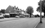
The service road alongside The Parade has now been incorporated into the busy A217, looking south towards today`s traffic lights at the junction with Reigate Road.

Given the Earl of Scarbrough's family name, Lumley Road is a straight road with the old High Street winding along south of it, diverging to the left of the trees to meet again at Lumley Square in front

This view looks south down the High Street from near High Bridge. The 11th-century tower of St Mary le Wigford church peers out amid the later commercial architecture.

To the south, across the Sleaford to Skegness Road, an alley leads to Lord Cromwell's College just beyond the road frontage buildings; it is another 15th-century brick building, known as the Old College

This 1940s view from the station, which is some way south of the town, shows just how many trees were still left then.

Here, the High Street splits into three roads: to Leicester; to South Back Way and to Stockerston. The rather crude signpost has now gone and there is no entry from this direction.

Among the church's interesting curiosities are a sundial on the south wall, a stout Norman tub font and a delicately carved 15th-century pulpit.

The Blackfriars, otherwise known as the South-East Tower, was used in the 19th century as a shop at street level with accommodation above—there was even a small cottage built on top.

On the south side of the palace was a huge deer park, Somersham Chase, that survived until the enclosures.

The baths were donated in 1914 by Sir William Gray, the famous local shipbuilder who had also founded the South Durham Steel and Iron Company in 1898.

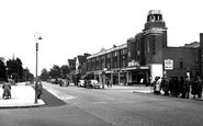
On the right is a glimpse of the electricity showrooms which bound the open frontage to the Town Hall on its north side, while to the south are the gas showrooms.

There is no known record of the history or appearance of this castle, which is situated eight miles south-west of Cardiff.

South-eat of Chesham town centre the road runs alongside the River Chess in its flat-bottomed valley.

The 120-foot tower of St James' dominates this view from the south-east. The church is notable for its 15th- century frontals, which are said to be the earliest set in the country.

Hopton is a diminutive village resort on the A12 just south of Great Yarmouth.

We are looking at the medieval Cobb harbour (centre) from the tennis ground on the cliffs south of Langmoor Gardens.

From the slopes of Quarry Hill, above Park Farm (centre), we look south-westwards to Golden Cap (left of centre) and Langdon Hill.

Half a mile south-east of Dicker we reach Michelham Priory, the buildings set within a large rectangular wet moat fed by the Cuckmere River, which forms the moat's north-west arm.

Newly-built Durlston Castle (top left) and the 40-ton Great Globe, also dating from 1887, are seen here from the south-east.

Ashburton was the terminus of the nine-mile branch of the Buckfastleigh, Totnes and South Devon line, which was completed in 1872.

The Scots are known to have raided at least as far south as Bradford.
The Scots are known to have raided at least as far south as Bradford.

Situated at the southernmost end of the Isle of Thanet, the bay is bounded by cliffs on the north, and by marshes to the south.

This view looks south towards Troutbeck, with the shoulder of Broad End on the left.
Places (15471)
Photos (5607)
Memories (1580)
Books (23)
Maps (2499)

