Places
36 places found.
Those places high-lighted have photos. All locations may have maps, books and memories.
- Shanklin, Isle of Wight
- Ventnor, Isle of Wight
- Ryde, Isle of Wight
- Cowes, Isle of Wight
- Sandown, Isle of Wight
- Port of Ness, Western Isles
- London, Greater London
- Cambridge, Cambridgeshire
- Dublin, Republic of Ireland
- Killarney, Republic of Ireland
- Douglas, Isle of Man
- Plymouth, Devon
- Newport, Isle of Wight
- Southwold, Suffolk
- Bristol, Avon
- Lowestoft, Suffolk
- Cromer, Norfolk
- Edinburgh, Lothian
- Maldon, Essex
- Clacton-On-Sea, Essex
- Norwich, Norfolk
- Felixstowe, Suffolk
- Hitchin, Hertfordshire
- Stevenage, Hertfordshire
- Colchester, Essex
- Nottingham, Nottinghamshire
- Bedford, Bedfordshire
- Bury St Edmunds, Suffolk
- Aldeburgh, Suffolk
- St Albans, Hertfordshire
- Hunstanton, Norfolk
- Chelmsford, Essex
- Bishop's Stortford, Hertfordshire
- Peterborough, Cambridgeshire
- Brentwood, Essex
- Glengarriff, Republic of Ireland
Photos
11,144 photos found. Showing results 14,781 to 11,144.
Maps
181,031 maps found.


Books
442 books found. Showing results 17,737 to 17,760.
Memories
29,040 memories found. Showing results 7,391 to 7,400.
French Kid
I was a french kid like can see and used to come in Hythe to my grand-parents house not very far from here in Hotspur Close. And I have meet a girl that was the grand daughter of Mr Stewart that as own the West Cliff Hall and ...Read more
A memory of Hythe in 1980 by
School Days
I also attended Fedsden school, when the now hospital was our grounds. Beautiful paintings on the ceilings and we used to explore the tunnels under the building. Have been trying to contact Bridget Castel. Her family lived on the Isle of White. Great memories.
A memory of Great Parndon in 1965 by
Spellow Lane Church, Walton
I was a member of Spellow Lane Church from 1964 to 1976. It is situated on Spellow Lane, about 500 yards from Goodison Park (home of Everton FC), on Goodison Road. One of the weekly meetings was held on Tuesday evening ...Read more
A memory of Liverpool in 1966 by
St Matthew's Church Warwick Street
I lived in Rugby from 1949 to 1952 having had contacts with the town since the early 1940s. My brother and sister and I, as children, used to attend this church which is the cloistered building back left of the ...Read more
A memory of Rugby in 1950 by
Waterfoot Is Still My Home After 54 Years.
I was born in 298 Burnley Road East on August 18th 1945. The Nurse who delivered me was Nurse Bowe, who was a good friend of my Gran's (Teresa Whittaker, nee O'Brien). All my Aunties and Uncles were born ...Read more
A memory of Waterfoot by
Tylney Hall
I first went to Tylney Hall in 1948 at the age of 8, I went there because I had caught T.B. from my Dad.I remember the bell that woke us up every morning at 7am, our visits to Hook every Saturday morning to spend our pocket money, ...Read more
A memory of Rotherwick in 1948 by
Memory Of Cross Street, Cambridge
I lived at 24 Cross Street, Cambridge from the age of three till I got married in 1969. My mother was Pat and my father was Bill Turner. I attended Saint Barnabus Infant School, then Saint Paul's, and went on to ...Read more
A memory of Cambridge in 1958 by
More Of My Memory Of Halling
Hi all, remembering more about the young days in Halling. On a Saturday, and holidays we used to go down the paths leading through the marshes to the river, our Mums used to say "if you are not off the marshes by 12 ...Read more
A memory of Halling in 1948 by
Childhood Memories Of Pink Farm
My mother worked in the cafe for many years. I used to play with John, who lived there with his parents and sister.
A memory of Llandudno in 1952 by
Over Square
This picture brings back the memories of the many years I spent at my pharmacy to the right of the view. I am now retired and in my late seventies. The roundabout has been altered to make way for the bypass to Chester.
A memory of Winsford in 1966 by
Your search returned a large number of results. Please try to refine your search further.
Captions
29,395 captions found. Showing results 17,737 to 17,760.

The parish church of St Margaret's high position above the Exe makes it a most prominent landmark, and its sandstone tower is a mark for shipping.

Only one or two brave souls are paddling in the sea. As always, a fishing boat draws a small but interested crowd, even though it is empty.

Tram tracks go to the right of the statue of James Ramsden, and beside it there is a pole for the overhead wires. Only one car is to be seen.

This crane is still in use, and can be seen from many parts of the town. Here, it is being used in the fitting out of the Oronsay in Buccleuch Dock.

Capstans (foreground and opposite it) on the outer piers were used for helping ships in and out of the difficult harbour entrance.

This shows the northern slope of Capstone Hill and its junction with Ropery Meadow (centre, in front of the chapel) as it was before any development took place.

The industrialisation of the Don Valley begins here at Stocksbridge, a town dominated by steel, chemicals and former coal and clay workings.

On the right Olivers, 'The Largest Retailer of Boots in the World', survives; it is still selling shoes as Timpsons. Beyond is now a 1960s Woolworths.

This attractive view from just behind the hamlet of Doniford looks along the bay towards the low Lias cliffs that partly conceal Watchet.

Looking from the B3153, just east of the town, this photograph shows a local train hauled by a steam engine, whilst the cows below, well used to the noise, continue unconcernedly chewing

Built in the Irish style, the round tower dates from the 10th or 11th centuries, and would have been used by the monks as a place of refuge during raids by pirates or Vikings.

Bruce's heart was carried on a crusade against the Moors of Granada by Sir James Douglas.

This view shows the esplanade (left of centre) and the twin piers protecting the channel into Bridport Harbour (right). Looking eastwards from the cliffs above Black Rock.

The reverse view from D69020, looking south towards the ancient cross-roads of Watling Street and the Icknield Way.

On the face of it this picture is the same as the previous one. However, there have been a few changes in the details.

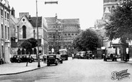
We have now passed through Stonebow into the southern part of the High Street, which grew up along the old Roman road south of the walled city.

The Roman Foss Dyke canal fell out of use during Anglo-Saxon times, but was restored after the Norman Conquest to become one of the main outlets for the great medieval city's wool and lead exports.

The river Sow surrounds Stafford on three sides. This is the Green Bridge, over which traffic had to pass before entering through the Green Gate in the medi- eval walls.

The cottages date from the 16th century, and are probably of the same age as the earliest known parish register of 1596. Notice the old Whieldon's green bus parked outside.

On the town's tithe map of 1841 it appears in its present width as 'New Road'.

Blossom Hill and Pound Lane are on the skyline (centre left).

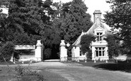
Described as an 'ambitious and correct neo-Elizabethan mansion', Greystoke Castle was remodelled by Anthony Salvin in 1839-48 and again after a fire of 1868.

It is suggested that the remains of Herstmonceux Castle form part of the oldest brick mansion in Britain; it was built in 1441, following a grant from the king to Roger de Fiennes to 'embattle

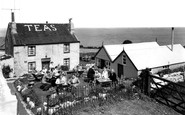
Rose Cottage, one of three cottages built for farm workers, is the foremost cottage in this photo.
Places (6814)
Photos (11144)
Memories (29040)
Books (442)
Maps (181031)

