Places
26 places found.
Those places high-lighted have photos. All locations may have maps, books and memories.
- Town End, Derbyshire
- Town End, Buckinghamshire
- Town's End, Somerset
- Towns End, Dorset
- Town End, Merseyside
- Town End, Cambridgeshire
- Town's End, Buckinghamshire
- West End Town, Northumberland
- Bolton Town End, Lancashire
- Kearby Town End, Yorkshire
- Town End, Cumbria (near Grange-Over-Sands)
- Town End, Cumbria (near Bowness-On-Windermere)
- Town End, Yorkshire (near Huddersfield)
- Town End, Yorkshire (near Wilberfoss)
- Town End, Cumbria (near Appleby-in-Westmorland)
- Town's End, Dorset (near Melbury Osmond)
- Town's End, Dorset (near Swanage)
- Town End, Cumbria (near Ambleside)
- Town End, Cumbria (near Lakeside)
- Town End, Cumbria (near Kirkby Lonsdale)
- Town End, Cumbria (near Ambleside)
- Town's End, Dorset (near Bere Regis)
- West-end Town, South Glamorgan
- Townend, Derbyshire
- Townend, Strathclyde (near Dumbarton)
- Townend, Staffordshire (near Stone)
Photos
23 photos found. Showing results 3,281 to 23.
Maps
195 maps found.
Books
3 books found. Showing results 3,937 to 3.
Memories
3,719 memories found. Showing results 1,641 to 1,650.
An Old Flame
My first love was Susan Sainty who, at this time, lived in London Road, Kings Lynn with sister Alison, and mum and dad. Her gran lived in Cley and the family probably had the chalet bungalow in West Runton at the time. We met at ...Read more
A memory of West Runton in 1964 by
Loftus Was Once A Lovely Market Town
Loftus in Cleveland I remember Slater's Banks, Primroses Violets, Cowslips rolling our paste eggs at Easter, Skylarks singing and Saturday Market shopping at the Co-op its butchers, shoe shop drapery offices ...Read more
A memory of Loftus by
47 Reservoir Road
I bought here in Surfleet in 1993. The house would be out of shot to the right and at the top of the bank. Whilst this shot is instantly recognisable, then viewer would now find far more property down by the riverside. In ...Read more
A memory of Surfleet in 1993 by
Wath 1954 To 1963
I lived in Wath for only 8 years from aged 1 to 9 (1954 to 1963) when we moved to Mexborough. We lived at No1 Melton View which was just off Well/Cat Lane opposite the old lock up building. We lived at number 1, next ...Read more
A memory of Wath Upon Dearne by
Queen Alexandra
I joined the Queen Alexandra Nursing Corps in 1958 and came down from Scotland to QA depot at Hindhead. After training at the Dental College, Aldershot was posted to the Dental Centre, Connaught Hospital. My name was then Smith. ...Read more
A memory of Hindhead in 1959 by
Childhood
I was born in Milland in 1942 at Great Trippetts Cottages. My father, Goody Luff, worked at the farm and had married the 'Nanny' from The Coombe. As with many farm cottages we had no running water or electricity. We relied on the well ...Read more
A memory of Milland in 1940 by
Wedding Bells
My mum and dad, Alf and Enid Myers, met at Woodlands in 1948. My mum was introduced to Woodlands by my aunt Renee. They were married on 5 September 1948, and I was born in September 1949, and my brother Barry in October 1951. We ...Read more
A memory of Woodlands in 1948 by
My Great (X3) Grandad Was Olivia Sparrows Footman
This memory relates to the late 1830s and early 1840s. My great x3 grandfather, William Makepeace, was Olivia Bernard Sparrow's Footman. A number of his children, including my ...Read more
A memory of Brampton by
My Childhood Garded Part Iv
If I remember correctly, a white climbing rose grew up one side of the arch and a red on the other. The path continued straight through the archway, and led up the garden to the two wooden sheds at the top of the ...Read more
A memory of Shamley Green in 1954 by
Sandown Youth Hostel
It was 1969 and I had just come down from Manchester and was staying once more in my family home in Hatch End. My parents suggested that I took my younger brother away for a break following his "O" Levels so we set off for a ...Read more
A memory of Sandown in 1969 by
Captions
5,054 captions found. Showing results 3,937 to 3,960.
Its core collection, gathered together by Philpot's sisters at their home in Silver Street, was moved down the hill in stages, but the Philpot Museum did not open to the general public until
This tiny cathedral city stands above the confluence of the River Clwyd and its tributary the Elwy. The cathedral is the smallest in Britain.
The saffron crocus, once very important in the dyeing industry, gave the town its name.
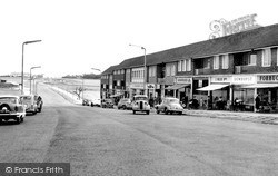
To the south of Easington, the new town of Peterlee was developed with the aim of attracting light industry into the area.
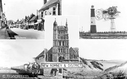
On this composite postcard of New Romney, we have the Dungeness lighthouse, built in 1904, and the Romney and Hythe District Light Railway, which started in 1927.
Caerphlly was primarily an industrial and market town.
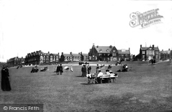
The new town is gathered around an expansive green. Hunstanton grew out of the hamlet of Hunstanton St Edmund, sited low on the cliffs and owned by the Le Strange family of the Hall.
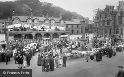
Settle lies on the road between Skipton and Ingleton. On the right is the Elizabethan-style Town Hall, built in 1832, and in the background, somewhat smothered by washing, is the Shambles.
This view shows that the houses are still few and far between, and the village, known as 'the town that never was', remains much the same now.
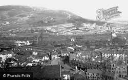
Notice the factory chimneys and their puff-ball smoky emissions.
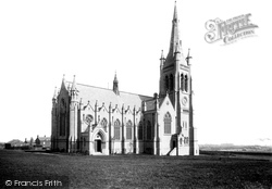
Situated on a hill overlooking the town, Christ Church, or the Jesse Haworth Memorial Church, was designed by Lawrence Booth and built in the late 1880s.
The Duke of York is one of Burnley's landmark inns, and gives its name to this part of town. The tip of a spire can be seen just off centre.
The arches around the veranda carry the shields of the Lancashire towns who supported the movement.
This view is one of several in the Frith archive taken from the Town Hall roof. To the left is the Queen's Hotel with its central flag-poled turret.
Rhuddlan is most famous for its castle and its historic association with Edward I. There are remnants of medieval buildings in the town.
A large number of its fine stone buildings now dominate the north part of the town.
The London & Provincial Bank established itself c1883, relocating to a vacant school building on the corner of Stanwell Road c1886. It became Barclays (left) after bank amalgamation of 1919.
Once tree-lined, the pavement edge to the right of the photograph has given itself up to signage and lighting standards.
The old Infirmary, designed by John Wing and opened in 1803, fronted Ampthill Road; it was later expanded to be the Bedford General Hospital (South Site).
The town was laid out north and west of the Abbey precincts, with the Market Place at the junction of High, Magdalen, Benedict and North Load Streets.
Bath Street curves away northwards from the Square and its junction with the High Street.
By the 1950s the south front of Gisborough Hall was covered in Boston ivy; it still is today, and looks stunning in the autumn.
Beginning with a series of ditches and bastions known as the Cumberland Lines in 1756, the Royal dockyard defences were extended later in the century.
Many of Chalford's streets are too narrow and steep to allow cars and are best explored on foot, much as the master-weavers of the cloth trade would have known them.
Places (26)
Photos (23)
Memories (3719)
Books (3)
Maps (195)

