Places
36 places found.
Did you mean: downs or doune ?
Those places high-lighted have photos. All locations may have maps, books and memories.
- Bangor, County Down
- Newcastle, County Down
- Greyabbey, County Down
- Donaghadee, County Down
- Downpatrick, County Down
- Portaferry, County Down
- Dromore, County Down
- Downings, Republic of Ireland
- Hillsborough, County Down
- Killyleagh, County Down
- Ardglass, County Down
- Rostrevor, County Down
- Dundrum, County Down
- Newtownards, County Down
- Warrenpoint, County Down
- Ballygowan, County Down
- Ballywalter, County Down
- Ballyward, County Down
- Bishops Court, County Down
- Boardmills, County Down
- Culcavy, County Down
- Katesbridge, County Down
- Killough, County Down
- Millisle, County Down
- Portavogie, County Down
- Saul, County Down
- Seaforde, County Down
- The Diamond, County Down
- Audleystown, County Down
- Kearney, County Down
- Annaclone, County Down
- Ballyhalbert, County Down
- Ballymartin, County Down
- Clare, County Down
- Conlig, County Down
- Dollingstown, County Down
Photos
994 photos found. Showing results 1,341 to 994.
Maps
459 maps found.
Books
Sorry, no books were found that related to your search.
Memories
8,148 memories found. Showing results 671 to 680.
Boddington School Maureen Simpson.
I attended the school from 1946-1951. The teacher at first was Miss Semper, who I do not remember too well. After her came Mrs. Pat Bishop, who was a lovely lady, she and her husband lived in the school ...Read more
A memory of Upper Boddington in 1946 by
Terrible Place
I lived and went to school in Shotton Colliery, and hated the place. Luckily I realised that living there was not for me, so at the age of 16 I joined the RAF and was posted to Wiltshire, clean air, beautiful rolling downs, ...Read more
A memory of Shotton Colliery in 1950 by
Boyhood Days
My aunts and uncles lived in East Howle and I was a regular visitor around and before 1950. The two families lived opposite one another in what I think may have been "railway cottages" and my cousins totalled 9. In those days you ...Read more
A memory of East Howle
Woodlands Holiday Camp Swimming Pool
I was brought up in Kemsing at the foot of the Downs and we children would walk up to Woodlands Holiday Camp to swim for a shilling or so. On a fine weekend you could take your swimming things and some ...Read more
A memory of Sevenoaks in 1960 by
Kitchen Staff
I worked at Moorlands with Chef Freddie Davis, a Basque Chef, great man, brandy and a garlic clove before we started the day, had a pastry cook who drove an Austin Champ. I believe the manager was called Smith. Freddie gave me a ...Read more
A memory of Haytor Vale in 1967 by
How Good Barking Was In The 1950s
I was born in Shirley Gardens in 1935, right opposite Barking Park where I spent most of my childhood at Barking open air lido. What a magnificent place that was! My father was a policeman in Barking so we always ...Read more
A memory of Barking by
James Joseph Irvine (Autobiography) 1911 1990
Stretching over about a mile on the A68 road to Edinburgh from Darlington, lies the small mining town of Tow Law. Approaching it from Elm Park Road Ends, on a clear day, as you pass the various openings ...Read more
A memory of Tow Law in 1930 by
Hopedene
I was born in Hopedene at the beginning of July 1960. I think it was good neutral territory as my father was Nursing at the General, and my mother was a Physio at the RVI. They had moved down to Corby at the start of the ...Read more
A memory of Elswick in 1960 by
Football
I left Blaengwynfi in 1952 when I was fourteen. My father was Emlyn (Capers) Thomas and my mother was Betty (Scotch) Thomas. I had four brothers and a sister. I remember that I was one of the ball boys at the football pitch at the top ...Read more
A memory of Abergwynfi in 1950 by
The Old Quay, Newlyn
This photograph shows "The Old Quay" which was a medieval construction inside the outer arms of the Newlyn Harbour. Behind the Old Quay is the South Pier and the extreme end of the North Pier shows to the left of the picture ...Read more
A memory of Newlyn in 1955
Captions
2,242 captions found. Showing results 1,609 to 1,632.
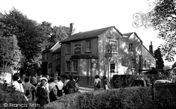
Moving north, the route climbs onto the North Downs to Headley and the Cock pub, now called the Cock Horse.
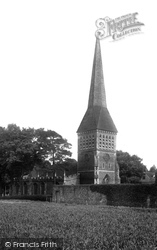
The tower with its tall lancet windows divided by louvres and its broach spire, designed by Henry Woodyear in 1862, blew down in 1947.
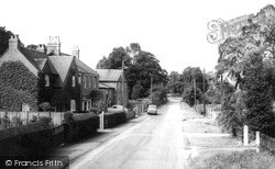
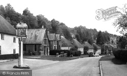
We are looking south-west down Crofts End, the lane which leads from Crofts End itself at the top of the hill behind the photographer to the main through road.
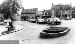
Northleach lies between Cheltenham and Burford, and most of this former wool town's buildings date from Tudor and Jacobean days.
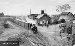
The Tal-y-Llyn railway was used originally between 1866 and 1946 to haul slate from the Bryn Eglwys quarry at Nant Gwernol down to Tywyn Wharf station.
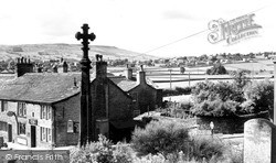
From the elevated position of St Andrew's Church we look down the Aire Valley, where now a dual carriageway leads into Keighley.
The lane curves gently down towards the ornamental lake at the foot of the hill. CORFE CASTLE, From the Church
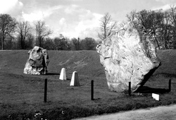
The impressive lozenge-shaped stone came from a surface outcrop of sarsen stones (the word sarsen derives from Saracen, and means stranger) which can be found on the Marlborough Downs about two miles away
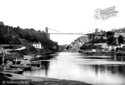
Today, the increase in size of vessels has led to a new port being created down-river at Avonmouth. Visiting ships now miss this magnificent suspension bridge.
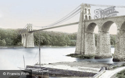
Rip tides up and down the strait made the ferry a dangerous option, and earned the Menai the nickname 'the British Bosphorus'.
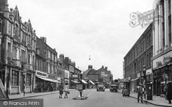
This view down Silver Street, widened here at the junction with Gold Street in the 1930s, looks towards Dalkieth Place.
The Village 1902 Here we look south down the main road into the village as it nears the estuary.
Boats travelling down the Thames estuary from London were met by stagecoaches here, and their passengers were transported onward by road to Dover.
The wall on the right was knocked down and a garage built. This disappeared in 1997, replaced by a pretty park. The Post Office has gone, and the Westward Ho!
This is a 16th-century building par excellence, much altered and added to down the centuries; it is timbered, tile hung and jettied, and bears a cluster of tall chimneys.
We are on the slope of the Downs between Eastbourne and Polegate. A nearby vantage point at Combe hill is 638 feet high.
The building is of about 1300 with an unbuttressed west tower of 1707, when its spire was taken down. As
During World War II it and the distinctive iron railings were dismantled and stored, thus escaping being melted down for Spitfires, and reinstated in 1949.
From this view it is obvious that the town occupies a ridge between the two rivers: the land drops to the Great Ouse (see the previous views) and to the Ouzel, as we see here - this view was
The Town Hall is down Duke Street on the right.
The old town of Cliffe, destroyed by fire in 1520, was revived briefly by the cement industry in the second half of the 19th century.
This view looks down towards the Cross from the A46 Bath Road. At the bottom of the slope is the clock tower and George Street, in which is found one of the largest kettles in the country.
We are looking east down the wide sweep of Swaledale, where we can reflect on the beauty of this, the quietest of the northern dales.
Most of the shops on the right have awnings pulled down to protect their wares and produce from the sun.
Places (198)
Photos (994)
Memories (8148)
Books (0)
Maps (459)

