Merry Christmas & Happy New Year!
Christmas Deliveries: If you placed an order on or before midday on Friday 19th December for Christmas delivery it was despatched before the Royal Mail or Parcel Force deadline and therefore should be received in time for Christmas. Orders placed after midday on Friday 19th December will be delivered in the New Year.
Please Note: Our offices and factory are now closed until Monday 5th January when we will be pleased to deal with any queries that have arisen during the holiday period.
During the holiday our Gift Cards may still be ordered for any last minute orders and will be sent automatically by email direct to your recipient - see here: Gift Cards
Places
36 places found.
Those places high-lighted have photos. All locations may have maps, books and memories.
- Cardiff, South Glamorgan
- Barry, South Glamorgan
- Penarth, South Glamorgan
- Rhoose, South Glamorgan
- St Athan, South Glamorgan
- Cowbridge, South Glamorgan
- South Molton, Devon
- Llantwit Major, South Glamorgan
- Chipping Sodbury, Avon
- South Chingford, Greater London
- South Shields, Tyne and Wear
- Ayr, Strathclyde
- St Donat's, South Glamorgan
- Llanblethian, South Glamorgan
- Thornbury, Avon
- Llandough, South Glamorgan
- Fonmon, South Glamorgan
- St Nicholas, South Glamorgan
- Jarrow, Tyne and Wear
- Penmark, South Glamorgan
- Font-y-gary, South Glamorgan
- Maybole, Strathclyde
- Yate, Avon
- Oxford, Oxfordshire
- Torquay, Devon
- Newquay, Cornwall
- Salisbury, Wiltshire
- Bournemouth, Dorset
- St Ives, Cornwall
- Falmouth, Cornwall
- Guildford, Surrey
- Bath, Avon
- Looe, Cornwall
- Reigate, Surrey
- Minehead, Somerset
- Bude, Cornwall
Photos
5,054 photos found. Showing results 1,581 to 1,600.
Maps
2,499 maps found.
Books
1 books found. Showing results 1,897 to 1.
Memories
1,580 memories found. Showing results 791 to 800.
My Time At Studwell Lodge And In The Village Of Droxford
My family first came to live in Studwell Lodge, which they bought from the Bruce family, when my father retired from farming in Berkshire at the age of fifty five. It was then 1959 and I, ...Read more
A memory of Droxford in 1960 by
The New Inn Crowd
My parents, Ron and Mary Grant took over the New Inn at Drayton in 1957. Prior to that they had the Royal Pier Hotel at Sandown, on IOW. My sister Suzanne came over with them. I joined them the following year, as ...Read more
A memory of Drayton in 1957 by
Mike Daley
I lived in Fleetwood in Crake Avenue until Christmas 1970 when we moved down south. I always remember the events at the Marine Hall, the top names in wrestling, as my Uncle Richard (Dicky Allen as everyone knew him) was the caretaker ...Read more
A memory of Fleetwood in 1962 by
A Wonderful Christmas Time
We arrived in England on 15/12/1988. My hubby Stephen and I were to be married on 7th January 1989 in Biddulph. I was amazed at the size of Heathrow Airport and for the first time in my life, I saw an English taxi, the ...Read more
A memory of Biddulph in 1988 by
My Holidays At South Shields In The 1940s And 1950s
My lovely memories are of going to South Shields from London to stay with my mum's brother, we stayed in Marsden Street and my cousins lived round the corner. We would leave London about 5 ...Read more
A memory of South Shields in 1950 by
Rhoos Hall (Aka Roos Hall Or Rose Hall)
Previously I had posted to My Memories, a much longer, "informative" post, but I learned from further research that a lot of what I had previously heard was not accurate in fact. My memories remain unchanged, ...Read more
A memory of Beccles in 1995 by
'holiday House'.
I was born and lived the early years of my life in South Molton. My father had his own building firm there. In 1958 we moved to Croyde Bay my father having bought this large house on the cliffs above the bay for £1800. This photo ...Read more
A memory of Croyde by
Waterloo In The 1940s To 1950s
My early memories are of Waterloo where I used to live at Winchester Avenue until 1958. My father died there in 1989. On College Road there were air raid shelters which me and other kids played in after the ...Read more
A memory of Waterloo by
Goldthorpe The Miners Welfare Hall
Ooh, I remember going to the Goldthopre Welfare Hall to see musicals staged there by the South Yorkshire Musical Comedy Society in the 1960s when they moved from their former home, the Mexborough Empire ...Read more
A memory of Goldthorpe in 1963 by
Captions
2,444 captions found. Showing results 1,897 to 1,920.
This is St Mary's parish church in South Street, seen from the north-east.
To the south-east is Mitcham Common, which offers more open space and increased rural character.
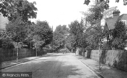
It is in effect the north-south spine road of the prosperous middle class estate as far north as Ray Mill Road East, the north limit of Ray Lodge's former grounds.
We are looking towards Stair Hole, where the downlands of Dorset meet the sea, is hollowed out by vast caverns, many used by smugglers for centuries.The South West Way Coastal Footpath, once an old
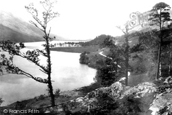
We are looking south from Lower Gatesgarth.The pines of Crag Wood are prominent in the centre of the photograph, while the slopes of Dodd sweep up the lake shore beyond.
The latter benefited from huge quantities of the bird manure 'guano' imported from South America to Whitehaven, carried by rail to the town in tons, and retailed by J and W Maxwell in Cornmarket
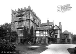
Turton Tower lies four miles south of Darwen, and four miles north-east of Bolton.The villages of Turton and Turton Bottoms are next to the Tower.Turton Tower is basically two buildings, a pele
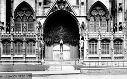
Known as the Judgement Porch from its carved scenes of the Last Judgement, the south porch of Lincoln Cathedral led into the richly carved Angel Choir, the east arm of the cathedral built for St Hugh's
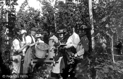
From Victorian times up to the start of the Second World War, Goudhurst and other Wealden villages among the hop fields were subjected to an annual late summer invasion of entire families from South
The large south window of the chapel is filled with 16th-century glass and is the work of Flemish craftsmen.
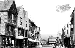
St John Street is the main entrance to the city from the south.
Lewes, the medieval guardian of the gap through the South Downs cut by the River Ouse, occupies a fine hilltop site which produces a superb townscape.
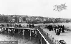
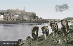
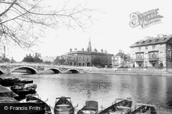
In the background is a popular promenade called the Bulwark, an embankment extending for about a mile on the south side of the river.
Two miles south east of Rotherham, Whiston was a large village by the end of the Napoleonic Wars.
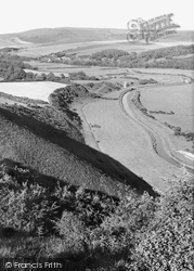
High and Over, or Hindover, is a vantage point on the South Downs, overlooking the Cuckmere river valley.
Holland had worked for the Duke of Bedford at his seat at Woburn Abbey some ten miles south-west of Bedford, and the duke had acquired the old inn in 1787.
Named after the original landowner, Justin de Cave, South Cave is a village of two halves, separated by the castle, built in 1787.
The new seaside resort was mostly laid out south of the old town on flatter land between the Lower Town, largely destroyed by fire in 1791, and the sea.
Two miles south-west of Othery, the Taunton Road skirts the Mump, a natural tor rising steeply from the surrounding Moors.
This view, from the south east near Vicarage Road, shows a heavily Victorianised medieval church; it further suffered in 1943 when a bomb blast destroyed all its stained glass.
Scott also rebuilt the river bridge in 1864, a fine red brick one in a medieval style, seen here from the south by the Thames. We can just see the church spirelet.
Lawrence was one of Wellington's infantry, serving in the 40th Regiment of Foot in campaigns from South America and the Peninsular War - where he was wounded in the storming of Badajoz in 1812 -
This view looking south over Lindow Moss towards Alderley Edge, overlooks the area where Lindow Man, a first-century sacrificial victim, was found in 1984.
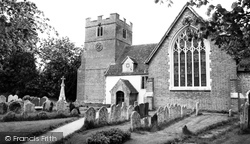
The church is comparatively plain apart from its large 15th-century traceried window on its south side.
Places (15471)
Photos (5054)
Memories (1580)
Books (1)
Maps (2499)


